Ongniud Banner
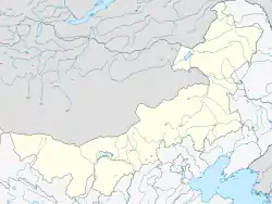
Ongniud Banner (Mongolian: ᠣᠩᠨᠢᠭᠤᠳ ᠬᠣᠰᠢᠭᠤ Oŋniɣud qosiɣu; Chinese: 翁牛特旗; pinyin: Wēngniútè Qí) is a banner of eastern Inner Mongolia, People's Republic of China. It is under the administration of Chifeng City, 76 kilometres (47 mi) to the south-southwest. Yulong Shahu Scenic Area is located about 25 km north of Ongniud town. The south of Ongniud Banner is arable land with grassy hills. The north east half is predominantly grassland and desert.
Ongniud Banner
翁牛特旗 • ᠣᠩᠨᠢᠭᠤᠳᠬᠣᠰᠢᠭᠤ | |
|---|---|
 Ongniud Location in Inner Mongolia | |
| Coordinates: 42°56′N 119°02′E | |
| Country | People's Republic of China |
| Region | Inner Mongolia |
| Prefecture-level city | Chifeng |
| Time zone | UTC+8 (China Standard) |
| Postal code | 024500 |
This article is issued from Wikipedia. The text is licensed under Creative Commons - Attribution - Sharealike. Additional terms may apply for the media files.