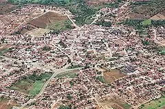
Passira
Geography
- Region - Agreste Pernambucano
- Boundaries - Limoeiro and Salgadinho (N); Gravatá, Bezerros and Pombos (S); Cumaru (W); Feira Nova and Glória do Goitá (E)
- Area - 329.75 km²
- Elevation - 176 m
- Hydrography - Capibaribe river
- Vegetation - Caatinga hipoxerófila
- Climate - semi arid hot
- Average annual temperature - 24.1 °C
- Distance to Recife - 115 km
- Population - 28,894 (2020)[1]
Economy
The main economic activities in Passira are based in commerce and agribusiness, especially tomatoes, corn and beans, and the rearing of cattle, goats, sheep and horses.
Economic Indicators
| Population [2] | GDP x(1000 R$).[3] | GDP pc (R$) | PE |
|---|---|---|---|
| 28.518 | 80.369 | 2.880 | 0.135% |
Economy by Sector 2006
| Primary sector | Secondary sector | Service sector |
|---|---|---|
| 11.04% | 8.80% | 80.16% |
References
- IBGE 2020
- http://www.ibge.gov.br/home/estatistica/populacao/estimativa2009/POP2009_DOU.pdf IBGE Population 2009 Passira, page 34]
- Passira 2007 GDP IBGE page 31 Archived 2016-03-04 at the Wayback Machine
- PE State site - City by city profile
This article is issued from Wikipedia. The text is licensed under Creative Commons - Attribution - Sharealike. Additional terms may apply for the media files.


