Putnam, Alabama
Putnam is an unincorporated community and census-designated place in Marengo County, Alabama, United States.[4] As of the 2010 census, its population was 193.[2]
Putnam, Alabama | |
|---|---|
 Location of Putnam in Marengo County, Alabama. | |
 Putnam, Alabama Location within the state of Alabama | |
| Coordinates: 32°1′22.8″N 88°1′51.6″W | |
| Country | United States |
| State | Alabama |
| County | Marengo |
| Area | |
| • Total | 9.48 sq mi (24.57 km2) |
| • Land | 9.48 sq mi (24.57 km2) |
| • Water | 0.00 sq mi (0.00 km2) |
| Elevation | 226 ft (69 m) |
| Population | |
| • Total | 223 |
| • Estimate (2016)[3] | N/A |
| Time zone | UTC-6 (Central (CST)) |
| • Summer (DST) | UTC-5 (CDT) |
| Area code(s) | 334 |
| FIPS code | 01-62952 |
Demographics
| Historical population | |||
|---|---|---|---|
| Census | Pop. | %± | |
| U.S. Decennial Census[5] | |||
As of the 2010 United States Census, there were 193 people living in the CDP. The racial makeup of the CDP was 72.5% Black, 23.3% White, 2.6% Native American and 1.6% from two or more races.
Geography
Putnam is located at 32.023°N 88.031°W and has an elevation of 226 feet (69 m).[4]
References
- "2016 U.S. Gazetteer Files". United States Census Bureau. Retrieved Jul 17, 2017.
- "U.S. Census website". United States Census Bureau. Retrieved 2011-05-14.
- "Population and Housing Unit Estimates". Retrieved June 9, 2017.
- "Putnam, Alabama". AL HomeTownLocator. Retrieved 2008-12-05.
- "Census of Population and Housing". Census.gov. Retrieved June 4, 2016.
Municipalities and communities of Marengo County, Alabama, United States | ||
|---|---|---|
| Cities | 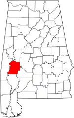 Map of Alabama highlighting Marengo County | |
| Towns | ||
| CDPs | ||
| Unincorporated communities |
| |
| Ghost town | ||
| ||
This article is issued from Wikipedia. The text is licensed under Creative Commons - Attribution - Sharealike. Additional terms may apply for the media files.