Saint-André-d'Embrun
Saint-André-d'Embrun is a commune in the Hautes-Alpes department in southeastern France. Surrounded by the towns of Chateauroux-les-Alpes, Embrun and Crévoux, Saint-André-d'Embrun is located 36 km northeast of Gap, the largest city nearby.[2]
Saint-André-d'Embrun | |
|---|---|
 Siguret Lake | |
 Coat of arms | |
Location of Saint-André-d'Embrun 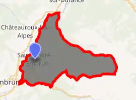
| |
 Saint-André-d'Embrun  Saint-André-d'Embrun | |
| Coordinates: 44°35′12″N 6°32′05″E | |
| Country | France |
| Region | Provence-Alpes-Côte d'Azur |
| Department | Hautes-Alpes |
| Arrondissement | Gap |
| Canton | Embrun |
| Intercommunality | Embrunais |
| Government | |
| • Mayor (2008–2014) | Marc Zanetto (PR) |
| Area 1 | 38.63 km2 (14.92 sq mi) |
| Population (2017-01-01)[1] | 661 |
| • Density | 17/km2 (44/sq mi) |
| Time zone | UTC+01:00 (CET) |
| • Summer (DST) | UTC+02:00 (CEST) |
| INSEE/Postal code | 05128 /05200 |
| Elevation | 796–2,934 m (2,612–9,626 ft) (avg. 920 m or 3,020 ft) |
| 1 French Land Register data, which excludes lakes, ponds, glaciers > 1 km2 (0.386 sq mi or 247 acres) and river estuaries. | |
Population
| Year | Pop. | ±% |
|---|---|---|
| 1962 | 412 | — |
| 1968 | 415 | +0.7% |
| 1975 | 361 | −13.0% |
| 1982 | 462 | +28.0% |
| 1990 | 417 | −9.7% |
| 1999 | 495 | +18.7% |
| 2008 | 637 | +28.7% |
References
- "Populations légales 2017". INSEE. Retrieved 6 January 2020.
- "Website in French- Information about Saint-André-d'Embrun "
| Wikimedia Commons has media related to Saint-André-d'Embrun. |
| Authority control |
|---|
This article is issued from Wikipedia. The text is licensed under Creative Commons - Attribution - Sharealike. Additional terms may apply for the media files.