Saint-Pierre-Avez
Saint-Pierre-Avez is a commune in the Hautes-Alpes department in southeastern France.
Saint-Pierre-Avez | |
|---|---|
 Coat of arms | |
Location of Saint-Pierre-Avez 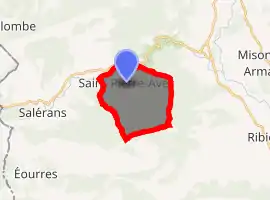
| |
 Saint-Pierre-Avez  Saint-Pierre-Avez | |
| Coordinates: 44°15′29″N 5°45′42″E | |
| Country | France |
| Region | Provence-Alpes-Côte d'Azur |
| Department | Hautes-Alpes |
| Arrondissement | Gap |
| Canton | Laragne-Montéglin |
| Government | |
| • Mayor (2008–2014) | Danielle Vidal |
| Area 1 | 11.37 km2 (4.39 sq mi) |
| Population (2017-01-01)[1] | 29 |
| • Density | 2.6/km2 (6.6/sq mi) |
| Demonym(s) | Saint-Pierre-Avéziens |
| Time zone | UTC+01:00 (CET) |
| • Summer (DST) | UTC+02:00 (CEST) |
| INSEE/Postal code | 05155 /05300 |
| Elevation | 610–1,480 m (2,000–4,860 ft) (avg. 750 m or 2,460 ft) |
| 1 French Land Register data, which excludes lakes, ponds, glaciers > 1 km2 (0.386 sq mi or 247 acres) and river estuaries. | |
Population
| Year | Pop. | ±% |
|---|---|---|
| 1962 | 22 | — |
| 1968 | 30 | +36.4% |
| 1975 | 28 | −6.7% |
| 1982 | 14 | −50.0% |
| 1990 | 20 | +42.9% |
| 1999 | 24 | +20.0% |
| 2008 | 23 | −4.2% |
References
- "Populations légales 2017". INSEE. Retrieved 6 January 2020.
| Wikimedia Commons has media related to Saint-Pierre-Avez. |
| Authority control |
|
|---|
This article is issued from Wikipedia. The text is licensed under Creative Commons - Attribution - Sharealike. Additional terms may apply for the media files.