Sarakreek
Sarakreek is a resort (≈ municipality) in the gold mining region[2] of Brokopondo District in Suriname.[3] Its population at the 2012 census was 3,076.[1] It is served by the Sarakreek Airstrip.
Sarakreek | |
|---|---|
 The former village of Koffiekamp (1955) | |
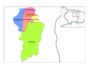
 Map showing the resorts of Brokopondo District. Sarakreek | |
| Coordinates: 4°19′N 54°58′W | |
| Country | |
| District | Brokopondo District |
| Area | |
| • Total | 4,566 km2 (1,763 sq mi) |
| Population (2012 census)[1] | |
| • Total | 3,076 |
| • Density | 0.67/km2 (1.7/sq mi) |
| Time zone | UTC-3 (AST) |
A large part of Sarakreek was flooded after the construction of the Afobaka Dam, and the villages which were lost in the Brokopondo Reservoir were resettled in Marshallkreek and Tapoeripa.[4] The federation of Koffiekamp was among the lost villages, and consisted of three settlements: Maipa-ondo of the misidjan lo of clan founded in 1793, Baka Mbuju of the Njanfai-lo of clan, and Maria Hartmann founded Koffiekamp in 1851.[5]
Villages in the resort include: Baikoetoe, Duwatra, Lebidoti,[6] and Zoewatta.[7]
Flooded villages: Abontjeman
References
- "Resorts in Suriname Census 2012" (PDF). Retrieved 18 May 2020.
- "KASSA RINKELT VOOR DORPEN SARAKREEK DANKZIJ SKALIANS". United News (in Dutch). Retrieved 19 May 2020.
- Bing Maps - Sarakreek
- "Sranan. Cultuur in Suriname". Digital Library for Dutch Literature (in Dutch). Retrieved 16 May 2020.
- "Koffiekamp in historisch perspectief". GFC Nieuws (in Dutch). Retrieved 19 May 2020.
- "Onderzoek Regionaal Plan Brokopondo 2015-2040" (PDF). Planning Office Suriname (in Dutch). Retrieved 19 May 2020.
- "Sarakreek Zoewatta". Map Landia. Retrieved 19 May 2020.
External links
| Wikimedia Commons has media related to Sarakreek. |
| Wikimedia Commons has media related to Photographs by Willem van de Poll in Koffiekamp, Suriname. |
This article is issued from Wikipedia. The text is licensed under Creative Commons - Attribution - Sharealike. Additional terms may apply for the media files.
