Türkmenbaşy Gulf
The Türkmenbaşy Gulf or Türkmenbaşy Bay (Russian: залив Туркменбашы[2][3] Turkmen: Türkmenbaşy aýlagy) is a bay of the Caspian Sea in the coast of Turkmenistan.
| Türkmenbaşy Gulf | |
|---|---|
| Krasnovodsk Gulf Balkan Gulf | |
 Türkmenbaşy Gulf | |
| Coordinates | 39°50′N 53°10′E |
| Type | Bay |
| Native name | Türkmenbaşy aýlagy (Turkmen) |
| Ocean/sea sources | Caspian Sea |
| Basin countries | Turkmenistan |
| Official name | Turkmenbashy Bay |
| Designated | 23 February 2008 |
| Reference no. | 1855[1] |
With the Krasnovodsk Peninsula to the north and the Cheleken Peninsula to the south, the gulf extends westwards into the sea for 46 km and has an 18 km wide mouth. At its northwest corner are the Bala-Ishem salt marshes which mark the mouth of the dried-up Uzboy River. It became part of the Hazar Nature Reserve in 1968 and was designated as a Ramsar site in 2008.[1] Among the animals in the bay the Krasnovodsk herring (Alosa braschnikowi nirchi) and the Caspian seal deserve mention.[4]
Cartography
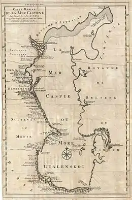
In 18th century maps of the Caspian Sea the gulf was known as 'Balkan Gulf' or 'Balchan Gulf' and was assumed to be much deeper. It was first accurately cartographed by Fedor Ivanovich Soimonov during the 1719 Caspian Expedition which surveyed the Caspian Sea from 1719 to 1727.[5]
The bay was later known as 'Krasnovodsk Gulf' or 'Krasnovodsk Bay',[6] but it changed its name when the city at its shores changed its name from Krasnovodsk to Türkmenbaşy.[7][8]
 1721 Van Verden map of the Caspian Sea with the Golphe de Balchan cutting deep inland. |
See also
References
- "Turkmenbashy Bay". Ramsar Sites Information Service. Retrieved 24 May 2020.
- Туркмения // Атлас мира / сост. и подгот. к изд. ПКО «Картография» в 2003 г. ; гл. ред. Г. В. Поздняк. — Испр. в 2005, 2007 и 2010 гг. — М. : ПКО «Картография» : Изд-во Оникс, 2010. — С. 118. — ISBN 978-5-85120-274-2 (Картография). — ISBN 978-5-488-01588-3 (Оникс, зел. пер.). — ISBN 978-5-488-01589-0 (Оникс, син. пер.).
- Туркмения: Справочная карта / сост. и подгот. к изд. Омской картогр. ф-кой в 1999 г.; ст. ред. Т. П. Филатова; ред. Н. Б. Смирнова. — Испр. в 2001 г. — 1:1 500 000, 15 км в 1 см. — М.:Роскартография, 2001. — 3 200 экз. — ISBN 5-85120-099-5.
- Igor S. Zonn, Aleksey N Kosarev, Michael H. Glantz & Andrey G. Kostianoy, The Caspian Sea Encyclopedia, p. K 256
- Igor S. Zonn, Aleksey N Kosarev, Michael H. Glantz & Andrey G. Kostianoy, The Caspian Sea Encyclopedia
- Chisholm, Hugh, ed. (1911). . Encyclopædia Britannica. 5 (11th ed.). Cambridge University Press. pp. 453–455.
- Западный Узбекистан, Туркмения // Атлас мира / сост. и подгот. к изд. ПКО «Картография» в 1999 г. ; отв. ред. Т. Г. Новикова, Т. М. Воробьева. — 3-е изд. стер., отпеч. в 2002 г. с диапоз. 1999 г. — М. : Роскартография, 2002. — С. 122—123. — ISBN 5-85120-055-3.
- Словарь географических названий СССР / ГУГК, ЦНИИГАиК. — 2-е изд., перераб. и доп. — М. : Недра, 1983. — С. 126.