Teplý Vrch
Teplý Vrch is a village and municipality in the Rimavská Sobota District of the Banská Bystrica Region of southern Slovakia.[1]
Teplý Vrch | |
|---|---|
Village | |
.jpg.webp) Lutheran church | |
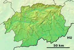 Teplý Vrch Location of Teplý Vrch in the Banská Bystrica Region  Teplý Vrch Teplý Vrch (Slovakia) | |
| Coordinates: 48°28′N 20°06′E | |
| Country | |
| Region | Banská Bystrica |
| District | Rimavská Sobota |
| First mentioned | 1301 |
| Area | |
| • Total | 5.98 km2 (2.31 sq mi) |
| Elevation | 217 m (712 ft) |
| Population (2011) | |
| • Total | 294 |
| • Density | 49/km2 (130/sq mi) |
| Time zone | UTC+1 (CET) |
| • Summer (DST) | UTC+2 (CEST) |
| Postal code | 980 23 |
| Area code(s) | +421-47 |
| Car plate | RS |
| Website | www.teplyvrch.com |
Tourism
It is known for the warmest geothermal lake in Slovakia (27 °C, 80 F).[2] A hotel, camping site and several accommodation facilities are at disposal in the village. It is a popular summer resort in Banská Bystrica Region. In the village is located menagerie.[3]
References
- "Statistical Office of the slovak Republic" (PDF). Výsledky SODB 2011. Štatistický úrad SR. Retrieved 9 August 2012.
- "Vodná plocha Teplý Vrch - Turistické oblasti - Zoznam zaujímavostí". Visit Slovakia .com. Retrieved 2014-03-19.
- "Zvernica na Teplom Vrchu je najstaršou na Slovensku | Dromedár.sk". Dromedar.topky.sk. 2011-09-26. Retrieved 2014-03-19.
External links
 Media related to Teplý Vrch at Wikimedia Commons
- Official website

- Touristic information
| Authority control |
|
|---|
This article is issued from Wikipedia. The text is licensed under Creative Commons - Attribution - Sharealike. Additional terms may apply for the media files.