Thornbury railway station, Melbourne
Thornbury railway station is located on the Mernda line, in Victoria, Australia. It serves the northern Melbourne suburb of Thornbury, and opened on 8 October 1889.[1]
Thornbury | |||||||||||
|---|---|---|---|---|---|---|---|---|---|---|---|
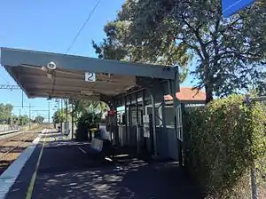 Southbound view from Platform 2 in December 2013 | |||||||||||
| Location | Ethel Street, Thornbury Australia | ||||||||||
| Coordinates | 37°45′19″S 144°59′54″E | ||||||||||
| Owned by | VicTrack | ||||||||||
| Operated by | Metro | ||||||||||
| Line(s) | Mernda | ||||||||||
| Distance | 10.62 kilometres from Southern Cross | ||||||||||
| Platforms | 2 side | ||||||||||
| Tracks | 2 | ||||||||||
| Connections | Tram | ||||||||||
| Construction | |||||||||||
| Structure type | Ground | ||||||||||
| Bicycle facilities | Yes | ||||||||||
| Disabled access | Yes | ||||||||||
| Other information | |||||||||||
| Status | Unstaffed station | ||||||||||
| Station code | TBY | ||||||||||
| Fare zone | Myki zone 1 | ||||||||||
| Website | Public Transport Victoria | ||||||||||
| History | |||||||||||
| Opened | 8 October 1889 | ||||||||||
| Electrified | Yes | ||||||||||
| Services | |||||||||||
| |||||||||||
During October 1987, the double line block system between Thornbury and Northcote was abolished, and replaced with three positioning signalling,[2] with all two position signals between Thornbury and Merri also abolished.[2]
Boom barriers replaced interlocked gates at the Hutton Street level crossing around 1987/1988.[3][4]
Platforms & services
Thornbury has two side platforms. It is serviced by Metro Trains' Mernda line services.[5]
Platform 1:
- Mernda line: all stations and limited stops services to Flinders Street
Platform 2:
- Mernda line: all stations services to Mernda
Transport links
Yarra Trams operates two routes via Thornbury station:
References
- Thornbury Vicsig
- "Works". Newsrail. Australian Railway Historical Society. January 1988. p. 27.
- "Northcote to Epping 1987". MetRail Signalling Diagram No 39’87. www.signaldiagramsandphotos.com. Retrieved 1 March 2016.
- "Northcote to Reservoir 1988". The Met Signalling Diagram No 17’88. www.signaldiagramsandphotos.com. Retrieved 1 March 2016.
- "Mernda Line". Public Transport Victoria.
- "11 West Preston - Victoria Harbour Docklands". Public Transport Victoria.
- "86 Bundoora RMIT - Waterfront City Docklands". Public Transport Victoria.
External links
- Melway map at street-directory.com.au
This article is issued from Wikipedia. The text is licensed under Creative Commons - Attribution - Sharealike. Additional terms may apply for the media files.