U.S. Route 85 in Colorado
U.S. Route 85 (US 85) is a part of the U.S. Highway System that travels from the Mexican border in El Paso, Texas, north to the Canadian border in Fortuna, North Dakota. In the U.S. state of Colorado, US 85 begins at the New Mexico state line south of Starkville and ends at the Wyoming state line south of Cheyenne, Wyoming.
| ||||
|---|---|---|---|---|
| CanAm Highway | ||||
_map.svg.png.webp) | ||||
| Route information | ||||
| Maintained by CDOT | ||||
| Length | 309.6 mi[1] (498.3 km) | |||
| Major junctions | ||||
| South end | ||||
| ||||
| North end | ||||
| Location | ||||
| Counties | Las Animas, Huerfano, Pueblo, El Paso, Douglas, Arapahoe, Denver, Adams, Weld | |||
| Highway system | ||||
|
Colorado State Highways
| ||||
Route description


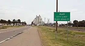
US 85 enters Colorado from New Mexico concurrent with Interstate 25 (I-25) but is not signed. US 85 leaves I-25 at exit 128 and follows Santa Fe Avenue through Fountain before turning west briefly onto Lake Avenue, then turning north following Nevada Avenue through Colorado Springs before rejoining I-25 at exit 148. Approaching the south side of Denver, US 85 again leaves I-25 at exit 184. From there it heads west and north as a two-lane rural highway. It becomes an expressway near Chatfield Lake and the southern Denver suburbs of Littleton and Englewood, where it is commonly known as Santa Fe Drive. It continues north through Denver for a few miles before once again joining with I-25 at mile marker 207. There it runs concurrently with US 87 as well as I-25 and heads north through downtown Denver. At exit 214, US 85 turns east and runs concurrently with I-70 and US 6 for about a mile where it exits with US 6 and heads northeast through Commerce City. In just a few miles the US 6/US 85 concurrency merges with I-76 at mile marker 9. They travel concurrently for three miles (4.8 km) until exit 12 when US 85 becomes an expressway and continues north out of the Denver area through Brighton.

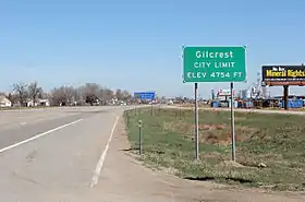
From there it parallels I-25 for about 75 miles (121 km) passing through Fort Lupton, Platteville, Evans, Greeley, and Eaton before crossing into Wyoming.[2]
History
US 85 originally followed the route that I-25 would later take.[3] In southern Colorado, US 85 originally was placed on city streets in Pueblo and Trinidad until 1938 where the route was ultimately paved from one state to another, taking place at the present I-25 corridor.
Realignment
Starting in 1942, a realignment project took place in northeastern Denver, involving the opening of Vasquez Blvd. Originally, US 85 ran along Brighton Blvd. from downtown going northeast and then was realigned along 46th Ave. to Vasquez Blvd. Five years later, in Pueblo, the route took the downtown streets before the Greenhorn/Crow bypass opened two years later. In 1950, the Palmer Lake/Larkspur bypass opened, moving US 85 along with US 87 along the expressway. The expressway opened north of Pueblo in 1951, which allowed both US 85 and US 87 to use the expressway coming out of downtown until 1954.
Junction list
| County | Location | mi[1] | km | Destinations | Notes | ||
|---|---|---|---|---|---|---|---|
| New Mexico state line | 0.0 | 0.0 | Continuation into New Mexico | ||||
| See I-25 | |||||||
| El Paso | Fountain | 128.0 | 206.0 | Northern end of I-25/US 87 concurrency; I-25 exit 128 | |||
| 131.7 | 212.0 | Interchange | |||||
| Stratmoor | 135.4 | 217.9 | Interchange | ||||
| Colorado Springs | 139.8 | 225.0 | Interchange | ||||
| 141.0 | 226.9 | I-25 exit 140 | |||||
| 148.0 | 238.2 | Southern end of I-25/US 87 concurrency; I-25 exit 148 | |||||
| See I-25 | |||||||
| Douglas | Castle Rock | 184.7 | 297.2 | Northern end of I-25/US 87 concurrency; I-25 exit 184 | |||
| Castle Rock–Castle Pines line | 186.3 | 299.8 | Castlegate Drive North / North Meadows Drive | Interchange | |||
| Sedalia | 190.4 | 306.4 | |||||
| | 196.4 | 316.1 | Titan Parkway | Interchange | |||
| Douglas–Arapahoe county line | Highlands Ranch | 200.5 | 322.7 | C-470 exit 17; interchange. | |||
| Arapahoe | Littleton | 204.0 | 328.3 | ||||
| Littleton–Englewood line | 204.8 | 329.6 | Interchange | ||||
| Englewood | 206.9 | 333.0 | Interchange | ||||
| City and County of Denver | 208.7 | 335.9 | Evans Avenue | Interchange | |||
| 211.0 | 339.6 | Southern end of I-25/US 6/US 87 concurrency; I-25 exit 270B | |||||
| See I-25 | |||||||
| 216.8 | 348.9 | Northern end of I-25/US 87 concurrency; southern end of I-70 concurrency; I-25 exit 214A; I-70 exit 274 | |||||
| See I-70 | |||||||
| 218.9 | 352.3 | Northern end of I-70 concurrency; I-70 exit 276A | |||||
| 219.1 | 352.6 | Southern end of US 6 concurrency | |||||
| See US 6 | |||||||
| Adams | Derby | 223.9 | 360.3 | Southern end of I-76 concurrency; I-76 exit 9 | |||
| See I-76 | |||||||
| | 228.1 | 367.1 | Northern end of I-76/US 6 concurrency; I-76 exit 12 | ||||
| | 228.3 | 367.4 | |||||
| Henderson | 231.3 | 372.2 | |||||
| 231.7 | 372.9 | Interchange; E-470 exit 38 | |||||
| Brighton | 235.7 | 379.3 | Interchange | ||||
| Weld | Fort Lupton | 241.6 | 388.8 | Interchange | |||
| | 249.3 | 401.2 | |||||
| Platteville | 250.5 | 403.1 | |||||
| 252.0 | 405.6 | ||||||
| | 253.8 | 408.5 | |||||
| Greeley | 265.6 | 427.4 | Southern end of US 34 concurrency | ||||
| 266.0 | 428.1 | Northern end of US 34 concurrency | |||||
| 267.2 | 430.0 | ||||||
| 268.2 | 431.6 | Access to Greeley-Weld County Airport | |||||
| 270.2 | 434.8 | 6th Avenue | Interchange; northbound exit and southbound entrance | ||||
| 270.5 | 435.3 | Interchange; southbound exit and northbound entrance | |||||
| Lucerne | 272.5 | 438.5 | |||||
| Ault | 279.8 | 450.3 | |||||
| Wyoming state line | 309.6 | 498.3 | Continuation into Wyoming | ||||
| 1.000 mi = 1.609 km; 1.000 km = 0.621 mi | |||||||
References
- Google (September 19, 2017). "John F. Kennedy Memorial Highway, Trinidad, CO 81082 to 68947 Canam Hwy, Colorado 80537" (Map). Google Maps. Google. Retrieved September 19, 2017.
- "U.S. Highway 85". AA Roads. Retrieved October 11, 2017.
- "Colorado State Roads and Highways" (PDF). Colorado Historical Society. p. 9. Retrieved October 11, 2017.
| Previous state: New Mexico |
Colorado | Next state: Wyoming |
