White River Falls State Park
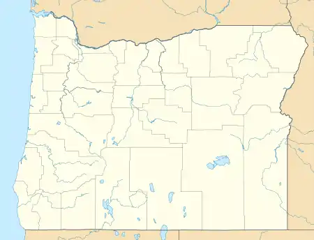
White River Falls State Park is a state park in north central Oregon. It is located 35 miles (56 km) by road south of The Dalles and 4.5 miles (7.2 km) east of Tygh Valley.
| White River Falls State Park | |
|---|---|
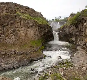 White River Falls is the upper 90 foot falls and Celestial Falls is the lower 44 foot falls dropping into the pool | |
 | |
| Type | Public, state |
| Location | Wasco County, Oregon, USA |
| Nearest city | Maupin |
| Coordinates | 45°14′29″N 121°05′44″W[1] |
| Operated by | Oregon Parks and Recreation Department |
| Open | mid-March through October |
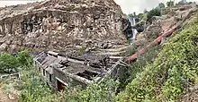
The focus of the park is the falls where wild and scenic White River plunges 90 feet (27 m) from a basalt shelf. At the base of the falls are the ruins of a hydropower plant which supplied electricity to north central Oregon from 1910 to 1960.[2]
The falls are located at river mile (RM) 3 of the White River which flows into the Deschutes at RM 46.5.
There are no fees to use the park and it is open mid-March through the end of October.[2]
See also
- "White River Falls State Park". Geographic Names Information System. United States Geological Survey. Retrieved 2008-11-24.
- "White River Falls State Park". Oregon Parks and Recreation. Retrieved 2008-11-24.
![]() This article incorporates public domain material from the United States Geological Survey website http://geonames.usgs.gov/apex/f?p=136:3:0::NO:3:P3_FID%2CP3_TITLE:2770703%2CCelestial+Falls.
This article incorporates public domain material from the United States Geological Survey website http://geonames.usgs.gov/apex/f?p=136:3:0::NO:3:P3_FID%2CP3_TITLE:2770703%2CCelestial+Falls.
![]() This article incorporates public domain material from the United States Geological Survey website http://geonames.usgs.gov/apex/f?p=136:3:0::NO::P3_FID,P3_TITLE:2770704,White%20River%20Falls.
This article incorporates public domain material from the United States Geological Survey website http://geonames.usgs.gov/apex/f?p=136:3:0::NO::P3_FID,P3_TITLE:2770704,White%20River%20Falls.