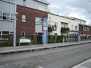
Windy Arbour
Windy Arbour (Irish: Na Glasáin) is a small suburban village in the Dundrum area of Dublin, Ireland. Situated between Dundrum and Milltown, along the banks of the Slang River (also Dundrum or Slann River).
Windy Arbour
Na Glasáin | |
|---|---|
Suburb | |
 | |
 Windy Arbour Location in Dublin  Windy Arbour Windy Arbour (Ireland) | |
| Coordinates: 53°18′N 6°15′W | |
| Country | Ireland |
| Province | Leinster |
| County | Dún Laoghaire–Rathdown |
| Time zone | UTC±0 (WET) |
| • Summer (DST) | UTC+1 (IST) |
| Eircode routing key | D14 |
| Telephone area code | +353(0)1 |
History
The name of the area was originally Irish Na Glasáin, "the green land"; this was Anglicised as 'Glassons'. The name Windy Harbour or Sandy Arbour was later applied, referring to a landing-point on the River Slang. A starch mill was formerly located there.[1] "Arbour" once had the meaning “grass plot, lawn, garden”; it is possible that the name was intended as a direct translation of glasáin.[2]

Perhaps the most famous person to live in Windy Arbour was Irish patriot Robert Emmet, who grew up in The Casino, a manor house that is now known as Emmet House, where the Secretariat of Secondary schools in Ireland is currently housed. It is located next to the Catholic church on Bird Avenue and was formerly known as Carton House.
The Central Mental Hospital is located beside the village and was built c.1850.[3] The hospital provides treatment in high, low, and medium security conditions. Patients are referred by the courts, the prisons and local hospitals for both assessment and residential treatment.
Amenities
Windy Arbour has a number of shops, a supermarket, post office, pharmacy and a bakery. It is also home to several takeaways, two restaurants and two pubs. There is a primary school in Columbanus Estate known as Our Lady's National School, Clonskeagh. Windy Arbour has its own Luas station and is served by the number 17, 44, 61 and 122 bus routes.
Housing
Windy Arbour is surrounded by several housing estates, including Columbanus. At the centre of Windy Arbour is the smaller and much older townland of Farranboley, which appears on maps dating from the 18th century.
References
- "Cobbett's Complete Collection of State Trials and Proceedings for High Treason and Other Crimes and Misdemeanors from the Earliest Period to the Present Time: With Notes and Other Illustrations". Bagshaw. June 17, 1820 – via Google Books.
- "Na Glasáin/Windy Arbour". Logainm.ie.
- "Central Mental Hospital, Dundrum Road, CHURCHTOWN LOWER, Dundrum, Dún Laoghaire-Rathdown". Buildings of Ireland.