Yakutat Army Airfield
Yakutat Army Airfield is a former United States Army airfield located three nautical miles (6 km) southeast of the central business district of Yakutat, a city and borough in the U.S. state of Alaska which has no road access to the outside world.[1] After its closure, it was redeveloped into Yakutat Airport.
Yakutat Army Airfield | |||||||||||||||
|---|---|---|---|---|---|---|---|---|---|---|---|---|---|---|---|
 | |||||||||||||||
| Summary | |||||||||||||||
| Airport type | Military | ||||||||||||||
| Owner | United States Army | ||||||||||||||
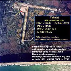
| Location | Yakutat, Alaska | ||||||||||||||
| Elevation AMSL | 33 ft / 10 m | ||||||||||||||
| Coordinates | 59°30′12″N 139°39′37″W | ||||||||||||||
| Map | |||||||||||||||
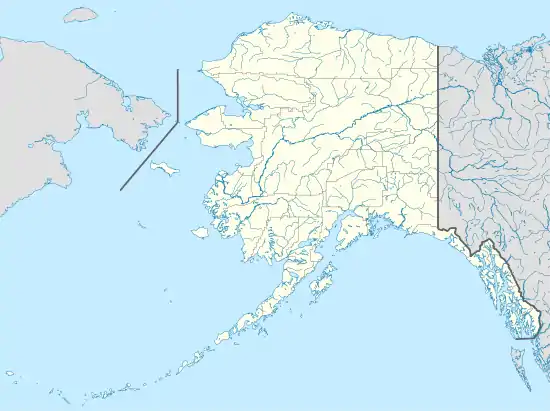 Yakutat AAF Location of airport in Alaska | |||||||||||||||
| Runways | |||||||||||||||
| |||||||||||||||
History
Yakutat Army Airfield was constructed as part of the United States Army's long-range defense program for Alaska. During World War II the airfield was a key USAAF base during the Aleutian Campaign. It was used in combat by the 406th Bombardment Squadron (June–November 1942) (28th Bombardment Group).
References
- FAA Airport Form 5010 for YAK PDF. Federal Aviation Administration. Effective April 5, 2012.
Other sources
 This article incorporates public domain material from the Air Force Historical Research Agency website http://www.afhra.af.mil/.
- Maurer, Maurer (1983). Air Force Combat Units Of World War II. Maxwell AFB, Alabama: Office of Air Force History. ISBN 0-89201-092-4.
- Maurer, Maurer (1969), Combat Squadrons of the Air Force, World War II, Air Force Historical Studies Office, Maxwell AFB, Alabama. ISBN 0-89201-097-5
External links
- Topographic map from USGS The National Map
Previously: Alaskan Air Force (1941-1942) | |||||||||
| Bases |
| .svg.png.webp) | |||||||
| Units |
| ||||||||
This article is issued from Wikipedia. The text is licensed under Creative Commons - Attribution - Sharealike. Additional terms may apply for the media files.