Zuni Indian Reservation
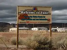
The Zuni Indian Reservation, also known as Pueblo of Zuni, is the homeland of the Zuni tribe of Native Americans.
Zuni Reservation | |
|---|---|
 | |
 | |
| Country | United States |
| State | New Mexico, Arizona |
| County | McKinley, Cibola, Apache County, Arizona |
| Government | |
| • Governor | Val Panteah |
| Population (2000)Enrolled tribal members | |
| • Total | 7,758 |
| Time zone | MT/MDT |
| Website | Official site of the Zuni tribe |
Location
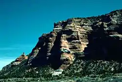
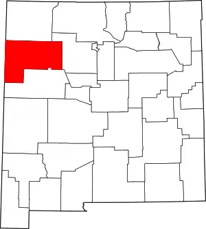
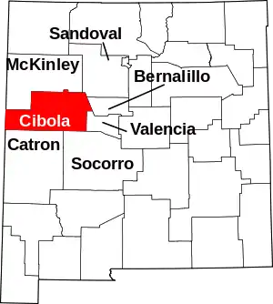
The reservation lies in the Zuni River valley and is located primarily in McKinley and Cibola counties in western New Mexico, about 150 miles (240 km) west of Albuquerque. There are also several smaller non-contiguous sections in Apache County, Arizona, northwest of the city of St. Johns. The main part of the reservation borders the state of Arizona to the west and the Ramah Navajo Reservation to the east. The main reservation is also surrounded by the Painted Cliffs, the Zuni Mountains and the Cibola National Forest. The reservation's total land area is 723.343 sq mi (1,873.45 km²).
The Zuni Tribe also has land holdings in Catron County, New Mexico and Apache County, Arizona, which do not border the main reservation.
Population
The population was reported at 7,891 inhabitants in the 2010 census.[1] Almost all of the population lives in the reservation headquarters community of Zuni Pueblo, located near the reservation's center, or in nearby Black Rock, to its east.

History and main features
Also on the main reservation are the Hawikuh Ruins. The ancient Zuni pueblo of Hawikuh was the largest of the Seven Cities of Cibola. It was established in the 13th century and abandoned in 1680. It was also the first pueblo seen by the Spanish explorers. The African scout Estevanico was the first non-Native to reach this area.
The largest town on the reservation is Zuni Pueblo, which is seat of Tribal government. Also on the reservation are the towns of Black Rock and Pescado. There is a branch campus of the University of New Mexico located in Zuni.
Tribal government
The Zuni Tribe is governed by an elected governor, lieutenant governor, and a six-member Tribal Council with elections being held every four years. The governor is the administrative head of the Tribal Council, which is the final decision-making body on the reservation. The council oversees finances, business decisions, taxes and contracts.
External links
Bibliography
- Zuni Reservation and Off-Reservation Trust Land, New Mexico/Arizona United States Census Bureau
References
- "New Mexico What the Data Show" (PDF). U.S. Census Bureau Population and Housing Occupancy Status: State - American Indian Area. July 22, 2011. Archived from the original (PDF) on May 22, 2014. Retrieved May 22, 2014.


