Ayase River
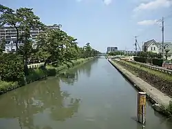
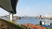
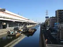
The Ayase River (綾瀬川, Ayase-gawa) is a river in Japan.
| Ayase River | |
|---|---|
 | |
| Location | |
| Country | Japan |
| Region | Kantō |
| Physical characteristics | |
| Source | |
| • location | Okegawa |
| Mouth | Naka River |
• location | Katsushika |
• coordinates | 35°43′22″N 139°50′33″E |
| Length | 47 km (29 mi) |
| Basin size | 178 km2 (69 sq mi)[1] |
| Discharge | |
| • location | Okegawa, Saitama |
| Basin features | |
| River system | Ara river basin |
Geography
The Ayase River, takes its source in the city of Okegawa in Saitama Prefecture then joins, in Katsushika, Tokyo, the Naka River. The latter flows into the river Arakawa River, 2 km before Tokyo Bay.
Development

The course of the river was developed in Edo period (1603-1868), when Edo (old name of Tokyo) became the shogunal capital of Japan.[2] Historically, the first part of the river is used for irrigation and agriculture, the middle and the end for the supply of water to the population of Tokyo and for river transport (the Ayase river notably allows the connection between the Arakawa and Tone).[1]
The river caused several major floods.[3]
Pollution

From the 1960s to the 1990s, the river was the most polluted in Japan, occupying twenty-five times the head of the classification of the most polluted rivers between 1972 and 2007. These pollutions are due to agriculture, to the density of the population living near the basin or the banks, and to industry. This situation led to the first depollution projects in the late 1990s and during the 2000s.[1]
References
- Oishi, Masao; Ikushima, Yoshimi (2008). "The Most Polluted River in Japan: Ayasegawa River ~Campaign Breaking the Worst One~" (PDF).
- (in Japanese) "綾瀬川の歴史・文化 (Histoire d'Ayase)". 江戸川河川事務所 (Office de la rivière Edo-gawa). Retrieved 13 March 2013.
- (in Japanese) "中川・綾瀬川の主な災害 (Principaux désastres de l'Ayase-gawa et de la Naka-gawa)". Ministry of Land, Infrastructure, Transport and Tourism. Archived from the original on 27 January 2013. Retrieved 13 March 2013.