Barrackpore Trunk Road
Barrackpore Trunk Road[1] ( BT Road) is a four-laned road in Kolkata, India. It connects Shyambazar 5-point Crossing with Barrackpore Chiria More. BT Road is a part of both State Highway 1 and State Highway 2.

| BT Road | |
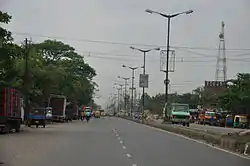 BT Road, Panihati | |
| Native name | বারাকপুর ট্রাঙ্ক রোড |
|---|---|
| Maintained by | Barrackpore Municipality, Titagarh Municipality, Khardaha Municipality, Panihati Municipality, Kamarhati Municipality, Baranagar Municipality and Kolkata Municipal Corporation |
| Length | 18.50 km (11.50 mi) |
| Location | Greater Kolkata (North 24 Parganas district and Kolkata district), India |
| Nearest Kolkata Metro station | Baranagar(under construction), Shyambazar |
| north end | Barrackpore |
| south end | Shyambazar |
Dunlop Mor (Baranagar) is the largest crossing on BT Road.[2]
Areas served
- Shyambazar
- Tala
- Sinthee
- Bonhooghly
- Dunlop
- Belgharia
- Kamarhati
- Agarpara
- Panihati
- Sodepur
- Sukchar
- Khardaha
- Titagarh
- Barrackpore - End of the Road at Barrackpore Commissionerate 2
Landmarks
.jpg.webp)
Academic building of Indian Statistical Institute on B.T. Road, Bonhooghly
- Rabindra Bharati University
- B. T. Road Government Sponsored H. S. School
- Indian Statistical Institute, Bonhooghly
- College of Medicine & Sagore Dutta Hospital
- Bengal Chemicals and Pharmaceuticals, Panihati
- Baranagar Road railway station
- Baranagar metro station
- Sri Sai Devsthan, Sukchar
- Vishal Mega Mart
- Siddha Eden Lakeville Project, Baranagar
- Solaris Project (Eden Realty Group), Baranagar
Reference
- "'Reinvention' of India's oldest metalled road". The Statesman. 18 February 2017. ISSN 0972-0219.
- Indigenous Medicinal Specialities. Biotech Books. 2005. p. 192. ISBN 9788176220637.
External links
![]() Media related to Barrackpore Trunk Road at Wikimedia Commons
Media related to Barrackpore Trunk Road at Wikimedia Commons
Kolkata topics | |||||||||
|---|---|---|---|---|---|---|---|---|---|
| History |
| ||||||||
| Localities and streets |
| ||||||||
| Buildings |
| ||||||||
| Education |
| ||||||||
| Industry and economy |
| ||||||||
| Transportation |
| ||||||||
| Culture |
| ||||||||
| Places of worship |
| ||||||||
| Sports |
| ||||||||
| Other topics |
| ||||||||
| |||||||||

This article is issued from Wikipedia. The text is licensed under Creative Commons - Attribution - Sharealike. Additional terms may apply for the media files.