National Highway 717 (India)
National Highway 717 (NH 717) is a national highway in India. This highway runs entirely in the state of West Bengal.[1] It is a secondary route of National Highway 17. Prior to renumbering of national highways in 2010, the stretch between Chalsa and Mainaguri was part of old national highway 31.[2] By a gazette notification on 27 December 2013, NH-717 route was extended from Mainaguri to land border crossing of India/Bangladesh border near Changrabandha.[3] Mainaguri to Changrabandha stretch of this route is part of Asian Highway 48.[4]
| ||||
|---|---|---|---|---|
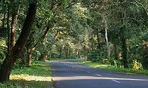
 NH 717 passing through Gorumara National Park | ||||
| Route information | ||||
| Auxiliary route of NH 17 | ||||
| Part of | ||||
| Length | 61 km (38 mi) | |||
| Major junctions | ||||
| South end | Chalsa | |||
| North end | India/Bangladesh border near Changrabandha | |||
| Location | ||||
| States | West Bengal | |||
| Primary destinations | Mainaguri | |||
| Highway system | ||||
| ||||
Route
.jpg.webp)
Schematic map of National Highways in India
NH717 connects Chalsa north of Baradighi, Mainaguri, Changrabandha and terminates at Indo/Bangladesh Border.[5]
Junctions
See also
- List of National Highways in India
- List of National Highways in India by state
References
- "Rationalisation of Numbering Systems of National Highways" (PDF). New Delhi: Department of Road Transport and Highways. Archived from the original (PDF) on 4 December 2018. Retrieved 3 April 2012.
- "New Numbering of National Highways notification - Government of India" (PDF). The Gazette of India. Retrieved 19 April 2019.
- "Route substitution (amendment) for national highways 10 and 717" (PDF). The Gazette of India. Retrieved 19 April 2019.
- "Asian Highway Database - Country wise". UNESCAP. Retrieved 24 April 2019.
- "State-wise length of National Highways (NH) in India". Ministry of Road Transport and Highways. Retrieved 19 April 2019.
This article is issued from Wikipedia. The text is licensed under Creative Commons - Attribution - Sharealike. Additional terms may apply for the media files.


