Brateyevo District
Brateyevo District (Russian: райо́н Брате́ево) is a district of Southern Administrative Okrug of the federal city of Moscow, Russia, located in the southeast of Moscow on the right bank of the Moskva River. Population: 102,600 (2010 Census);[2] 94,644 (2002 Census).[5] The area of the district is 7.63 square kilometers (2.95 sq mi).[1]
Brateyevo District
район Братеево | |
|---|---|
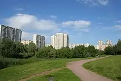
 Apartment blocks in Brateyevo District | |
.png.webp) Flag .png.webp) Coat of arms | |

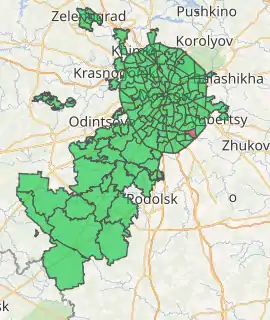
Location of Brateyevo District in Moscow | |
| Coordinates: 55°38′02″N 37°45′49″E | |
| Country | Russia |
| Federal subject | Moscow |
| Area | |
| • Total | 7.63 km2 (2.95 sq mi) |
| Population | |
| • Total | 102,600 |
| • Estimate (2018)[3] | 109,815 (+7%) |
| • Density | 13,000/km2 (35,000/sq mi) |
| • Urban | 100% |
| • Rural | 0% |
| Time zone | UTC+3 (MSK |
| OKTMO ID | 45913000 |
| Website | https://web.archive.org/web/20110719065745/http://br.uao.mos.ru/ |
History
Several pagan mounds dated back to ancient settlements have been discovered on the territory of Brateyevo District. The settlement transformed into the prosperous village located on the Brateyevo hill which later gave its name to the district. There are two common versions of origin the name of the village. According to one, the name the toponym "Brateyevo" came from the personal name "Bratey".[6] According to another version, in the 16th century the nearest villages (Borisovo and Besedy) belonged to the Godunov family, while Brateyevo himself was owned by Boris Godunov’s brother (Russian: брат), Semyon.
In 1960 Brateyevo village became administrative part of Moscow. In the 1980s Brateyevo village has been demolished during the construction of the modern district.
Transportation
Metro
 Borisovo, opened on December 2, 2011; located in western part of district
 Alma-Atinskaya, opened on December 24, 2012; located in south-eastern part of district
Nearest stations, which are not located in Brateyevo District but accessible using public transportation:
References
- Показатели муниципальных образования. Братеево (in Russian). Территориальный орган Федеральной службы государственной статистики по г. Москве. Retrieved August 10, 2011.
- Russian Federal State Statistics Service (2011). "Всероссийская перепись населения 2010 года. Том 1" [2010 All-Russian Population Census, vol. 1]. Всероссийская перепись населения 2010 года [2010 All-Russia Population Census] (in Russian). Federal State Statistics Service.
- "26. Численность постоянного населения Российской Федерации по муниципальным образованиям на 1 января 2018 года". Federal State Statistics Service. Retrieved January 23, 2019.
- "Об исчислении времени". Официальный интернет-портал правовой информации (in Russian). June 3, 2011. Retrieved January 19, 2019.
- Russian Federal State Statistics Service (May 21, 2004). "Численность населения России, субъектов Российской Федерации в составе федеральных округов, районов, городских поселений, сельских населённых пунктов – районных центров и сельских населённых пунктов с населением 3 тысячи и более человек" [Population of Russia, Its Federal Districts, Federal Subjects, Districts, Urban Localities, Rural Localities—Administrative Centers, and Rural Localities with Population of Over 3,000] (XLS). Всероссийская перепись населения 2002 года [All-Russia Population Census of 2002] (in Russian).
- Ageeva, R.A. (2007). Имена московских улиц. Топонимический словарь [The names of Moscow streets. Toponymic dictionary.] (in Russian). Moscow. ISBN 5942824320.
External links
- Official website of Brateyevo District (in Russian)
- Official website of Brateyevo Municipal Formation (in Russian)
