Bright Angel Shale
The Cambrian Bright Angel Shale is the middle layer of the three member Tonto Group geologic feature. The 3-rock Tonto section famously sits upon the Great Unconformity because of the highly resistant cliffs of the base layer, vertical Tapeats Sandstone cliffs.
| Bright Angel Shale Stratigraphic range: Middle Cambrian[1][2] | |
|---|---|
 Muav Limestone-(dk or lt gray, brown, or orange-red subcliff at base of Redwall Limestone cliff) and Bright Angel Shale (greenish slope-former), resting on Tapeats Sandstone (short, dp brown vertical cliff) (Tapeats forms the "Tonto Platform"), inner canyon, Granite Gorge. (The 3 units–Muav, Bright Angel, and Tapeats, are easily seen below the red-stained Redwall Limestone (550 ft thick)) | |
| Type | Geological formation |
| Unit of | Tonto Group[3] |
| Underlies | Muav Limestone |
| Overlies | Tapeats Sandstone |
| Thickness | 500 feet (150 m) at its maximum |
| Lithology | |
| Primary | micaceous siltstone and shale |
| Other | sandstone and glauconitic sandstone |
| Location | |
| Region | northern Arizona, southeast California, southern Nevada, and southcentral Utah |
| Country | United States of America |
| Type section | |
| Named for | Bright Angel Canyon, Bright Angel quadrangle, Coconino Co., Arizona[4] |
| Named by | Noble (1914)[4] |
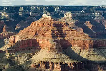
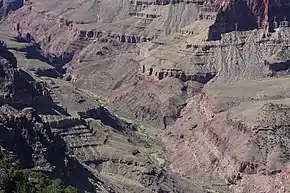
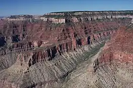
The Bright Angel Shale is easily identified for two reasons. Its soft-greenish color stands out against the browns, reds, and whites of neighboring rock units. And secondly for its slope-forming character against mostly cliff-forming resistant rocks.
The Bright Angel Shale is about 500 feet (152 m) thick at its maximum.[5] It is a nonresistant slope-forming unit. The Bright Angel Shale consists of green and purple-red, siltstone and shale which is interbedded with red-brown to brown sandstone that is similar in lithology to the underlying Tapeats.[6] The Bright Angel Shale underlies and interfingers with Muav Limestone. The Bright Angel Shale is located in the lower elevations of the Grand Canyon, Arizona.[7] The Bright Angel Shale preserves fossils dating back to the Cambrian Period.[8]
The three units of the Tonto Group and the colorful Bright Angel Shale are easily identified as a geological sequence beneath the tall cliffs of the Redwall Limestone (the Redwall sits upon a short resistant cliff of Muav Limestone); the Tonto Group is also easily seen beside Granite Gorge of the Colorado River and the Vishnu Basement Rocks
The units of the Tonto Group:[5]
- Redwall Limestone
- Temple Butte Formation, Devonian-(409-363 Ma), channel deposits upon Muav Limestone
- Tonto Group (~544-505 Ma)
See also
| Wikimedia Commons has media related to Bright Angel Shale. |
- Geology of the Grand Canyon area
- List of fossiliferous stratigraphic units in Arizona
- Paleontology in Arizona
![]() Paleozoic portal
Paleozoic portal
References
- Rose, E (2006) "Nonmarine aspects of the Cambrian Tonto Group of the Grand Canyon, USA, and broader implications." Palaeoworld. 15:223–241.
- Rose, E (2011) Modification of the nomenclature and a revised deposition model for the Cambrian Tonto Group of the Grand Canyon, Arizona. in JS Hollingsworth, FA Sundberg, and JR Foster, eds., pp 77-98, Cambrian Stratigraphy and Paleontology of Northern Arizona and Southern Nevada: Museum of Northern Arizona Bulletin 67, 321 p.
- "Tonto Lexicon entry". National Geologic Map Database Lexicon. United States Geological Survey. n.d. Retrieved 2 June 2019.
- L. F. Noble (1914). "The Shinumo quadrangle, Grand Canyon district, Arizona" (PDF). U.S. Geological Survey Bulletin. 549. doi:10.3133/B549. ISSN 0083-1093. Wikidata Q57659039.
- Chronic, Halka (1983). Roadside Geology of Arizona. Seattle, Washington: The Mountaineers Books. ISBN 978-0-87842-147-3.
- "Bright Angel Lexicon entry". National Geologic Map Database Lexicon. United States Geological Survey. n.d. Retrieved 2 June 2019.
- Hampton, HM (1998). "Geologic Map of the Grand Canyon in the Vicinity of the South Rim Visitor Center". In Kamilli, Robert J.; Richard, Stephen M. (eds.). Geologic Highway Map of Arizona. Arizona Geological Society and Arizona Geological Survey. ISBN 978-1-8919-2400-2., 1 sheet, scale 1:62,500.
- Various Contributors to the Paleobiology Database. "Fossilworks: Gateway to the Paleobiology Database". Archived from the original on 31 July 2014. Retrieved 8 July 2014.
- "Muav Lexicon entry". National Geologic Map Database Lexicon. United States Geological Survey. n.d. Retrieved 2 June 2019.
- "Tapeats Lexicon entry". National Geologic Map Database Lexicon. United States Geological Survey. n.d. Retrieved 2 June 2019.
Further reading
- Blakey, Ron and Wayne Ranney, Ancient Landscapes of the Colorado Plateau, Grand Canyon Association (publisher), 2008, 176 pages, ISBN 978-1934656037
- Brandriss, M. (2004) Angular unconformity between Proterozoic and Cambrian rocks, Grand Canyon, Arizona. GeoDIL, A Geoscience Digital Image Library, University of North Dakota, Grand Forks, North Dakota.
- Lucchitta, Ivo, Hiking Arizona's Geology, 2001, Mountaineers's Books, ISBN 0-89886-730-4
- Mathis, A., and C. Bowman (2007) The Grand Age of Rocks: The Numeric Ages for Rocks Exposed within Grand Canyon, Grand Canyon National Park, Arizona, National Park Service, Grand Canyon National Park, Arizona.
- Share, J. (2102a) The Great Unconformity of the Grand Canyon and the Late Proterozoic-Cambrian Time Interval: Part I - Defining It.
- Share, J. (2102a) The Great Unconformity and the Late Proterozoic-Cambrian Time Interval: Part II - The Rifting of Rodinia and the "Snowball Earth" Glaciations That Followed.
- Timmons, M. K. Karlstrom, and C. Dehler (1999) Grand Canyon Supergroup Six Unconformities Make One Great Unconformity A Record of Supercontinent Assembly and Disassembly. Boatman's Quarterly Review. vol. 12, no. 1, pp. 29–32.
- Timmons, S. S. (2003) Learning to Read the Pages of a Book (Grand Canyon Geology Training Manual), National Park Service, Grand Canyon National Park, Arizona.


