Bucy-le-Roi
Bucy-le-Roi is a commune in the Loiret department in north-central France.
Bucy-le-Roi | |
|---|---|
.svg.png.webp) Coat of arms | |
Location of Bucy-le-Roi 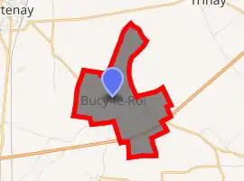
| |
 Bucy-le-Roi  Bucy-le-Roi | |
| Coordinates: 48°03′40″N 1°55′05″E | |
| Country | France |
| Region | Centre-Val de Loire |
| Department | Loiret |
| Arrondissement | Orléans |
| Canton | Meung-sur-Loire |
| Government | |
| • Mayor (2008–2014) | Gervais Greffin |
| Area 1 | 4.58 km2 (1.77 sq mi) |
| Population (2017-01-01)[1] | 171 |
| • Density | 37/km2 (97/sq mi) |
| Time zone | UTC+01:00 (CET) |
| • Summer (DST) | UTC+02:00 (CEST) |
| INSEE/Postal code | 45058 /45410 |
| Elevation | 121–128 m (397–420 ft) |
| 1 French Land Register data, which excludes lakes, ponds, glaciers > 1 km2 (0.386 sq mi or 247 acres) and river estuaries. | |
Population
| Year | Pop. | ±% |
|---|---|---|
| 1793 | 171 | — |
| 1800 | 191 | +11.7% |
| 1806 | 254 | +33.0% |
| 1821 | 257 | +1.2% |
| 1831 | 290 | +12.8% |
| 1836 | 275 | −5.2% |
| 1841 | 280 | +1.8% |
| 1846 | 270 | −3.6% |
| 1851 | 278 | +3.0% |
| 1856 | 260 | −6.5% |
| 1861 | 267 | +2.7% |
| 1866 | 272 | +1.9% |
| 1872 | 275 | +1.1% |
| 1876 | 255 | −7.3% |
| 1881 | 233 | −8.6% |
| 1886 | 241 | +3.4% |
| 1891 | 235 | −2.5% |
| 1896 | 224 | −4.7% |
| 1901 | 219 | −2.2% |
| 1906 | 193 | −11.9% |
| 1911 | 194 | +0.5% |
| 1921 | 187 | −3.6% |
| 1926 | 189 | +1.1% |
| 1931 | 193 | +2.1% |
| 1936 | 190 | −1.6% |
| 1946 | 191 | +0.5% |
| 1954 | 180 | −5.8% |
| 1962 | 165 | −8.3% |
| 1968 | 137 | −17.0% |
| 1975 | 136 | −0.7% |
| 1982 | 127 | −6.6% |
| 1990 | 156 | +22.8% |
| 1999 | 177 | +13.5% |
| 2006 | 185 | +4.5% |
| 2009 | 190 | +2.7% |
See also
References
- "Populations légales 2017". INSEE. Retrieved 6 January 2020.
| Wikimedia Commons has media related to Bucy-le-Roi. |
| Authority control |
|---|
This article is issued from Wikipedia. The text is licensed under Creative Commons - Attribution - Sharealike. Additional terms may apply for the media files.