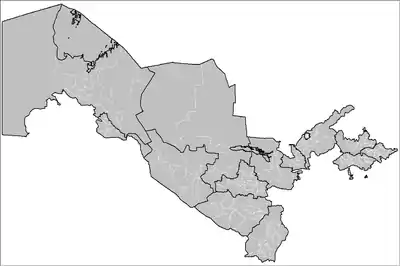
Districts of Uzbekistan
The regions of Uzbekistan are divided into districts (tuman). The districts are listed by region, in the general direction from west to east. Names often transliterated from Russian.
 |
|---|
| This article is part of a series on the politics and government of Uzbekistan |
|
|
| Government |
|
|
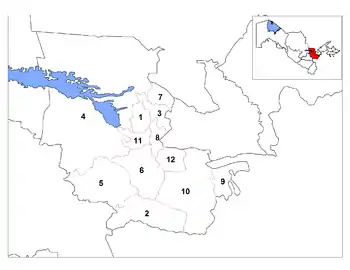
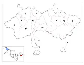
Karakalpakstan
*Kegeyli district was created in 2004 by the merger of former Bozatau district (the northern part of district 5 on the map) and former Kegeyli district (the south-eastern part of district 5). This merger was effected by Resolution 598-II of the Oliy Majlis of the Republic of Uzbekistan (11 February 2004) and Resolution 225 of the Cabinet of Ministers of the Republic of Uzbekistan (11 May 2004), which abolished Bozatau district and created the enlarged Kegeyli district. Prior to that date, there were 15 districts in Karakalpakstan. See Cabinet of Ministers of the Republic of Karakalpakstan and Karakalpakstan on gov.uz.
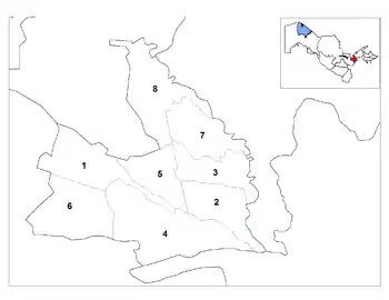
Xorazm
Navoiy
Bukhara
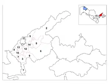
Samarqand

Latinization of district names according to Samarqand regional web site on gov.uz
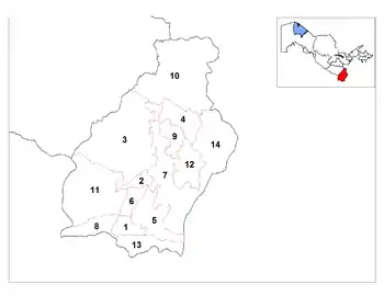
Qashqadaryo
Latinization of district names according to Qashqadaryo Region web site on gov.uz
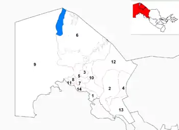
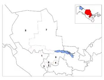
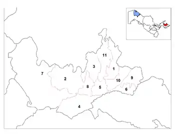
Surxondaryo
| District name | District capital | |
|---|---|---|
| 1 | Angor District | Angor |
| 2 | Bandixon District | Bandixon |
| 3 | Boysun District | Boysun |
| 4 | Denov District | Denov (Denau) |
| 5 | Jarkurghon District | Jarkurghon |
| 6 | Kizirik District | Sariq |
| 7 | Kumkurghon District | Kumkurghon |
| 8 | Muzrabot District | Khalkobod (Khalkabad) |
| 9 | Oltinsoy District | Qarluq |
| 10 | Sariosiyo District | Sariosiyo |
| 11 | Sherobod District | Sherobod (Shirabad) |
| 12 | Shurchi District | Shurchi |
| 13 | Termiz District | Uchkhizil |
| 14 | Uzun District | Uzun |
Jizzakh
Sirdaryo
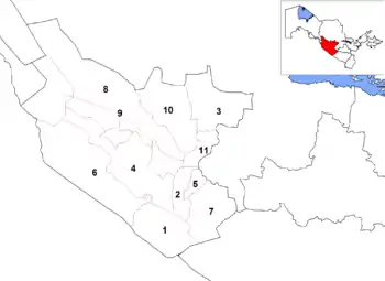
Tashkent
Toshkent and Zangiota Districts was merged in August 2010
Latinization of district names according to Tashkent regional web site on gov.uz
Namangan
Fergana
Ohunboboev District was renamed to Qo'shtepa District in August 2010.
Latinization of district names according to Fergana regional web site on gov.uz
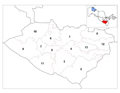
Andijan

Latinization of district names according to Andijan regional web site on gov.uz
Source: Administrative-Territorial Division of the Republic of Uzbekistan, map, State Committee on Land Resources, Geodesy, Cartography, and State Cadastre, Tashkent, 2007.
Tashkent City
| Nr | District | Population (2009)[1] |
Area (km²)[1] |
Density (area/km²)[1] |
Map |
|---|---|---|---|---|---|
| 1 | Bektemir | 27,500 | 20.5 | 1,341 | |
| 2 | Chilanzar | 217,000 | 30.0 | 7,233 | |
| 3 | Hamza | 204,800 | 33.7 | 6,077 | |
| 4 | Mirobod | 122,700 | 17.1 | 7,175 | |
| 5 | Mirzo Ulugbek | 245,200 | 31.9 | 7,687 | |
| 6 | Sergeli | 149,000 | 56.0 | 2,661 | |
| 7 | Shaykhontohur | 285,800 | 27.2 | 10,507 | |
| 8 | Olmazar | 305,400 | 34.5 | 8,852 | |
| 9 | Uchtepa | 237,000 | 28.2 | 8,404 | |
| 10 | Yakkasaray | 115,200 | 14.6 | 7,890 | |
| 11 | Yunusabad | 296,700 | 41.1 | 7,219 |
References
- (in Russian) Statistics of the subdivisions of Tashkent Archived 2015-02-07 at the Wayback Machine