Erp, Ariège
Erp is a commune in the Ariège department in southwestern France.
Erp | |
|---|---|
 Haymaking in Erp | |
Location of Erp 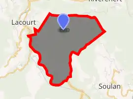
| |
 Erp  Erp | |
| Coordinates: 42°56′33″N 1°12′04″E | |
| Country | France |
| Region | Occitanie |
| Department | Ariège |
| Arrondissement | Saint-Girons |
| Canton | Couserans Est |
| Government | |
| • Mayor (2008–2014) | Jean-Claude Dega |
| Area 1 | 9.24 km2 (3.57 sq mi) |
| Population (2017-01-01)[1] | 121 |
| • Density | 13/km2 (34/sq mi) |
| Time zone | UTC+01:00 (CET) |
| • Summer (DST) | UTC+02:00 (CEST) |
| INSEE/Postal code | 09114 /09200 |
| Elevation | 428–1,208 m (1,404–3,963 ft) (avg. 700 m or 2,300 ft) |
| 1 French Land Register data, which excludes lakes, ponds, glaciers > 1 km2 (0.386 sq mi or 247 acres) and river estuaries. | |
Population
Inhabitants are called Erpois.
| Year | Pop. | ±% |
|---|---|---|
| 1962 | 71 | — |
| 1968 | 109 | +53.5% |
| 1975 | 114 | +4.6% |
| 1982 | 105 | −7.9% |
| 1990 | 88 | −16.2% |
| 1999 | 102 | +15.9% |
| 2008 | 130 | +27.5% |
See also
References
- "Populations légales 2017". INSEE. Retrieved 6 January 2020.
| Wikimedia Commons has media related to Erp, Ariège. |
This article is issued from Wikipedia. The text is licensed under Creative Commons - Attribution - Sharealike. Additional terms may apply for the media files.