Le Vernet, Ariège
Le Vernet (Languedocien: Lo Vernet) is a commune in the Ariège department in southwestern France.
Le Vernet | |
|---|---|
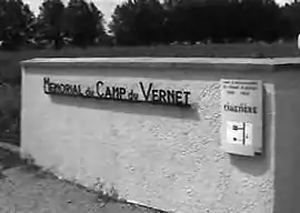
 Memorial for the Le Vernet Internment Camp | |
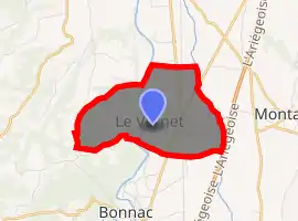
Location of Le Vernet 
| |
 Le Vernet  Le Vernet | |
| Coordinates: 43°11′10″N 1°36′11″E | |
| Country | France |
| Region | Occitanie |
| Department | Ariège |
| Arrondissement | Pamiers |
| Canton | Portes d'Ariège |
| Government | |
| • Mayor (2008–2014) | Michel Grasa |
| Area 1 | 5.59 km2 (2.16 sq mi) |
| Population (2017-01-01)[1] | 708 |
| • Density | 130/km2 (330/sq mi) |
| Time zone | UTC+01:00 (CET) |
| • Summer (DST) | UTC+02:00 (CEST) |
| INSEE/Postal code | 09331 /09700 |
| Elevation | 235–376 m (771–1,234 ft) (avg. 261 m or 856 ft) |
| 1 French Land Register data, which excludes lakes, ponds, glaciers > 1 km2 (0.386 sq mi or 247 acres) and river estuaries. | |
Population
Inhabitants of Le Vernet are called Vernétois.
| Year | Pop. | ±% |
|---|---|---|
| 1962 | 323 | — |
| 1968 | 382 | +18.3% |
| 1975 | 417 | +9.2% |
| 1982 | 464 | +11.3% |
| 1990 | 508 | +9.5% |
| 1999 | 536 | +5.5% |
| 2008 | 632 | +17.9% |
History
It was the site of Camp Vernet, a concentration camp built in 1918. During World War II it was used by the Vichy authorities to intern "undesirable aliens", primarily European refugees, including Jews, and as a transit camp for detained Jews who were to be deported to Nazi labor and extermination camps.
Transport
References
- "Populations légales 2017". INSEE. Retrieved 6 January 2020.
| Wikimedia Commons has media related to Le Vernet, Ariège. |
This article is issued from Wikipedia. The text is licensed under Creative Commons - Attribution - Sharealike. Additional terms may apply for the media files.