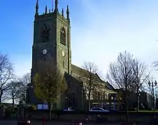
Grade II* listed buildings in Erewash
There are over 20,000 Grade II* listed buildings in England. This page is a list of these buildings in the district of Erewash in Derbyshire.
List of buildings
| Name | Location | Type | Completed [note 1] | Date designated | Grid ref.[note 2] Geo-coordinates |
Entry number [note 3] | Image |
|---|---|---|---|---|---|---|---|
| The Old Hall | Breadsall | House | 16th century | 10 November 1967 | SK3707539828 52°57′16″N 1°26′59″W |
1141230 | 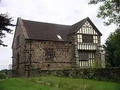 The Old Hall |
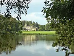
| Locko Park | Dale Abbey | Country house | 1669 | 2 September 1952 | SK4096738648 52°56′37″N 1°23′31″W |
1140431 | |
| Mausoleum west of Saint Matthews Church | Morley | Mausoleum | 1897 | 6 November 1986 | SK3962940938 52°57′52″N 1°24′41″W |
1205888 | 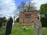 Mausoleum west of Saint Matthews Church |
| The Recreation Room, Tithe Barn and Dovecote | Morley | House | 16th century | 2 September 1952 | SK3967540956 52°57′52″N 1°24′39″W |
1140415 | 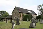 The Recreation Room, Tithe Barn and Dovecote |
| Church of All Saints | Ockbrook | Church | Late 12th century | 10 November 1967 | SK4237035702 52°55′01″N 1°22′17″W |
1087941 | |
| The Moravian Chapel/church | Ockbrook | Church | 1751 | 10 November 1967 | SK4213836176 52°55′17″N 1°22′29″W |
1204382 | 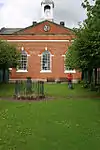 The Moravian Chapel/church |
| The Moravian Manse | Ockbrook | House | c.1800 | 10 November 1967 | SK4212636169 52°55′17″N 1°22′30″W |
1204379 |  |
| Balustrades, gateway and bridge on terrace to south east of Risley Hall | Risley | Balustrade | Early 17th century | 10 November 1967 | SK4607735536 52°54′55″N 1°18′58″W |
1087914 | .JPG.webp) Balustrades, gateway and bridge on terrace to south east of Risley Hall |
| Church of All Saints | Risley | Church | 1593 | 10 November 1967 | SK4610535701 52°55′00″N 1°18′57″W |
1334829 | 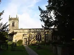 Church of All Saints |
| Latin College and the Latin Cottage | Risley | House | 1720 | 2 September 1952 | SK4616135692 52°55′00″N 1°18′54″W |
1087956 | .JPG.webp) Latin College and the Latin Cottage |
| Latin House | Risley | House | 1706 | 2 September 1952 | SK4612935679 52°55′00″N 1°18′56″W |
1087955 | .JPG.webp) Latin House |
| The Old School House | Risley | House | c.1720 | 2 September 1952 | SK4616835714 52°55′01″N 1°18′53″W |
1204445 | .JPG.webp) The Old School House |
| Church of St Michael and All Angels | Stanton by Dale | Church | Early 14th century | 10 November 1967 | SK4648238143 52°56′19″N 1°18′35″W |
1206037 | 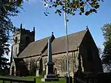 Church of St Michael and All Angels |
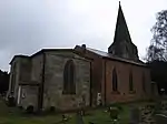
| Church of St Wilfrid | West Hallam | Church | 15th century | 10 November 1967 | SK4321841116 52°57′56″N 1°21′29″W |
1140423 | 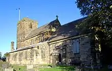 Church of St Wilfrid |
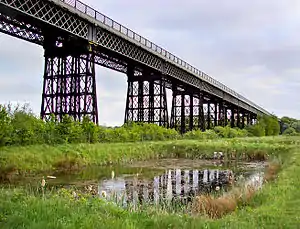
| Bennerley Viaduct | Ilkeston | Railway viaduct | 1878–79 | 21 November 1974 | SK4722143809 52°59′22″N 1°17′53″W |
1140437 | |
| Church of St Laurence and St James | Long Eaton | Church | 12th century | 22 October 1962 | SK4915833736 52°53′56″N 1°16′14″W |
1204249 | |
| Church of St Mary | Ilkeston | Church | Early 13th century | 26 September 1963 | SK4654941739 52°58′16″N 1°18′30″W |
1205669 | |
| Ormiston Ilkeston Enterprise Academy | Ilkeston | School | 1910–14 | 6 November 1986 | SK4604441827 52°58′19″N 1°18′57″W |
1329206 | |
| Scala Cinema | Ilkeston | Cinema | 1913 | 6 November 1986 | SK4643941782 52°58′17″N 1°18′36″W |
1205711 |  Scala Cinema |
| The Hall | Long Eaton | House | 1778 | 22 October 1962 | SK4905233917 52°54′02″N 1°16′20″W |
1204191 | 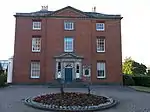 The Hall |
See also
- Grade I listed buildings in Derbyshire
- Grade II* listed buildings in Amber Valley
- Grade II* listed buildings in Bolsover (district)
- Grade II* listed buildings in Chesterfield
- Grade II* listed buildings in Derby
- Grade II* listed buildings in Derbyshire Dales
- Grade II* listed buildings in High Peak
- Grade II* listed buildings in North East Derbyshire
- Grade II* listed buildings in South Derbyshire
Notes
- The date given is the date used by Historic England as significant for the initial building or that of an important part in the structure's description.
- Sometimes known as OSGB36, the grid reference is based on the British national grid reference system used by the Ordnance Survey.
- The "List Entry Number" is a unique number assigned to each listed building and scheduled monument by Historic England.
External links
![]() Media related to Grade II* listed buildings in Derbyshire at Wikimedia Commons
Media related to Grade II* listed buildings in Derbyshire at Wikimedia Commons
This article is issued from Wikipedia. The text is licensed under Creative Commons - Attribution - Sharealike. Additional terms may apply for the media files.
.jpg.webp)
