Haegen
Haegen (German: Hägen) is a commune in the Bas-Rhin department in Grand Est in north-eastern France.
Haegen
Haaje | |
|---|---|
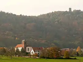
 Haegen overlooked by the Château du Grand-Geroldseck | |
.svg.png.webp) Coat of arms | |
Location of Haegen 
| |
 Haegen  Haegen | |
| Coordinates: 48°42′53″N 7°20′23″E | |
| Country | France |
| Region | Grand Est |
| Department | Bas-Rhin |
| Arrondissement | Saverne |
| Canton | Saverne |
| Intercommunality | Pays de Saverne |
| Government | |
| • Mayor (2014-2020) | Bernard Bich |
| Area 1 | 20.32 km2 (7.85 sq mi) |
| Population (2017-01-01)[1] | 677 |
| • Density | 33/km2 (86/sq mi) |
| Time zone | UTC+01:00 (CET) |
| • Summer (DST) | UTC+02:00 (CEST) |
| INSEE/Postal code | 67179 /67700 |
| Elevation | 195–587 m (640–1,926 ft) |
| 1 French Land Register data, which excludes lakes, ponds, glaciers > 1 km2 (0.386 sq mi or 247 acres) and river estuaries. | |
Population
| Year | Pop. | ±% |
|---|---|---|
| 2004 | 650 | — |
| 2006 | 636 | −2.2% |
| 2007 | 637 | +0.2% |
| 2008 | 637 | +0.0% |
| 2009 | 638 | +0.2% |
| 2010 | 633 | −0.8% |
| 2011 | 643 | +1.6% |
| 2012 | 657 | +2.2% |
| 2013 | 670 | +2.0% |
| 2014 | 684 | +2.1% |
| 2015 | 689 | +0.7% |
| 2016 | 691 | +0.3% |
Geography
Haegen is a mountain village located on the western frontier of Alsace which at this point coincides with the western frontier of the Alemanish dialect area. Across the Vosges Mountains to the west of the commune is Lorraine.
On the Alsace side, neighbouring communes are Saverne and Gottenhouse to the north-east, and Thal-Marmoutier and Reinhardsmunster to the south-east.
Landmarks
The commune contains the ruined remains of a twelfth-century castle, one of the earliest surviving castles in the North Vosges region, and of a fourteenth-century smaller fortress. These are known as the Château du Grand-Geroldseck and the Château du Petit-Geroldseck.
See also
References
- "Populations légales 2017". INSEE. Retrieved 6 January 2020.
| Wikimedia Commons has media related to Haegen. |
This article is issued from Wikipedia. The text is licensed under Creative Commons - Attribution - Sharealike. Additional terms may apply for the media files.