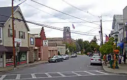
Highland, Ulster County, New York
Highland /ˈhaɪˌlænd/ is a hamlet (and census-designated place) in Ulster County, New York, United States. The population was 5,647 at the 2010 census. It is part of the New York City Combined Statistical area.
Highland | |
|---|---|
 Downtown Highland | |
 Location in Ulster County and the state of New York. | |
| Coordinates: 41°43′6″N 73°57′49″W | |
| Country | United States |
| State | New York |
| County | Ulster |
| Area | |
| • Total | 5.1 sq mi (13 km2) |
| • Land | 4.7 sq mi (12 km2) |
| • Water | 0.3 sq mi (0.8 km2) |
| Population (2010) | |
| • Total | 5,647 |
| Time zone | UTC-5 (Eastern (EST)) |
| • Summer (DST) | UTC-4 (EDT) |
| ZIP codes | 12528 |
Highland is a community in the town of Lloyd, on U.S. Route 9W. Routes 44 and 55 run through it as well. It is town at the western end of the Mid-Hudson Bridge across from Poughkeepsie.
History
The Brown–Ellis House and Anthony Yelverton House are listed on the National Register of Historic Places.[1][2]
Geography
The community is on the west bank of the Hudson River.
Highland is located at 41°43′6″N 73°57′49″W (41.718357, -73.963590).[3]
According to the United States Census Bureau, the CDP has a total area of 5.1 square miles (13 km2), of which, 4.7 square miles (12 km2) of it is land and 0.3 square miles (0.78 km2) of it (6.90%) is water.
Demographics
Of the 1,891 households 31.3% had children under the age of 18 living with them, 48.0% were married couples living together, 11.7% had a female householder with no husband present, and 36.8% were non-families. 28.5% of households were one person and 8.8% were one person aged 65 or older. The average household size was 2.44 and the average family size was 3.05.
The age distribution was 22.8% under the age of 18, 7.5% from 18 to 24, 30.3% from 25 to 44, 20.7% from 45 to 64, and 18.7% 65 or older. The median age was 38 years. For every 100 females, there were 84.6 males. For every 100 females age 18 and over, there were 79.7 males.
The median household income was $48,877 and the median family income was $60,938. Males had a median income of $40,781 versus $26,335 for females. The per capita income for the CDP was $21,346. About 6.3% of families and 6.5% of the population were below the poverty line, including 7.3% of those under age 18 and 11.6% of those age 65 or over.
References
- "National Register Information System". National Register of Historic Places. National Park Service. July 9, 2010.
- "National Register of Historic Places Listings". Weekly List of Actions Taken on Properties: 6/16/14 through 6/27/14. National Park Service. 2014-06-27.
- "US Gazetteer files: 2010, 2000, and 1990". United States Census Bureau. 2011-02-12. Retrieved 2011-04-23.
