Marlboro, New York
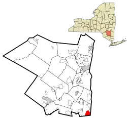
Marlboro is a hamlet (and census-designated place) in Ulster County, New York, United States. The population was 3,669 at the 2010 census. Marlboro is in the southeastern part of the town of Marlborough, located in the southeast corner of the county.
Marlboro, New York | |
|---|---|
 Location in Ulster County and the state of New York. | |
| Coordinates: 41°36′17″N 73°58′29″W | |
| Country | United States |
| State | New York |
| County | Ulster |
| Area | |
| • Total | 3.4 sq mi (8.7 km2) |
| • Land | 2.8 sq mi (7.2 km2) |
| • Water | 0.6 sq mi (1.5 km2) |
| Elevation | 180 ft (55 m) |
| Population (2010) | |
| • Total | 3,669 |
| Time zone | UTC-5 (Eastern (EST)) |
| • Summer (DST) | UTC-4 (EDT) |
| ZIP code | 12542 |
| Area code(s) | 845 |
| FIPS code | 36-45700 |
| GNIS feature ID | 0956544 |
History
The community was the site of the first settlement in the town, around 1697. The Chapel Hill Bible Church, Christ Episcopal Church, Dubois-Sarles Octagon, Elliot–Buckley House, and Shady Brook Farm are listed on the National Register of Historic Places.[1][2][3] Marlboro is also the location of the Gomez Mill House, an historical site which is the oldest Jewish residence in Ulster County. It was additionally the first paper mill in Ulster County.
Geography
Marlboro is located at 41°36′17″N 73°58′29″W (41.604693, -73.974822).[4]
According to the United States Census Bureau, the CDP has a total area of 3.3 square miles (8.5 km2), of which 2.8 square miles (7.3 km2) is land and 0.6 square miles (1.5 km2, or 17.61%) is water.
The community is on the west bank of the Hudson River.
Demographics
As of the census[5] of 2000, there were 2,339 people, 926 households, and 605 families residing in the CDP. The population density was 846.3 per square mile (327.2/km2). There were 981 housing units at an average density of 354.9/sq mi (137.2/km2). The racial makeup of the CDP was 95.68% White, 1.84% African American, 0.26% Native American, 0.34% Asian, 0.81% from other races, and 1.07% from two or more races. Hispanic or Latino of any race were 4.96% of the population.
There were 926 households, out of which 32.2% had children under the age of 18 living with them, 51.2% were married couples living together, 9.9% had a female householder with no husband present, and 34.6% were non-families. 28.2% of all households were made up of individuals, and 12.3% had someone living alone who was 65 years of age or older. The average household size was 2.53 and the average family size was 3.14.
In the CDP, the population was spread out, with 26.0% under the age of 18, 6.4% from 18 to 24, 31.1% from 25 to 44, 21.7% from 45 to 64, and 14.8% who were 65 years of age or older. The median age was 37 years. For every 100 females, there were 93.8 males. For every 100 females age 18 and over, there were 89.4 males.
The median income for a household in the CDP was $43,073, and the median income for a family was $52,688. Males had a median income of $37,788 versus $28,542 for females. The per capita income for the CDP was $20,123. About 10.9% of families and 12.0% of the population were below the poverty line, including 16.1% of those under age 18 and 12.0% of those age 65 or over.
Notable residents
- Rob Bell - Major League Baseball player for the Cincinnati Reds, Texas Rangers and Tampa Bay Devil Rays
- Brian Benben - actor; star of Dream On on HBO.
- Dee Brown - Major League Baseball player for the Kansas City Royals
- Wade Davis - Pitcher for the Colorado Rockies
- John Esposito - Jazz pianist. Graduated from Marlboro High School June 1971. Teaches at Bard College.
- John M. Falcone - Police officer in Poughkeepsie, NY. Killed in the line of duty in February 2011.
- Nicole Polizzi - person known as "Snooki" on MTV's reality television series Jersey Shore.
References
- "National Register Information System". National Register of Historic Places. National Park Service. July 9, 2010.
- "National Register of Historic Places". WEEKLY LIST OF ACTIONS TAKEN ON PROPERTIES: 11/08/10 THROUGH 11/12/10. National Park Service. 2010-11-19.
- "National Register of Historic Places Listings". Weekly List of Actions Taken on Properties: 11/19/12 through 11/23/12. National Park Service. 2012-11-30.
- "US Gazetteer files: 2010, 2000, and 1990". United States Census Bureau. 2011-02-12. Retrieved 2011-04-23.
- "U.S. Census website". United States Census Bureau. Retrieved 2008-01-31.
