Japan National Route 129
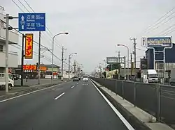
National Route 129 is a national highway of Japan connecting Hiratsuka and Sagamihara in Kanagawa Prefecture in the Kantō region of Japan. It has a total length of 31.7 km (19.7 mi).
| ||||
|---|---|---|---|---|
| 国道129号 | ||||

| ||||
| Route information | ||||
| Length | 31.7 km[1] (19.7 mi) | |||
| Existed | 1963–present | |||
| Major junctions | ||||
| South end | ||||
| North end | ||||
| Highway system | ||||
| National highways of Japan Expressways of Japan
| ||||
Route description

It has junctions with National Route 16 in Sagamihara, National Routes 412 and 246 in Atsugi, Kanagawa, and National Routes 1 and 134 in Hiratsuka, Kanagawa. The route runs in a north to south direction and has junctions with some major expressways. These include, two interchanges with the Ken-Ō Expressway, Atsugi Interchange at the Tōmei Expressway and Odawara-Atsugi Road, and Atsugi-minami Interchange at the Shin-Tōmei Expressway.[2]
History
Route 129 was originally designated on 18 May 1953 from Yokohama to Chiba as a loop around Tokyo. This was redesignated (along with a section of Route 127) as Route 16 on 1 April 1963 and the current Route 129 was designated the same day.
List of major junctions
The entire route is in Kanagawa Prefecture.
| Location | km | mi | Destinations | Notes | |||
|---|---|---|---|---|---|---|---|
| Hiratsuka | 0.0 | 0.0 | Southern terminus | ||||
| 0.6 | 0.37 | Kanagawa Prefecture Route 607 | |||||
| 1.7 | 1.1 | ||||||
| 4.3 | 2.7 | Kanagawa Prefecture Route 44 (Shonan New Way) east | |||||
| 6.7 | 4.2 | Kanagawa Prefecture Route 44 (Shonan New Way) | |||||
| Atsugi | 9.9 | 6.2 | Kanagawa Prefecture Route 22 | ||||
| 10.1 | 6.3 | E1A exit 2 (Atsugi-minami Interchange) | |||||
| 10.9 | 6.8 | Kanagawa Prefecture Route 601 north | |||||
| 11.1 | 6.9 | Kanagawa Prefecture Route 604 | |||||
| 11.5 | 7.1 | E1 Exit 5 (Atsugi Interchange), no exit number assigned to E85; no access to westbound E85 | |||||
| 12.5 | 7.8 | Kanagawa Prefecture Route 63 south | |||||
| 13.3 | 8.3 | National Route 246 merges into Route 129; southern end of National Route 246 concurrency | |||||
| 14.3 | 8.9 | Kanagawa Prefecture Route 603 | |||||
| 15.0 | 9.3 | Kanagawa Prefecture Route 60 | |||||
| 15.6 | 9.7 | Kanagawa Prefecture Route 43 south | |||||
| 17.3 | 10.7 | Northern end of National Route 246 concurrency | |||||
| 18.5 | 11.5 | C4 Exit 32 (Ken-Ō-Atsugi Interchange) | |||||
| 19.7 | 12.2 | Kanagawa Prefecture Route 42 | |||||
| 21.2 | 13.2 | Kanagawa Prefecture Route 65 west | |||||
| 23.4 | 14.5 | Kanagawa Prefecture Route 511 | |||||
| Sagamihara | 24.3 | 15.1 | C4 Exit 33 (Sagamihara-Aikawa Interchange) | ||||
| 25.4 | 15.8 | Kanagawa Prefecture Route 508 south | Southern end of Kanagawa Prefecture Route 508 concurrency | ||||
| 26.0 | 16.2 | Kanagawa Prefecture Route 508 north | Northern end of Kanagawa Prefecture Route 508 concurrency | ||||
| 28.0 | 17.4 | Kanagawa Prefecture Route 54 | |||||
| 31.5 | 19.6 | Northern terminus | |||||
1.000 mi = 1.609 km; 1.000 km = 0.621 mi
| |||||||
References
- "一般国道の路線別、都道府県別道路現況" [Road statistics by General National Highway route and prefecture] (PDF) (in Japanese). Ministry of Land, Infrastructure, Transport and Tourism. Retrieved 19 February 2020.
- "一般国道の路線を指定する政令". Wikisource (in Japanese). Retrieved 5 September 2019.
| Wikimedia Commons has media related to Route 129 (Japan). |
