La Chapelle-Saint-Aubert
La Chapelle-Saint-Aubert (Breton: Chapel-Sant-Alverzh) is a commune in the Ille-et-Vilaine department in Brittany in northwestern France.
La Chapelle-Saint-Aubert
Chapel-Sant-Alverzh | |
|---|---|
_Mairie.jpg.webp) Town hall | |
Location of La Chapelle-Saint-Aubert 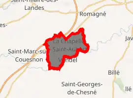
| |
 La Chapelle-Saint-Aubert 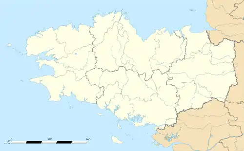 La Chapelle-Saint-Aubert | |
| Coordinates: 48°18′52″N 1°18′23″W | |
| Country | France |
| Region | Brittany |
| Department | Ille-et-Vilaine |
| Arrondissement | Fougères-Vitré |
| Canton | Fougères-1 |
| Government | |
| • Mayor (2014–2020) | Christian Galle |
| Area 1 | 9.77 km2 (3.77 sq mi) |
| Population (2017-01-01)[1] | 439 |
| • Density | 45/km2 (120/sq mi) |
| Time zone | UTC+01:00 (CET) |
| • Summer (DST) | UTC+02:00 (CEST) |
| INSEE/Postal code | 35063 /35140 |
| Elevation | 51–128 m (167–420 ft) |
| 1 French Land Register data, which excludes lakes, ponds, glaciers > 1 km2 (0.386 sq mi or 247 acres) and river estuaries. | |
Geography
La Chapelle-Saint-Aubert is located at 39 km (24 mi) in the North-East of Rennes and at 43 km (27 mi) in the south of the Mont Saint-Michel.
The communes bordering are Saint-Sauveur-des-Landes, Romagné, Billé, Vendel, Saint-Jean-sur-Couesnon and Saint-Marc-sur-Couesnon.
Population
| Year | Pop. | ±% |
|---|---|---|
| 1962 | 379 | — |
| 1968 | 399 | +5.3% |
| 1975 | 352 | −11.8% |
| 1982 | 377 | +7.1% |
| 1990 | 387 | +2.7% |
| 1999 | 359 | −7.2% |
| 2008 | 419 | +16.7% |
References
- "Populations légales 2017". INSEE. Retrieved 6 January 2020.
External links
| Wikimedia Commons has media related to La Chapelle-Saint-Aubert. |
- The commune on infobretagne.com
- Base Mérimée: Search for heritage in the commune, Ministère français de la Culture. (in French)
| Authority control |
|---|
This article is issued from Wikipedia. The text is licensed under Creative Commons - Attribution - Sharealike. Additional terms may apply for the media files.