Thourie
Thourie (Breton: Tourig) is a commune in the Ille-et-Vilaine department in Brittany in northwestern France.
Thourie
Tourig | |
|---|---|
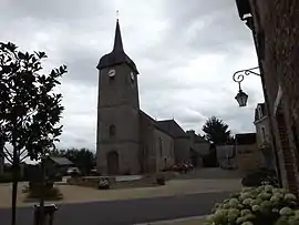 The church in Thourie | |
Location of Thourie 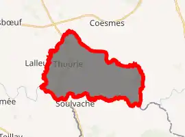
| |
 Thourie  Thourie | |
| Coordinates: 47°51′18″N 1°28′47″W | |
| Country | France |
| Region | Brittany |
| Department | Ille-et-Vilaine |
| Arrondissement | Fougères-Vitré |
| Canton | La Guerche-de-Bretagne |
| Intercommunality | Pays de la Roche-aux-Fées |
| Government | |
| • Mayor (2014–2020) | Daniel Bordier |
| Area 1 | 24.04 km2 (9.28 sq mi) |
| Population (2017-01-01)[1] | 802 |
| • Density | 33/km2 (86/sq mi) |
| Time zone | UTC+01:00 (CET) |
| • Summer (DST) | UTC+02:00 (CEST) |
| INSEE/Postal code | 35335 /35134 |
| Elevation | 34–97 m (112–318 ft) |
| 1 French Land Register data, which excludes lakes, ponds, glaciers > 1 km2 (0.386 sq mi or 247 acres) and river estuaries. | |
Geography
The ruisseau de la Couyère forms all of the commune's western border, then flows into the Semnon, which forms all of its southern border.
Population
Inhabitants of Thourie are called Thourisiens in French.
| Year | Pop. | ±% |
|---|---|---|
| 1962 | 743 | — |
| 1968 | 828 | +11.4% |
| 1975 | 690 | −16.7% |
| 1982 | 591 | −14.3% |
| 1990 | 501 | −15.2% |
| 1999 | 526 | +5.0% |
| 2009 | 696 | +32.3% |
References
- "Populations légales 2017". INSEE. Retrieved 6 January 2020.
External links
| Wikimedia Commons has media related to Thourie. |
- Base Mérimée: Search for heritage in the commune, Ministère français de la Culture. (in French)
- Mayors of Ille-et-Vilaine Association (in French)
| Authority control |
|---|
This article is issued from Wikipedia. The text is licensed under Creative Commons - Attribution - Sharealike. Additional terms may apply for the media files.