Le Grand-Pressigny
Le Grand-Pressigny is a commune in the Indre-et-Loire department in central France.
Le Grand-Pressigny | |
|---|---|
 The church in Le Grand-Pressigny | |
.svg.png.webp) Coat of arms | |
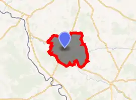
Location of Le Grand-Pressigny 
| |
 Le Grand-Pressigny  Le Grand-Pressigny | |
| Coordinates: 46°55′16″N 0°48′13″E | |
| Country | France |
| Region | Centre-Val de Loire |
| Department | Indre-et-Loire |
| Arrondissement | Loches |
| Canton | Descartes |
| Intercommunality | CC Loches Sud Touraine |
| Government | |
| • Mayor (2008–2014) | François-Nicolas Joannès |
| Area 1 | 39.55 km2 (15.27 sq mi) |
| Population (2017-01-01)[1] | 916 |
| • Density | 23/km2 (60/sq mi) |
| Time zone | UTC+01:00 (CET) |
| • Summer (DST) | UTC+02:00 (CEST) |
| INSEE/Postal code | 37113 /37350 |
| Elevation | 52–135 m (171–443 ft) (avg. 60 m or 200 ft) |
| 1 French Land Register data, which excludes lakes, ponds, glaciers > 1 km2 (0.386 sq mi or 247 acres) and river estuaries. | |
There is a Chalcolithic flint mine located in the commune. It produced an unusual caramel-coloured stone which appears to have been highly prized across Europe with examples found in the Pyrenees, the Netherlands and Switzerland. Blocks of flint and unfinished blanks were traded, as well as finished tools.
Population
| Year | Pop. | ±% |
|---|---|---|
| 1793 | 967 | — |
| 1800 | 953 | −1.4% |
| 1806 | 1,115 | +17.0% |
| 1821 | 1,098 | −1.5% |
| 1831 | 1,768 | +61.0% |
| 1836 | 1,870 | +5.8% |
| 1841 | 1,876 | +0.3% |
| 1846 | 1,826 | −2.7% |
| 1851 | 1,909 | +4.5% |
| 1856 | 1,840 | −3.6% |
| 1861 | 1,809 | −1.7% |
| 1866 | 1,832 | +1.3% |
| 1872 | 1,686 | −8.0% |
| 1876 | 1,702 | +0.9% |
| 1881 | 1,779 | +4.5% |
| 1886 | 1,774 | −0.3% |
| 1891 | 1,705 | −3.9% |
| 1896 | 1,637 | −4.0% |
| 1901 | 1,648 | +0.7% |
| 1906 | 1,569 | −4.8% |
| 1911 | 1,559 | −0.6% |
| 1921 | 1,556 | −0.2% |
| 1926 | 1,583 | +1.7% |
| 1931 | 1,559 | −1.5% |
| 1936 | 1,595 | +2.3% |
| 1946 | 1,595 | +0.0% |
| 1954 | 1,580 | −0.9% |
| 1962 | 1,480 | −6.3% |
| 1968 | 1,415 | −4.4% |
| 1975 | 1,256 | −11.2% |
| 1982 | 1,185 | −5.7% |
| 1990 | 1,120 | −5.5% |
| 1999 | 1,117 | −0.3% |
| 2006 | 1,064 | −4.7% |
| 2009 | 1,012 | −4.9% |
References
- "Populations légales 2017". INSEE. Retrieved 6 January 2020.
| Wikimedia Commons has media related to Le Grand-Pressigny. |
This article is issued from Wikipedia. The text is licensed under Creative Commons - Attribution - Sharealike. Additional terms may apply for the media files.