Saint-Martin-le-Beau
Saint-Martin-le-Beau is a commune in the Indre-et-Loire department in central France.
Saint-Martin-le-Beau | |
|---|---|
.svg.png.webp) Coat of arms | |
Location of Saint-Martin-le-Beau 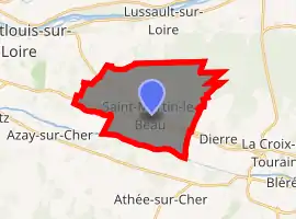
| |
 Saint-Martin-le-Beau  Saint-Martin-le-Beau | |
| Coordinates: 47°21′24″N 0°54′37″E | |
| Country | France |
| Region | Centre-Val de Loire |
| Department | Indre-et-Loire |
| Arrondissement | Loches |
| Canton | Bléré |
| Intercommunality | Bléré Val de Cher |
| Government | |
| • Mayor (2008–2014) | Didier Avenet |
| Area 1 | 18.44 km2 (7.12 sq mi) |
| Population (2017-01-01)[1] | 3,156 |
| • Density | 170/km2 (440/sq mi) |
| Time zone | UTC+01:00 (CET) |
| • Summer (DST) | UTC+02:00 (CEST) |
| INSEE/Postal code | 37225 /37270 |
| Elevation | 49–108 m (161–354 ft) |
| 1 French Land Register data, which excludes lakes, ponds, glaciers > 1 km2 (0.386 sq mi or 247 acres) and river estuaries. | |
Population
| Year | Pop. | ±% |
|---|---|---|
| 1793 | 1,206 | — |
| 1800 | 1,298 | +7.6% |
| 1806 | 1,323 | +1.9% |
| 1821 | 1,445 | +9.2% |
| 1831 | 1,406 | −2.7% |
| 1836 | 1,422 | +1.1% |
| 1841 | 1,345 | −5.4% |
| 1846 | 1,353 | +0.6% |
| 1851 | 1,379 | +1.9% |
| 1856 | 1,340 | −2.8% |
| 1861 | 1,341 | +0.1% |
| 1866 | 1,297 | −3.3% |
| 1872 | 1,323 | +2.0% |
| 1876 | 1,331 | +0.6% |
| 1881 | 1,368 | +2.8% |
| 1886 | 1,408 | +2.9% |
| 1891 | 1,296 | −8.0% |
| 1896 | 1,288 | −0.6% |
| 1901 | 1,207 | −6.3% |
| 1906 | 1,239 | +2.7% |
| 1911 | 1,212 | −2.2% |
| 1921 | 1,133 | −6.5% |
| 1926 | 1,127 | −0.5% |
| 1931 | 1,030 | −8.6% |
| 1936 | 1,067 | +3.6% |
| 1946 | 1,159 | +8.6% |
| 1954 | 1,130 | −2.5% |
| 1962 | 1,106 | −2.1% |
| 1968 | 1,220 | +10.3% |
| 1975 | 1,403 | +15.0% |
| 1982 | 2,051 | +46.2% |
| 1990 | 2,427 | +18.3% |
| 1999 | 2,481 | +2.2% |
| 2006 | 2,606 | +5.0% |
| 2009 | 2,819 | +8.2% |
External links
| Wikimedia Commons has media related to Saint-Martin-le-Beau. |
| Authority control |
|---|
This article is issued from Wikipedia. The text is licensed under Creative Commons - Attribution - Sharealike. Additional terms may apply for the media files.