Lesterps
Lesterps (L'Esterp in Limousin, an Occitan dialect) is a commune in the Charente department in southwestern France.
Lesterps | |
|---|---|
 Entering Lesterps from Confolens | |
.svg.png.webp) Coat of arms | |
Location of Lesterps 
| |
 Lesterps 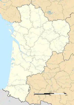 Lesterps | |
| Coordinates: 46°00′41″N 0°46′53″E | |
| Country | France |
| Region | Nouvelle-Aquitaine |
| Department | Charente |
| Arrondissement | Confolens |
| Canton | Charente-Vienne |
| Intercommunality | Confolentais |
| Government | |
| • Mayor (2008–2014) | Jacques Thibaut |
| Area 1 | 36.03 km2 (13.91 sq mi) |
| Population (2017-01-01)[1] | 479 |
| • Density | 13/km2 (34/sq mi) |
| Time zone | UTC+01:00 (CET) |
| • Summer (DST) | UTC+02:00 (CEST) |
| INSEE/Postal code | 16182 /16420 |
| Elevation | 170–275 m (558–902 ft) (avg. 260 m or 850 ft) |
| 1 French Land Register data, which excludes lakes, ponds, glaciers > 1 km2 (0.386 sq mi or 247 acres) and river estuaries. | |
The inhabitants are called Lesterrois and Lesterroises.
Geography
Lesterps is located in Charente Limousin, in the north-east of the Charente department and borders Haute-Vienne. The village of Lesterps, 9 km east of Confolens, is a major market town. It is 16 km from Chabanais, 17 km from Saint-Junien, 42 km from Limoges and 63 km from Angoulême.
The town is well served by roads. The D30, from Confolens to Limoges via Saint-Junien, crosses it from west to east, and the D29, from Saulgond to Brillac, crosses it from south to north. The D82 east of the village goes to Limoges via Saint-Christophe. The nearest train station is Chabanais, served by TER to Angoulême and Limoges.
Population
| Year | Pop. | ±% |
|---|---|---|
| 1793 | 1,457 | — |
| 1800 | 1,510 | +3.6% |
| 1806 | 1,374 | −9.0% |
| 1821 | 1,396 | +1.6% |
| 1831 | 1,426 | +2.1% |
| 1841 | 1,385 | −2.9% |
| 1846 | 1,427 | +3.0% |
| 1851 | 1,361 | −4.6% |
| 1856 | 1,355 | −0.4% |
| 1861 | 1,281 | −5.5% |
| 1866 | 1,320 | +3.0% |
| 1872 | 1,355 | +2.7% |
| 1876 | 1,375 | +1.5% |
| 1881 | 1,455 | +5.8% |
| 1886 | 1,436 | −1.3% |
| 1891 | 1,464 | +1.9% |
| 1896 | 1,461 | −0.2% |
| 1901 | 1,413 | −3.3% |
| 1906 | 1,361 | −3.7% |
| 1911 | 1,365 | +0.3% |
| 1921 | 1,216 | −10.9% |
| 1926 | 1,125 | −7.5% |
| 1931 | 1,085 | −3.6% |
| 1936 | 1,047 | −3.5% |
| 1946 | 957 | −8.6% |
| 1954 | 906 | −5.3% |
| 1962 | 801 | −11.6% |
| 1968 | 754 | −5.9% |
| 1975 | 623 | −17.4% |
| 1982 | 557 | −10.6% |
| 1990 | 560 | +0.5% |
| 1999 | 594 | +6.1% |
| 2008 | 484 | −18.5% |
See also
References
- "Populations légales 2017". INSEE. Retrieved 6 January 2020.
| Wikimedia Commons has media related to Lesterps. |
| Authority control |
|
|---|