List of bridges, tunnels, and cuts in Hudson County, New Jersey
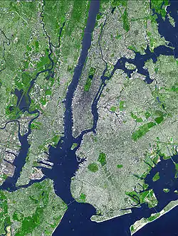
This is a list of vehicular and rail bridges, tunnels, and cuts in Hudson County, New Jersey. Located in the northeastern part of New Jersey Hudson lies at the heart of the Port of New York and New Jersey and is a major crossroads of the New York Metropolitan area and Northeast Megalopolis. Located on two peninsulas, formerly known as Bergen Neck and New Barbadoes Neck, it has extensive waterfront along the Hudson River, Upper New York Bay, Kill van Kull, Newark Bay and the Hackensack and Passaic Rivers. The main part of Hudson lies on Bergen Hill, the southern emergence of the Hudson Palisades, starting at sea level at Bergen Point and rising to 260 feet travelling through Bayonne, Jersey City and North Hudson. Secaucus and most of West Hudson are part of the New Jersey Meadowlands. Listings are generally from south to north.
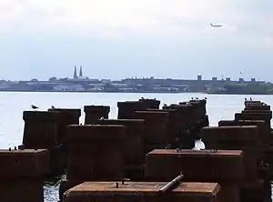
Hudson River
| Crossing | Carries | Location | Coordinates |
|---|---|---|---|
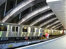
| Downtown Hudson Tubes | Port Authority Trans-Hudson | Jersey City and World Trade Center | 40.7151°N 74.0244°W |
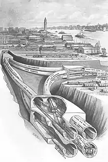
| Holland Tunnel | Jersey City and Lower Manhattan | 40°43′39″N 74°01′16″W | |
| Uptown Hudson Tubes | Port Authority Trans-Hudson | Jersey City and Manhattan | |
| Gateway Tunnel (proposed) |
Amtrak New Jersey Transit |
North Bergen and Midtown Manhattan | |
| THE Tunnel (project cancelled) |
New Jersey Transit | Weehawken and Midtown Manhattan connecting Secaucus Junction and Penn Station |
|
| North River Tunnels | Amtrak New Jersey Transit |
Weehawken and Midtown Manhattan | 40°45′32″N 74°00′46″W |
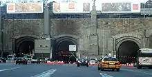
| Lincoln Tunnel | Weehawken and Midtown Manhattan | 40°45′47″N 74°00′36″W | |
| The next crossing to the north and the last in New Jersey is in Bergen County | |||
| George Washington Bridge | Fort Lee and Upper Manhattan | 40°51′05″N 73°57′09″W | |
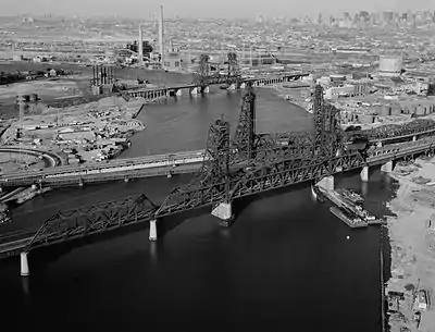
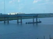
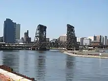
Kill van Kull and Newark Bay
| Crossing | Carries | Location | Coordinates |
|---|---|---|---|
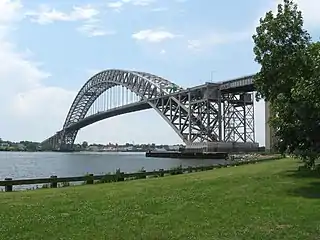
| Bayonne Bridge | Bayonne - Staten Island | ||
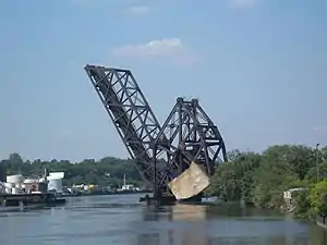
| CRRNJ Newark Bay Bridge (defunct) |
Central Railroad of New Jersey | Bayonne - Elizabethport | 40.6545°N 74.15°W |
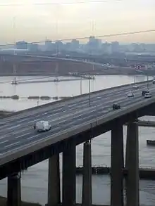
| Newark Bay Bridge | New Jersey Turnpike |
Bayonne - Newark | |
| Upper Bay Bridge | CSX Transportation Norfolk Southern Conrail National Docks Secondary |
Bayonne - Newark | 40.699052°N 74.11°W |
Hackensack River

Passaic River
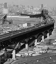
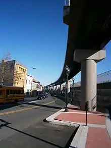
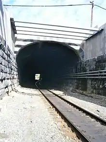
Bergen Hill-Hudson Palisades


| vehicular cuts | carries | location | connection |
|---|---|---|---|
| State Highway (Depressed Highway) |
Jersey City | Pulaski Skyway - Holland Tunnel | |
| Lincoln Tunnel Approach | North Hudson | New Jersey Turnpike - Lincoln Tunnel | |
| The next vehicular cut to the north and the last in New Jersey is in Bergen County | |||
| GWB Plaza | Fort Lee | to George Washington Bridge | |
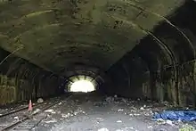
| There are numerous excavations for roads on the eastern escarpment of the Hudson Palisades, including New York Avenue, Mountain Road, Paterson Plank Road, Wing Viaduct, Hackensack Plank Road, Shippen Street, Boulevard East, Pershing Road, Bull Ferry Road, Gorge Road | |||
Meadowlands
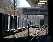
Kearny and Croxton in the low-lying Meadowlands supports an infrastructure that includes many unnamed bridges, embankments, flyovers, and causeways.
The Manhattan Transfer was once located in the Kearny Meadows. The Kearny Connection allows transfer between the Hoboken and Newark Divisions of New Jersey Transit rail operations for its Waterfront Connection. The Sawtooth Bridges carries the Northeast Corridor over NJ Tranist, PATH, and Conrail.
The Main, Bergen County, Pascack Valley, Meadowlands, and Port Jervis lines uses a series of embankments and bridges to cross the Meadowlands. Planned expansion of Secaucus Junction includes a massive loop. Numerous junctions, including the Marion, and the Northern Running Track are part of the Conrail's North Jersey Shared Assets Area, a component in the national freight rail network. Much of the New Jersey Turnpike travels along a causeway. Nearby Snake Hill, Exit 15's huge horseshoe-shaped U-turn rises above the rail yards and lines below it.
See also
References
- Bulger, Teresa D. (May 7, 2019). "Feats of Engineering: Bridging the Hackensack River and Cutting through Bergen HillDocumentation for Three Historic Resources that Help Move Commerce and Commuters throughout the Port of New York and New Jersey" (PDF). NJDOT. Retrieved May 5, 2020.
- "Jersey: Jersey City Bridge Profile". Shoutingthomas.typepad.com. Archived from the original on October 22, 2012. Retrieved October 23, 2012.
- (PDF) https://web.archive.org/web/20090327025729/http://www.state.nj.us/dep/hpo/1identify/lists/essex.pdf. Archived from the original (PDF) on March 27, 2009. Retrieved August 21, 2010. Missing or empty
|title=(help) - "Pennsylvania Railroad cut, Mt Pleasant, Jersey City, Hudson Co., New Jersey, USA". Mindat.org. October 11, 2012. Retrieved October 23, 2012.
- "Bergen Arches". Njcu.edu. Archived from the original on September 29, 2012. Retrieved October 23, 2012.
- "Stone above Long Dock Tunnel". Modelengineers.org. Archived from the original on February 29, 2012. Retrieved October 23, 2012.
- French, Kenneth, Images of Rail: Railroads of Hoboken and Jersey City,Arcadia Publishing, 2002, p125, ISBN 978-0-7385-0966-2
- "The Bergen Hill Tunnels". Gutenberg.org. Retrieved October 23, 2012.
- "JFK Blvd. Bridge". 40.773333;-74.015556: Bridgehunter.com. Retrieved October 23, 2012.CS1 maint: location (link)
- "Design And Construction Of The Weehawken Tunnel And Bergenline Avenue Station For The Hudson-Bergen Light Rail Transit System - Publications Index". Pubsindex.trb.org. Retrieved October 23, 2012.
- "New York - West Shore & Buffalo RR tunnel, Weehawken, Bergen Hill, Hudson Co., New Jersey, USA". Mindat.org. July 30, 2012. Retrieved October 23, 2012.
- NJDOT Web Development Unit. "Paterson Plank Road Project Debuts in Hudson County". Nj.gov. Retrieved October 23, 2012.
- https://timesmachine.nytimes.com/timesmachine/1893/03/17/109695387.pdf Palisades/NYS&W Tunnel
- Palisades diabase