List of cultural property of national significance in Switzerland: Zürich
This list contains all cultural property of national significance (class A) in the canton of Zürich from the 2009 Swiss Inventory of Cultural Property of National and Regional Significance. It is sorted by municipality and contains 204 individual buildings, 66 collections, 50 archaeological finds and 3 other, special sites or objects.
The geographic coordinates provided are in the Swiss coordinate system as given in the Inventory.
Adlikon
| KGS No.? |
Picture | Name | Street Address | CH1903 X coordinate | CH1903 Y coordinate | Location |
|---|---|---|---|---|---|---|
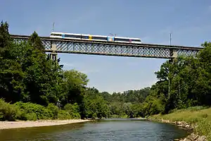
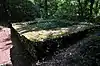
| 10506 | Thurbrücke (Thur Bridge, shared with Ossingen) |
696.637 | 273.123 | 47.60167°N 8.723681°E |
Affoltern am Albis
| KGS No.? |
Picture | Name | Street Address | CH1903 X coordinate | CH1903 Y coordinate | Location |
|---|---|---|---|---|---|---|
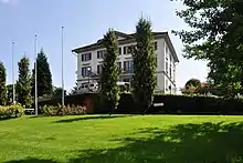
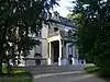
| 11777 |  Collection Center of the Swiss National Museums |
Lindenmoosstrasse 3 | 676.219 | 235.865 | 47.269284°N 8.445847°E |
Andelfingen
| KGS No.? |
Picture | Name | Street Address | CH1903 X coordinate | CH1903 Y coordinate | Location |
|---|---|---|---|---|---|---|
| 10063 |  Haldenmühle with Outbuildings |
 Landstrasse 80 | 693.402 | 272.499 | 47.596527°N 8.680539°E |
| Unknown | ISOS Dorf: Andelfingen |
Bäretswil
| KGS No.? |
Picture | Name | Street Address | CH1903 X coordinate | CH1903 Y coordinate | Location |
|---|---|---|---|---|---|---|
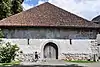
| 7393 |  Former Cotton mill |
 Neuthal | 707.730 | 246.330 | 47.359007°N 8.864691°E |
| 7394 |  Greifenberg, Former Castle Site |
707.740 | 244.900 | 47.346146°N 8.864479°E | |
| Unknown | ISOS Spezialfall: Neuthal |
Bauma
| KGS No.? |
Picture | Name | Street Address | CH1903 X coordinate | CH1903 Y coordinate | Location |
|---|---|---|---|---|---|---|
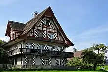
| 9504 |  Flarz with Freddi House |
 Undelstrasse 29–37 | 707.088 | 248.728 | 47.380677°N 8.856768°E |
| Unknown | ISOS Verstädtertes Dorf: Bauma | |||||
| Unknown | ISOS Weiler: Wellenau | |||||
| Unknown | ISOS Spezialfall: Blitterswil / Juckeren |
Berg am Irchel
| KGS No.? |
Picture | Name | Street Address | CH1903 X coordinate | CH1903 Y coordinate | Location |
|---|---|---|---|---|---|---|
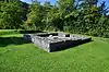
| 11655 | Ebersberg Part of the late-Roman era Rhine Fortifications |
685.810 | 269.635 | 47.571808°N 8.579054°E | ||
| Unknown | ISOS Dorf: Berg am Irchel |
Bülach
| KGS No.? |
Picture | Name | Street Address | CH1903 X coordinate | CH1903 Y coordinate | Location |
|---|---|---|---|---|---|---|
| Unknown | ISOS Kleinstadt / Flecken: Bülach | |||||
| Unknown | ISOS Spezialfall: Spinnerei Jakobsthal |
Bubikon
| KGS No.? |
Picture | Name | Street Address | CH1903 X coordinate | CH1903 Y coordinate | Location |
|---|---|---|---|---|---|---|
| 7411 | Ritterhaus Former Knights Hospitaller Commandry |
Ritterhaus 35 | 705.166 | 235.976 | 47.266307°N 8.828331°E |
Dägerlen
| KGS No.? |
Picture | Name | Street Address | CH1903 X coordinate | CH1903 Y coordinate | Location |
|---|---|---|---|---|---|---|
| Unknown | ISOS Weiler: Dägerlen |
Dinhard
| KGS No.? |
Picture | Name | Street Address | CH1903 X coordinate | CH1903 Y coordinate | Location |
|---|---|---|---|---|---|---|
| Unknown | ISOS Dorf: Kirchdinhard |
Dübendorf
| KGS No.? |
Picture | Name | Street Address | CH1903 X coordinate | CH1903 Y coordinate | Location |
|---|---|---|---|---|---|---|
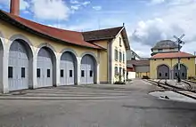
| 8554 | 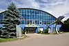 Flieger Flab Museum |
 Überlandstrasse 255 | 690.009 | 250.375 | 47.398043°N 8.630964°E |
| 11775 | Military History Collection (Shared with Burgdorf and Thun) |
Überlandstrasse | 689.573 | 250.595 | 47.400081°N 8.625234°E | |
| 7433 |  Werkstattgebäude 1 Workshop Building 1 |
Rechweg | 689.874 | 250.655 | 47.400579°N 8.629232°E |
Dürnten
| KGS No.? |
Picture | Name | Street Address | CH1903 X coordinate | CH1903 Y coordinate | Location |
|---|---|---|---|---|---|---|
| 7434 |  Swiss Reformed Church |
 Oberdürntnerstrasse | 706.260 | 237.310 | 47.278129°N 8.8431°E |
Eglisau
| KGS No.? |
Picture | Name | Street Address | CH1903 X coordinate | CH1903 Y coordinate | Location |
|---|---|---|---|---|---|---|
| 7439 |  Gasthof Zum Hirschen |
 Untergass 28 | 681.751 | 269.962 | 47.575267°N 8.525177°E |
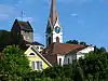
| 7440 | 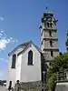 Swiss Reformed Church |
 Chilengass | 681.800 | 269.950 | 47.575153°N 8.525826°E |
| 9707 |  |
Rhinsberg, Late-Bronze Age Hilltop Settlement / Early Modern Watch Tower |
682.595 | 268.220 | 47.559496°N 8.53607°E | |
| Unknown | ISOS Kleinstadt / Flecken: Eglisau |
Elgg
| KGS No.? |
Picture | Name | Street Address | CH1903 X coordinate | CH1903 Y coordinate | Location |
|---|---|---|---|---|---|---|
| 7443 | 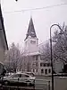 Swiss Reformed Church with Rectory |
 Lindenplatz | 707.660 | 260.910 | 47.490132°N 8.867277°E |
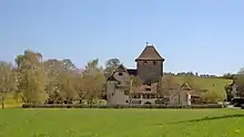
| 7444 | 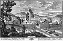 Elgg Castle with Surrounding Buildings |
 Lindenplatz | 707.570 | 260.160 | 47.483402°N 8.865902°E |
| Unknown | ISOS Kleinstadt / Flecken: Elgg with Schloss |
Erlenbach
| KGS No.? |
Picture | Name | Street Address | CH1903 X coordinate | CH1903 Y coordinate | Location |
|---|---|---|---|---|---|---|
| 10374 |  Swiss Reformed Church |
 Seestrasse | 687.188 | 239.671 | 47.302157°N 8.591518°E |
Fehraltorf
| KGS No.? |
Picture | Name | Street Address | CH1903 X coordinate | CH1903 Y coordinate | Location |
|---|---|---|---|---|---|---|
| 7452 | 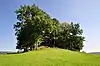 Rüti, Earthen Fortifications |
698.220 | 248.970 | 47.384234°N 8.739407°E |
Feuerthalen
| KGS No.? |
Picture | Name | Street Address | CH1903 X coordinate | CH1903 Y coordinate | Location |
|---|---|---|---|---|---|---|
| Unknown | ISOS Verstädtertes Dorf: Feuerthalen |
Flaach
| KGS No.? |
Picture | Name | Street Address | CH1903 X coordinate | CH1903 Y coordinate | Location |
|---|---|---|---|---|---|---|
| Unknown | 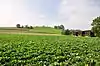 Chrumben, Early Medieval Cemetery |
||||
| 7458 | 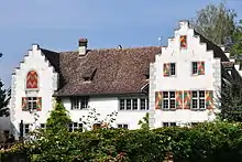 Flaach Castle with Wine Press and Fountain |
Schloss 396 | 687.689 | 270.287 | 47.577424°N 8.604151°E |
Flurlingen
| KGS No.? |
Picture | Name | Street Address | CH1903 X coordinate | CH1903 Y coordinate | Location |
|---|---|---|---|---|---|---|
| 10051 | 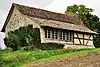 Stantenwegtrotte |
 Stanten-Weg | 689.647 | 282.358 | 47.685707°N 8.632611°E |
Freienstein-Teufen
| KGS No.? |
Picture | Name | Street Address | CH1903 X coordinate | CH1903 Y coordinate | Location |
|---|---|---|---|---|---|---|
| 11659 | Tössegg-Schlössliacker, Part of the late-Roman era Rhine Fortifications |
684.235 | 267.270 | 47.550744°N 8.557677°E | ||
| Unknown | ISOS Spezialfall: Oberteufen with Castle |
Glattfelden
| KGS No.? |
Picture | Name | Street Address | CH1903 X coordinate | CH1903 Y coordinate | Location |
|---|---|---|---|---|---|---|
| 10376 | %252C_Gottfried-Keller-Strasse_8_2011-09-15_13-47-02_ShiftN.jpg.webp) Klingelehaus (Gottfried-Keller-Zentrum) |
Klingelehaus (Gottfried-Keller-Zentrum) |
Gottfried-Keller-Strasse 8 | 679.833 | 268.118 | 47.55892°N 8.499357°E |
| 7466 | 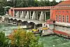 NOK Eglisau – Rheinsfelden Power Plant |
 Zollstrasse | 677.848 | 269.861 | 47.574833°N 8.473291°E |
| 11673 | Zweidlen-Schlossbuck, Part of the late-Roman era Rhine Fortifications |
677.310 | 268.385 | 47.561623°N 8.465885°E | ||
| Unknown | ISOS Dorf: Glattfelden |
Gossau
| KGS No.? |
Picture | Name | Street Address | CH1903 X coordinate | CH1903 Y coordinate | Location |
|---|---|---|---|---|---|---|
| 7472 |  Dürsteler House |
 Grüningerstrasse 150 | 701.285 | 239.002 | 47.294127°N 8.777738°E |
| 7471 |  Swiss Reformed Church |
 Bergstrasse | 700.116 | 239.746 | 47.300997°N 8.762452°E |
Greifensee
| KGS No.? |
Picture | Name | Street Address | CH1903 X coordinate | CH1903 Y coordinate | Location |
|---|---|---|---|---|---|---|
| 7473 | Reformed Church (Gallus Chapel) | Im Städtli | 693.531 | 246.745 | 47.364907°N 8.676854°E | |
| Unknown | Greifensee Castle | Im Städtli | 693.440 | 246.758 | 47.365037°N 8.675652°E | |
| 7474 | Storen, lake shore settlement |
|||||
| Unknown | _-_Schloss_-_Landenberghaus_-_Greifensee_IMG_6558_ShiftN.jpg.webp) ISOS Kleinstadt / Flecken: Greifensee |
ISOS Kleinstadt / Flecken: Greifensee |
_-_Gallus-Kapelle_IMG_6563_ShiftN.jpg.webp)
_-_Schloss_IMG_6552.jpg.webp)
_2011-09-03_15-54-40.JPG.webp)
Grüningen
| KGS No.? |
Picture | Name | Street Address | CH1903 X coordinate | CH1903 Y coordinate | Location |
|---|---|---|---|---|---|---|
| Unknown |  ISOS Kleinstadt / Flecken: Grüningen |
Hausen am Albis
| KGS No.? |
Picture | Name | Street Address | CH1903 X coordinate | CH1903 Y coordinate | Location |
|---|---|---|---|---|---|---|
| Unknown | ISOS Weiler: Husertal | |||||
| Unknown | ISOS Weiler: Tüfenbach |
Henggart
| KGS No.? |
Picture | Name | Street Address | CH1903 X coordinate | CH1903 Y coordinate | Location |
|---|---|---|---|---|---|---|
| 7484 | _053.JPG.webp) Schlossbuck, Earthen Fortification |
Schlossbuck, Earthen Fortification |
694.210 | 269.030 | 47.565217°N 8.690545°E |
Herrliberg
| KGS No.? |
Picture | Name | Street Address | CH1903 X coordinate | CH1903 Y coordinate | Location |
|---|---|---|---|---|---|---|
| 7486 |  Landhaus Schipf |
 Seestrasse 1 | 687.747 | 238.749 | 47.293791°N 8.598729°E |
| Unknown | ISOS Spezialfall: Landgut Schipf with Seeuferhang |
Hittnau
| KGS No.? |
Picture | Name | Street Address | CH1903 X coordinate | CH1903 Y coordinate | Location |
|---|---|---|---|---|---|---|
| Unknown | ISOS Weiler: Dürstelen |
Hombrechtikon
| KGS No.? |
Picture | Name | Street Address | CH1903 X coordinate | CH1903 Y coordinate | Location |
|---|---|---|---|---|---|---|
| Unknown | Feldbach, Neolithic and Early-Bronze Age lake shore settlement Seegubel |
|||||
| 9479 |  Hof Oberhaus |
 Seestrasse 2, 4 | 702.140 | 232.930 | 47.239389°N 8.78766°E |
| 7498 |  Hürlimann House |
 Lützelsee 2, 4 | 701.406 | 235.028 | 47.25837°N 8.778441°E |
| 7500 | Country Estate Rosenberg | Alte Landstrasse 1, 3 | 701.697 | 232.741 | 47.237757°N 8.781768°E | |
| 10377 | 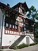 Menzi House |
 Lützelsee 3 | 701.355 | 235.024 | 47.258342°N 8.777766°E |
| 7503 | 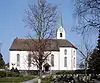 Swiss Reformed Church |
 Oetwilerstrasse | 700.330 | 234.420 | 47.253066°N 8.764091°E |
| 7501 | 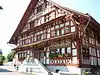 Egli House |
 Lutikon 1–3 | 700.494 | 234.904 | 47.257394°N 8.766366°E |
| Unknown | ISOS Weiler: Lützelsee | |||||
| Unknown | ISOS Spezialfall: Feldbach / Schirmensee |
Horgen
| KGS No.? |
Picture | Name | Street Address | CH1903 X coordinate | CH1903 Y coordinate | Location |
|---|---|---|---|---|---|---|
| 7509 | 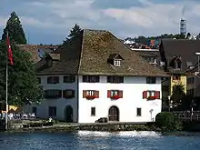 Former Sust (Warehouse) |
 Bahnhofstrasse 27 | 687.857 | 235.115 | 47.261093°N 8.599472°E |
| 7511 | Country Estate Bocken | Hauptgebäude, Bockenweg | 688.889 | 233.116 | 47.242977°N 8.612711°E | |
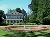
| 10442 | 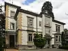 Parks around Villa Stünzi |
 Seestrasse 229 | 688.415 | 234.741 | 47.257655°N 8.60677°E |
| 7513 | 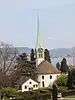 Swiss Reformed Church |
 Kirchstrasse | 687.673 | 234.920 | 47.259364°N 8.597003°E |
| 9131 | 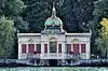 Herner Lake Pavillon |
 Seegartenstrasse | 687.259 | 235.506 | 47.264689°N 8.591648°E |
| 10052 | 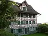 Agenten House |
 Seestrasse 175 | 687.944 | 234.976 | 47.259832°N 8.600594°E |
| Unknown | ISOS Verstädtertes Dorf: Horgen | |||||
| Unknown | ISOS Spezialfall: Landgut Bocken |
Hüttikon
| KGS No.? |
Picture | Name | Street Address | CH1903 X coordinate | CH1903 Y coordinate | Location |
|---|---|---|---|---|---|---|
| 7516 | 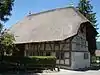 Straw Thatched House |
 Oetwilerstrasse 12 | 671.480 | 255.390 | 47.445416°N 8.386343°E |
Illnau-Effretikon
| KGS No.? |
Picture | Name | Street Address | CH1903 X coordinate | CH1903 Y coordinate | Location |
|---|---|---|---|---|---|---|
| 7518 | 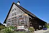 Former Farm House, Known as Hablützelhaus |
Horbenerstrasse 9 | 698.568 | 252.173 | 47.412987°N 8.74472°E |
| 10490 | 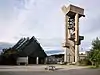 Swiss Reformed Church of Effretikon |
 Rebbuckstrasse | 694.368 | 253.793 | 47.428171°N 8.689419°E |
Kappel am Albis
| KGS No.? |
Picture | Name | Street Address | CH1903 X coordinate | CH1903 Y coordinate | Location |
|---|---|---|---|---|---|---|
| 7521 |  Former Cistercian Monastery |
 Kappelerhof | 682.285 | 231.247 | 47.227023°N 8.525153°E |
| Unknown | ISOS Weiler: Hauptikon | |||||
| Unknown | ISOS Spezialfall: Kappel / Näfenhüser |
Kilchberg
| KGS No.? |
Picture | Name | Street Address | CH1903 X coordinate | CH1903 Y coordinate | Location |
|---|---|---|---|---|---|---|
| 9171 | 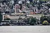 Corporate Archives of Lindt & Sprüngli AG |
 Seestrasse 204 | 684.242 | 241.300 | 47.31719°N 8.552874°E |
Kleinandelfingen
| KGS No.? |
Picture | Name | Street Address | CH1903 X coordinate | CH1903 Y coordinate | Location |
|---|---|---|---|---|---|---|
| 9531 | 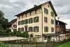 Zur Friedau House |
 Schaffhauserstrasse 3 | 693.491 | 272.630 | 47.597693°N 8.681749°E |
Knonau
| KGS No.? |
Picture | Name | Street Address | CH1903 X coordinate | CH1903 Y coordinate | Location |
|---|---|---|---|---|---|---|
| Unknown | ISOS Weiler: Hinteruttenberg |
Küsnacht
| KGS No.? |
Picture | Name | Street Address | CH1903 X coordinate | CH1903 Y coordinate | Location |
|---|---|---|---|---|---|---|
| 9484 | 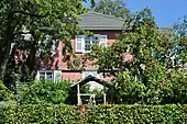 Lux Guyer's house «Sunnebüel» |
 Am Itschnacherstich 1 | 687.691 | 242.420 | 47.326813°N 8.598705°E |
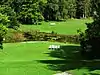
| 10443 |  Vogel-Sulzer Garden |
 Zur Letzi 25 | 688.400 | 242.975 | 47.33171°N 8.608193°E |
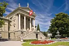
| 8537 |  Town Museum |
 Tobelweg 1 | 686.817 | 241.343 | 47.317243°N 8.586936°E |
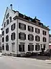
| 11686 |  Villa Streiff |
 Zürichstrasse 21 | 685.882 | 242.811 | 47.330568°N 8.574852°E |
| 7536 |  Carl Jung's House |
 Seestrasse 228 | 686.520 | 240.609 | 47.310681°N 8.582867°E |
| 7532 | Tithe Press | Theodor-Brunner-Weg 4 | 686.240 | 241.120 | 47.315313°N 8.579263°E |
Kyburg
| KGS No.? |
Picture | Name | Street Address | CH1903 X coordinate | CH1903 Y coordinate | Location |
|---|---|---|---|---|---|---|
| 7537 9711 |
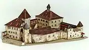 Medieval / Early Modern Castle and Village |
 698.380 | 257.220 | 47.458402°N 8.743341°E | |
| Unknown | ISOS Dorf: Kyburg |
Laufen-Uhwiesen
| KGS No.? |
Picture | Name | Street Address | CH1903 X coordinate | CH1903 Y coordinate | Location |
|---|---|---|---|---|---|---|
| 9505 |  Former Municipal Meeting House |
 Dorfstrasse 16 | 689.758 | 280.696 | 47.670747°N 8.633753°E |
| Unknown | 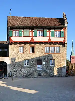 ISOS Spezialfall: Laufen Castle |
 Rheinfallweg | 688.343 | 281.322 | 47.676568°N 8.61504°E |
Lindau
| KGS No.? |
Picture | Name | Street Address | CH1903 X coordinate | CH1903 Y coordinate | Location |
|---|---|---|---|---|---|---|
| 9289 |  Production and Warehouse Buildings for the Maggi AG Company |
Winterthurerstrasse | 695.456 | 256.398 | 47.451441°N 8.704394°E |
Männedorf
| KGS No.? |
Picture | Name | Street Address | CH1903 X coordinate | CH1903 Y coordinate | Location |
|---|---|---|---|---|---|---|
| 7547 | 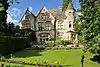 Villa Alma with Surrounding Buildings |
 Seestrasse 80 | 694.197 | 234.707 | 47.25655°N 8.683142°E |
Marthalen
| KGS No.? |
Picture | Name | Street Address | CH1903 X coordinate | CH1903 Y coordinate | Location |
|---|---|---|---|---|---|---|
| 7551 | 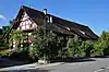 House, Known as the Altes Wirtshaus |
Schaffhauserstrasse 3 | 691.074 | 275.761 | 47.626188°N 8.650259°E |
| Unknown | ISOS Dorf: Marthalen | |||||
| Unknown | ISOS Weiler: Ellikon am Rhein |
Maschwanden
| KGS No.? |
Picture | Name | Street Address | CH1903 X coordinate | CH1903 Y coordinate | Location |
|---|---|---|---|---|---|---|
| Unknown | ISOS Dorf: Maschwanden |
Meilen
| KGS No.? |
Picture | Name | Street Address | CH1903 X coordinate | CH1903 Y coordinate | Location |
|---|---|---|---|---|---|---|
| 11705 | 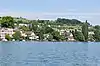 Feldmeilen-Vorderfeld, Neolithic and Bronze Age lake shore settlement |
689.670 | 236.500 | 47.273306°N 8.6237°E | |
| 7561 | 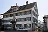 Landsitz Seehalde with former Rental House |
 Seestrasse 444 | 690.352 | 236.259 | 47.271045°N 8.632663°E |
| 7562 |  Landsitz Seehof with Surrounding Buildings |
 Seestrasse 642 | 691.196 | 235.878 | 47.267503°N 8.643738°E |
| 11711 |  |
Rohrenhab, Neolithic and Early-Bronze Age lake shore settlement |
||||
| 11711 |  |
Schellen, Neolithic and Bronze Age Lake Shore Settlement |
||||
| 9134 |  House, Known as Breuer Lakehouse |
Im Hausacher 35 | 688.823 | 237.619 | 47.283484°N 8.612729°E |
| Unknown | ISOS Weiler: Burg |
Mettmenstetten
| KGS No.? |
Picture | Name | Street Address | CH1903 X coordinate | CH1903 Y coordinate | Location |
|---|---|---|---|---|---|---|
| 10081 | 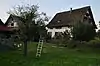 Hof Rossau, House with Outbuildings |
Baarerstrasse 17 | 679.150 | 231.200 | 47.226984°N 8.483754°E |
| 7571 |  House |
 Buechstock | 679.110 | 234.370 | 47.255499°N 8.483783°E |
| Unknown | ISOS Weiler: Grossholz / Grüt | |||||
| Unknown | ISOS Weiler: Weissenbach |
Neerach
| KGS No.? |
Picture | Name | Street Address | CH1903 X coordinate | CH1903 Y coordinate | Location |
|---|---|---|---|---|---|---|
| Unknown | ISOS Dorf: Neerach |
Neftenbach
| KGS No.? |
Picture | Name | Street Address | CH1903 X coordinate | CH1903 Y coordinate | Location |
|---|---|---|---|---|---|---|
| 7574 | 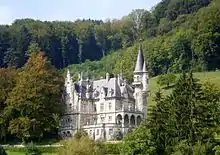 Wart Castle with Outbuildings and Park |
 Wartgutstrasse 80 | 690.921 | 264.612 | 47.52595°N 8.645943°E |
Nürensdorf
| KGS No.? |
Picture | Name | Street Address | CH1903 X coordinate | CH1903 Y coordinate | Location |
|---|---|---|---|---|---|---|
| 7576 | 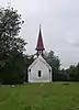 Swiss Reformed St. Oswald's Chapel |
 Hitzenbachstrasse | 692.090 | 257.280 | 47.459852°N 8.659949°E |
Oberrieden
| KGS No.? |
Picture | Name | Street Address | CH1903 X coordinate | CH1903 Y coordinate | Location |
|---|---|---|---|---|---|---|
| 9506 | 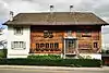 Bindern House |
 Alte Landstrasse 79, 81 | 686.532 | 236.141 | 47.270496°N 8.582165°E |
Oberstammheim
| KGS No.? |
Picture | Name | Street Address | CH1903 X coordinate | CH1903 Y coordinate | Location |
|---|---|---|---|---|---|---|
| 9275 | 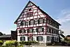 Alte Kanzlei Former Administration Building |
Hauptstrasse 76 | 702.377 | 276.566 | 47.63176°N 8.800789°E |
| 7584 | 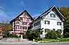 Gasthaus (Combination Hotel and Restaurant) Hirschen |
 Steigstrasse 4 | 702.414 | 276.598 | 47.632042°N 8.801289°E |
| 7585 | 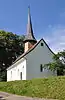 Swiss Reformed Galluskapelle |
 Chilenbückli | 702.400 | 276.820 | 47.63404°N 8.801154°E |
| 9811 | %252C_Steigstrasse_6_2011-09-16_14-01-32.JPG.webp) Forge (Former Wine press Building) |
Forge (Former Wine press Building) |
Steigstrasse 6 | 702.425 | 276.612 | 47.632166°N 8.801438°E |
| Unknown | ISOS Dorf: Oberstammheim |
Oetwil an der Limmat
| KGS No.? |
Picture | Name | Street Address | CH1903 X coordinate | CH1903 Y coordinate | Location |
|---|---|---|---|---|---|---|
| Unknown | 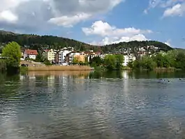 ISOS Dorf: Oetwil an der Limmat |
Ossingen
| KGS No.? |
Picture | Name | Street Address | CH1903 X coordinate | CH1903 Y coordinate | Location |
|---|---|---|---|---|---|---|
| Unknown | De Chreebuck, Early Medieval Settlement and Graveyard |
|||||
| 7591 | Thurbrücke (Thur Bridge, shared with Adlikon) |
696.637 | 273.123 | 47.60167°N 8.723681°E | ||
| Unknown | ISOS Dorf: Ossingen | |||||
| Unknown | ISOS Weiler: Husen with Castle Wyden |
Otelfingen
| KGS No.? |
Picture | Name | Street Address | CH1903 X coordinate | CH1903 Y coordinate | Location |
|---|---|---|---|---|---|---|
| 7596 |  Mill with Former Brewery |
 Mühlegasse 2 | 671.550 | 257.414 | 47.463611°N 8.387595°E |
| Unknown | ISOS Dorf: Otelfingen |
Pfäffikon
| KGS No.? |
Picture | Name | Street Address | CH1903 X coordinate | CH1903 Y coordinate | Location |
|---|---|---|---|---|---|---|
| 7598 |  Flarzhaus Ruetschberg |
 Hohlgass 1–11 | 700.288 | 245.694 | 47.354462°N 8.766055°E |
| Unknown | _-_Pf%C3%A4ffikon_1920.jpg.webp) ISOS Verstädtertes Dorf: Pfäffikon |
ISOS Verstädtertes Dorf: Pfäffikon | ||||
| Unknown | ISOS Weiler: Hermatswil |
Pfungen
| KGS No.? |
Picture | Name | Street Address | CH1903 X coordinate | CH1903 Y coordinate | Location |
|---|---|---|---|---|---|---|
| 7602 |  Villa Schlosshalde |
 Dorfstrasse 14 | 690.499 | 263.487 | 47.515892°N 8.640112°E |
| Unknown | ISOS Dorf: Pfungen |
Rafz
| KGS No.? |
Picture | Name | Street Address | CH1903 X coordinate | CH1903 Y coordinate | Location |
|---|---|---|---|---|---|---|
| Unknown | ISOS Dorf: Rafz |
Regensberg
| KGS No.? |
Picture | Name | Street Address | CH1903 X coordinate | CH1903 Y coordinate | Location |
|---|---|---|---|---|---|---|
| 7605 | %252C_Oberburg_41_in_Regensberg_2011-08-28_14-16-04.jpg.webp) Engelfrid House |
Engelfrid House | Oberburg 41 | 675.411 | 259.660 | 47.483379°N 8.439178°E |
| Unknown |  ISOS Kleinstadt / Flecken: Regensberg |
Regensdorf
| KGS No.? |
Picture | Name | Street Address | CH1903 X coordinate | CH1903 Y coordinate | Location |
|---|---|---|---|---|---|---|
| 9733 | %252C_M%C3%BChlestrasse_2011-09-04_16-57-08_ShiftN.jpg.webp) Obere (Upper) Church and Reginli Chapel |
Obere (Upper) Church and Reginli Chapel | Mühlestrasse | 677.303 | 253.699 | 47.42955°N 8.463246°E |
| 10084 |  Granary |
 Im Sand 7 | 678.470 | 255.050 | 47.441562°N 8.478949°E |
Rheinau
| KGS No.? |
Picture | Name | Street Address | CH1903 X coordinate | CH1903 Y coordinate | Location |
|---|---|---|---|---|---|---|
| 7608 |  Former Benedictine Abbey |
 Alt-Rheinau | 687.900 | 277.500 | 47.642259°N 8.608383°E |
| 9714 | 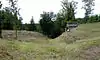 Rheinau Peninsula and Island, Celtic Oppidum Medieval / Early Modern Monastery and City Prehistoric Wall-Cemetery, later used as a Medieval City Wall |
687.720 | 277.850 | 47.64543°N 8.606058°E | |
| 11677 | Mannhausen, Part of the late-Roman era Rhine Fortifications |
689.560 | 278.070 | 47.64716°N 8.630586°E | ||
| 7615 | Strickboden, Köpferplatz, Part of the late-Roman era Rhine Fortifications |
687.770 | 274.750 | 47.617547°N 8.60611°E | ||
| Unknown | ISOS Spezialfall: Rheinau with Monastery and Klinik |
Richterswil
| KGS No.? |
Picture | Name | Street Address | CH1903 X coordinate | CH1903 Y coordinate | Location |
|---|---|---|---|---|---|---|
| 7616 | Richterswil railway station | Seestrasse 20 | 696.121 | 229.378 | 47.208347°N 8.707419°E | |
| 7618 | 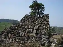 Ruins of Alt Wädenswil Castle |
 694.360 | 229.880 | 47.213115°N 8.684284°E | |
| 9715 |  Samstagern, Early Modern Sconce |
 694.960 | 228.080 | 47.196841°N 8.691823°E | |
| Unknown |  ISOS Verstädtertes Dorf: Richterswil |
 ||||
| Unknown | ISOS Spezialfall: Mülenen |
Rifferswil
| KGS No.? |
Picture | Name | Street Address | CH1903 X coordinate | CH1903 Y coordinate | Location |
|---|---|---|---|---|---|---|
| 7632 |  Farm House |
 Jonenbachstrasse 42, 44 | 679.952 | 233.514 | 47.247699°N 8.494753°E |
| 10085 |  Baer House |
 Hauptikerstrasse 6 | 680.024 | 232.775 | 47.241044°N 8.495573°E |
| Unknown | ISOS Dorf: Oberrifferswil |
Rorbas
| KGS No.? |
Picture | Name | Street Address | CH1903 X coordinate | CH1903 Y coordinate | Location |
|---|---|---|---|---|---|---|
| 7634 | 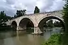 Steinbrücke |
 685.980 | 265.000 | 47.530105°N 8.580418°E |
Rümlang
| KGS No.? |
Picture | Name | Street Address | CH1903 X coordinate | CH1903 Y coordinate | Location |
|---|---|---|---|---|---|---|
| 7638 |  Kleinjogg-Hof |
 Katzenrüti 321 | 680.527 | 254.505 | 47.436412°N 8.506118°E |
Rüti
| KGS No.? |
Picture | Name | Street Address | CH1903 X coordinate | CH1903 Y coordinate | Location |
|---|---|---|---|---|---|---|
| 10086 | 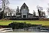 Krematorium |
 Krematoriumstrasse 1 | 706.896 | 234.700 | 47.254554°N 8.850883°E |
| 7648 | 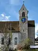 Swiss Reformed Church, Former Monastery Church |
Pfauenplatz | 706.735 | 235.222 | 47.259275°N 8.848881°E |
| Unknown |  ISOS Verstädtertes Dorf: Rüti with Untertann |
Russikon
| KGS No.? |
Picture | Name | Street Address | CH1903 X coordinate | CH1903 Y coordinate | Location |
|---|---|---|---|---|---|---|
| Unknown | ISOS Weiler: Gündisau |
Schlieren
| KGS No.? |
Picture | Name | Street Address | CH1903 X coordinate | CH1903 Y coordinate | Location |
|---|---|---|---|---|---|---|
| 7651 | 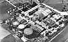 Gas Plant of the City of Zürich |
 Bernstrasse / Turmstrasse | 677.376 | 250.643 | 47.402058°N 8.463684°E |
Seegräben
| KGS No.? |
Picture | Name | Street Address | CH1903 X coordinate | CH1903 Y coordinate | Location |
|---|---|---|---|---|---|---|
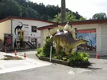
| 8603 | Aathal Dinosaur Museum | Zürichstrasse / Unter Aathal 202 | 699.990 | 243.950 | 47.338823°N 8.761723°E | |
| Unknown | 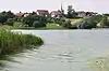 ISOS Dorf: Seegräben |
 ||||
| Unknown | ISOS Weiler: Ottenhusen |
Stadel
| KGS No.? |
Picture | Name | Street Address | CH1903 X coordinate | CH1903 Y coordinate | Location |
|---|---|---|---|---|---|---|
| Unknown | ISOS Dorf: Stadel |
Stäfa
| KGS No.? |
Picture | Name | Street Address | CH1903 X coordinate | CH1903 Y coordinate | Location |
|---|---|---|---|---|---|---|
| 7661 |  House Zur Farb |
 Dorfstrasse 11–15 | 698.104 | 232.765 | 47.238516°N 8.734328°E |
| 9507 |  Mies, Building Complex with Long House |
Eichstrasse 1, 3 | 698.427 | 232.745 | 47.238288°N 8.738589°E |
| 7664 | 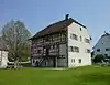 Ritterhaus (Knight's House) and Chapel |
 699.827 | 232.339 | 47.234427°N 8.756986°E | |
| 9133 | _-_Villa_Sunneschy_-_Seestrasse_156_2011-08-24_14-03-10_ShiftN.jpg.webp) Villa Sunneschy |
Villa Sunneschy | Seestrasse 156 | 698.180 | 232.282 | 47.234161°N 8.735226°E |
| Unknown | ISOS Verstädtertes Dorf: Oetikon | |||||
| Unknown | ISOS Weiler: Mutzmalen |
Stallikon
| KGS No.? |
Picture | Name | Street Address | CH1903 X coordinate | CH1903 Y coordinate | Location |
|---|---|---|---|---|---|---|
| 10082 | 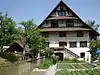 Mill and Surrounding Buildings |
 Aumüli | 679.124 | 239.575 | 47.30231°N 8.484884°E |
| 7666 | Üetliberg, Prehistoric and Roman era Settlement |
679.500 | 244.900 | 47.350155°N 8.490799°E |
Thalwil
| KGS No.? |
Picture | Name | Street Address | CH1903 X coordinate | CH1903 Y coordinate | Location |
|---|---|---|---|---|---|---|
| 9129 | 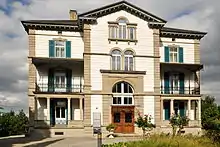 Jenny Castle with Outbuildings |
 Mühlebachstrasse 51 B | 685.293 | 238.523 | 47.29208°N 8.566246°E |
| 7674 | 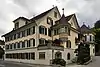 House am Gstad |
 Seestrasse 135 | 685.331 | 239.086 | 47.297138°N 8.566855°E |
Trüllikon
| KGS No.? |
Picture | Name | Street Address | CH1903 X coordinate | CH1903 Y coordinate | Location |
|---|---|---|---|---|---|---|
| Unknown | Hattlebuck, Hallstatt Culture Tumuli |
|||||
| 10337 | 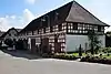 Noble's House and Double Barn |
 Rudolfingen, Dorfstrasse | 692.652 | 277.432 | 47.640993°N 8.671598°E |
| 10083 | 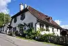 Hofmeister House |
 Steig 2 | 692.653 | 277.500 | 47.641604°N 8.671625°E |
| Unknown | ISOS Dorf: Rudolfingen |
Turbenthal
| KGS No.? |
Picture | Name | Street Address | CH1903 X coordinate | CH1903 Y coordinate | Location |
|---|---|---|---|---|---|---|
| 7681 | Former Medicinal Spa Gyrenbad | 706.120 | 256.634 | 47.45193°N 8.845828°E |
Uetikon am See
| KGS No.? |
Picture | Name | Street Address | CH1903 X coordinate | CH1903 Y coordinate | Location |
|---|---|---|---|---|---|---|
| 9041 | 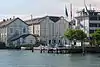 Chemical Factory |
 Seestrasse 99 | 693.500 | 235.000 | 47.259284°N 8.673996°E |
Uitikon
| KGS No.? |
Picture | Name | Street Address | CH1903 X coordinate | CH1903 Y coordinate | Location |
|---|---|---|---|---|---|---|
| 11734 |  Üetliberg, Prehistoric and Roman era Settlement |
679.500 | 244.900 | 47.350155°N 8.490799°E |
Unterengstringen
| KGS No.? |
Picture | Name | Street Address | CH1903 X coordinate | CH1903 Y coordinate | Location |
|---|---|---|---|---|---|---|
| 9718 | 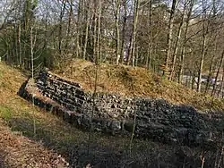 Glanzenberg, Medieval Ruins / Castle |
673.800 | 250.600 | 47.402081°N 8.416308°E | |
| 9719 |  Schanz, Early Modern Sconce |
 673.500 | 250.650 | 47.402565°N 8.412343°E |
Unterstammheim
| KGS No.? |
Picture | Name | Street Address | CH1903 X coordinate | CH1903 Y coordinate | Location |
|---|---|---|---|---|---|---|
| 7693 |  Municipal Administration Building |
 Zur Delle | 701.616 | 277.378 | 47.63918°N 8.790852°E |
| 11662 |  Hof Girsperger |
 Kellhofstrasse 8, 10 | 701.556 | 277.489 | 47.640187°N 8.790079°E |
| 7696 | 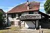 Girsberger House |
 Sennegasse 5 | 701.607 | 277.307 | 47.638543°N 8.790716°E |
| Unknown | ISOS Dorf: Unterstammheim |
Uster
| KGS No.? |
Picture | Name | Street Address | CH1903 X coordinate | CH1903 Y coordinate | Location |
|---|---|---|---|---|---|---|
| 7698 | Railway Station with two engine sheds | Industriestrasse 1 A – C | 696.711 | 245.254 | 47.351039°N 8.718623°E | |
| 7706 | Reformierte Kirche | Zentralstrasse | 696.600 | 244.670 | 47.345803°N 8.717029°E | |
| 10338 | .jpg.webp) Gujer House |
Gujer House | Wermatswil, Hintergasse 5 | 698.787 | 246.573 | 47.362593°N 8.746385°E |
| Unknown | ISOS Verstädtertes Dorf: Uster | |||||
| Unknown | ISOS Weiler: Freudwil | |||||
| Unknown | ISOS Weiler: Winikon |
Wädenswil
| KGS No.? |
Picture | Name | Street Address | CH1903 X coordinate | CH1903 Y coordinate | Location |
|---|---|---|---|---|---|---|
| 7711 | 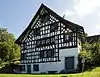 Farm House Obere Ödischwänd |
 Ödischwändweg | 691.520 | 231.075 | 47.224262°N 8.647041°E |
| 7712 | %252C_Burstel_-_Einsiedlerstrasse_2011-09-22_13-35-00.jpg.webp) Hof Burstel (Double House with Outbuildings) |
Hof Burstel (Double House with Outbuildings) | Burstel | 689.830 | 231.210 | 47.225708°N 8.624757°E |
| 7719 | %252C_Neuguet_2011-09-05_17-40-48_ShiftN.jpg.webp) Hof Neuguet (House with Outbuildings) |
Hof Neuguet (House with Outbuildings) | Neuguet | 694.220 | 229.690 | 47.211426°N 8.682396°E |
| 7710 |  Swiss Reformed Church |
 Schönenbergstrasse 9 | 693.388 | 231.575 | 47.228497°N 8.671806°E |
Wald
| KGS No.? |
Picture | Name | Street Address | CH1903 X coordinate | CH1903 Y coordinate | Location |
|---|---|---|---|---|---|---|
| 11661 |  Binzholz Primary School |
 Schulhausstrasse 6 | 711.356 | 237.515 | 47.279133°N 8.910491°E |
| Unknown | ISOS Verstädtertes Dorf: Wald (ZH) |
Waltalingen
| KGS No.? |
Picture | Name | Street Address | CH1903 X coordinate | CH1903 Y coordinate | Location |
|---|---|---|---|---|---|---|
| Unknown | ISOS Dorf: Guntalingen | |||||
| Unknown | ISOS Dorf: Waltalingen with Castle Schwandegg | |||||
| Unknown | ISOS Weiler: Girsberg with Castle |
Wallisellen
| KGS No.? |
Picture | Name | Street Address | CH1903 X coordinate | CH1903 Y coordinate | Location |
|---|---|---|---|---|---|---|
| 7731 |  Swiss Reformed Church |
 Kirchstrasse | 687.153 | 252.184 | 47.414695°N 8.593489°E |
Wangen-Brüttisellen
| KGS No.? |
Picture | Name | Street Address | CH1903 X coordinate | CH1903 Y coordinate | Location |
|---|---|---|---|---|---|---|
| 9066 | _-_Flugplatz_-_Ehemaliges_Aufnahmegeb%C3%A4ude_Zivilflugplatz%252C_D%C3%BCbendorfstrasse_2011-09-01_15-00-24.jpg.webp) Former Reception Building of the Civil Airport |
Former Reception Building of the Civil Airport | Dübendorfstrasse | 690.525 | 251.450 | 47.40764°N 8.638016°E |
| Unknown | ISOS Dorf: Wangen |
Wasterkingen
| KGS No.? |
Picture | Name | Street Address | CH1903 X coordinate | CH1903 Y coordinate | Location |
|---|---|---|---|---|---|---|
| Unknown | ISOS Dorf: Wasterkingen |
Weiach
| KGS No.? |
Picture | Name | Street Address | CH1903 X coordinate | CH1903 Y coordinate | Location |
|---|---|---|---|---|---|---|
| 11679 | Hardwald, Part of the late-Roman era Rhine Fortifications |
676.450 | 269.400 | 47.570851°N 8.454633°E | ||
| 10339 |  Church and Churchyard |
 Büelstrasse 17 | 675.212 | 267.896 | 47.557469°N 8.437928°E |
| 11678 | Leebern, Part of the late-Roman era Rhine Fortifications |
675.000 | 268.625 | 47.564049°N 8.435235°E |

Wetzikon
| KGS No.? |
Picture | Name | Street Address | CH1903 X coordinate | CH1903 Y coordinate | Location |
|---|---|---|---|---|---|---|
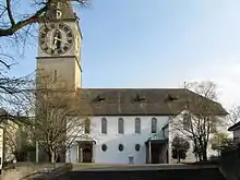
| 7751 | 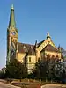 Swiss Reformed Church |
 Bahnhofstrasse | 702.780 | 242.640 | 47.326613°N 8.798333°E |
| 7747 |  |
Robenhausen, Neolithic and Bronze Age lake shore settlement |
701.800 | 243.675 | 47.336073°N 8.785606°E |
Wiesendangen
| KGS No.? |
Picture | Name | Street Address | CH1903 X coordinate | CH1903 Y coordinate | Location |
|---|---|---|---|---|---|---|
| 7755 | 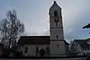 Swiss Reformed Church |
 Dorfstrasse | 701.740 | 264.270 | 47.521289°N 8.789501°E |
| Unknown | ISOS Dorf: Wiesendangen |
Wila
| KGS No.? |
Picture | Name | Street Address | CH1903 X coordinate | CH1903 Y coordinate | Location |
|---|---|---|---|---|---|---|
| 7757 | 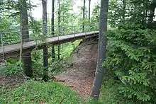 Ruins of Hohenlandenberg Castle |
 707.740 | 250.590 | 47.397315°N 8.865848°E | |
| 7756 | 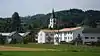 Swiss Reformed Church |
Winkel
| KGS No.? |
Picture | Name | Street Address | CH1903 X coordinate | CH1903 Y coordinate | Location |
|---|---|---|---|---|---|---|
| 7758 |  Seeb, Roman era Estate |
 683.150 | 260.930 | 47.493867°N 8.542082°E |
Winterthur
| KGS No.? |
Picture | Name | Street Address | CH1903 X coordinate | CH1903 Y coordinate | Location |
|---|---|---|---|---|---|---|
| 7836 |  Ruins of Alt-Wülflingen Castle |
 694.140 | 261.760 | 47.49985°N 8.688078°E | |
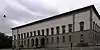
| 7781 | 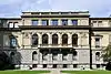 Old District Administration Building |
 Lindstrasse 10 | 697.328 | 262.269 | 47.503963°N 8.730493°E |
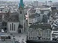
| 9721 | 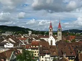 Old City, Medieval / Early Modern City |
 697.210 | 261.700 | 47.498864°N 8.728803°E | |
| 7773 |  Former Spinning Mill Hard |
 Hard 11 | 693.188 | 263.717 | 47.517584°N 8.675854°E |
| 7772 | 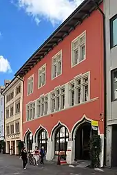 Former Waaghaus |
 Marktgasse 25 | 697.229 | 261.777 | 47.499553°N 8.729072°E |
| 8612 | Federal Gottfried Keller Foundation | Haldenstrasse 95 | 697.406 | 263.082 | 47.511263°N 8.731706°E | |
| 8476 |  Photography Museum |
 Grüzenstrasse 44 | 697.976 | 261.416 | 47.496196°N 8.738906°E |
| 8475 |  Photography Foundation of Switzerland |
 Grüzenstrasse 45 | 697.920 | 261.375 | 47.495836°N 8.738153°E |
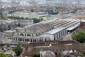
| 7760 |  Winterthur Hauptbahnhof (main station) |
 Bahnhofplatz 5–9 | 696.822 | 261.809 | 47.499901°N 8.723678°E |
| 7793 |  Zum Warteck House |
 Stadthausstrasse 39 | 697.399 | 261.868 | 47.500346°N 8.731348°E |
| 7762 |  Hohland House |
 Hohlandstrasse 11 | 699.249 | 262.556 | 47.506257°N 8.756051°E |
| 7761 8535 8969 8474 |
 |
Art Museum, Winterthur City Library, Special Collections and Natural History Museum |
Museumstrasse 52 | 697.300 | 262.035 | 47.501863°N 8.730071°E |
| 7813 | 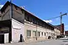 Locomotive Factory with Worker's Barracks |
 Zürcherstrasse 41 | 696.126 | 261.375 | 47.4961°N 8.714349°E |
| 8807 | 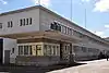 Machinery Factory of Rieter AG, Historical Archives |
Klosterstrasse 20 | 695.528 | 260.412 | 47.487527°N 8.706208°E |
| 9290 |  Machinery Park of the Nagel Factory |
 St. Gallerstrasse 138 | 698.818 | 261.652 | 47.498192°N 8.75013°E |
| 7767 | 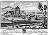 Mörsburg |
 Mörsburgstrasse 30 | 700.140 | 266.314 | 47.539916°N 8.768721°E |
| 7765 |  Rathaus (Town council house) |
 Marktgasse 20 | 697.295 | 261.816 | 47.499894°N 8.729957°E |
| 9807 | 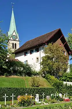 Swiss Reformed Church of St. Arbogast |
 Obere Hohlgasse | 699.228 | 262.593 | 47.506593°N 8.75578°E |
| 7764 | 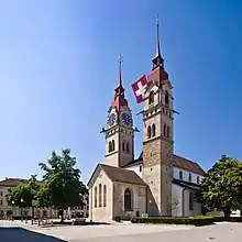 Swiss Reformed City Church |
 Kirchplatz 1 | 697.201 | 261.714 | 47.498991°N 8.728687°E |
| 8459 | 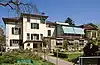 Hahnloser Collection in the Villa Flora |
 Tösstalstrasse 42/44 | 697.698 | 261.444 | 47.496489°N 8.735223°E |
| 7766 | Hegi Castle | Hegifeldstrasse 125 | 700.401 | 262.796 | 47.50824°N 8.771393°E | |
| 7841 |  Wülflingen Castle with Laundry House and Barn |
Wülflingerstrasse 214 | 694.965 | 263.038 | 47.511224°N 8.699298°E |
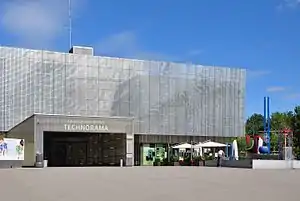
| 8460 | Bommer Collection of Toy Trains | Technoramastrasse 1 | 699.869 | 263.397 | 47.513726°N 8.764467°E | |
| 7768 9172 |
 City House and City Archives of Winterthur |
 Stadthausstrasse 4 A | 697.400 | 261.943 | 47.501021°N 8.731378°E |
| 7769 8472 |
 Oskar Reinhart Foundation (Former Boys' School House) and Oskar Reinhart Museum Am Stadtgarten |
Stadthausstrasse 6 | 697.222 | 261.882 | 47.500499°N 8.729002°E |
| 8810 | 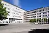 Sulzer AG, Historical Corporate Archives |
 Zürcherstrasse 12 | 696.475 | 261.713 | 47.499089°N 8.719053°E |
| 7819 | 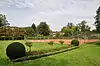 Geiselweid Tennis Complex |
 Pflanzschulstrasse 36 | 698.085 | 261.710 | 47.498824°N 8.740417°E |
| 8458 | Kellenberger Watch Collection | Kirchplatz 14 | 697.259 | 261.742 | 47.499234°N 8.729463°E | |
| 11757 | 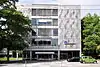 Corporate Archives of AXA-Winterthur Versicherungen AG |
 Römerstrasse 17 | 697.747 | 261.947 | 47.501005°N 8.735983°E |
| 7770 8471 |
 Villa Am Römerholz (former Villa Henri Sulzer-Ziegler) and Oskar Reinhart Collection Am Römerholz |
Haldenstrasse 95 | 697.406 | 263.082 | 47.511263°N 8.731706°E |
| 7771 8473 |
 Villa Bühler-Egg and Coin and Antique Collection |
 Lindstrasse 8 | 697.368 | 262.166 | 47.503031°N 8.731002°E |
| 9722 | Vitudurum / Oberwinterthur, Roman era Vicus | 699.230 | 262.170 | 47.502789°N 8.755713°E | ||
| 7774 | 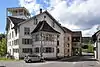 Wespi-Mühle |
 Wieshofstrasse 105 | 693.840 | 262.382 | 47.505486°N 8.684228°E |
| 9318 | 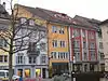 Winterthur Library |
 Obere Kirchgasse 6 | 697.253 | 261.678 | 47.498659°N 8.729369°E |
| Unknown | ISOS Stadt: Winterthur | |||||
| Unknown | ISOS Weiler: Grundhof / Mörsburg |
Zürich
| KGS No.? |
Picture | Name | Street Address | CH1903 X coordinate | CH1903 Y coordinate | Location |
|---|---|---|---|---|---|---|
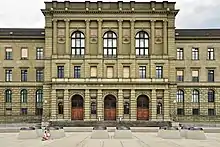
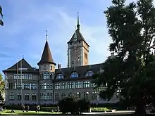
| 7882 | 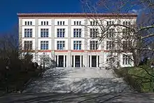 Old Cantonal School |
 Rämistrasse 59 | 683.953 | 247.395 | 47.372042°N 8.550194°E |
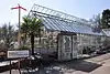
| 7915 |  Old Botanical Garden with Palmen House |
 Pelikanstrasse 40 | 682.759 | 247.244 | 47.370835°N 8.534359°E |
| 9723 |  |
Old City Celtic / Roman era settlement / Medieval City |
683.250 | 247.500 | 47.373075°N 8.540907°E | |
| 11769 | 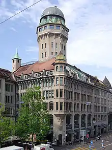 Administration Building I–IV including Sternwarte Urania |
 Bahnhofquai 3–5 / Lindenhofstrasse | 683.283 | 247.731 | 47.375149°N 8.541386°E |
| 10445 | Arboretum | General-Guisan-Quai | 682.908 | 246.386 | 47.3631°N 8.536173°E | |
| 8773 | 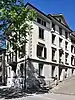 Archive of the History of ETH Zurich |
 Hirschengraben 62 | 683.628 | 247.744 | 47.375222°N 8.545956°E |
| 9169 | 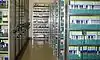 Archive of Swiss Television |
 Fernsehstrasse 1 | 684.750 | 252.340 | 47.416412°N 8.561681°E |
| 7896 | Enge Railway Station | Tessinerplatz 10, 12 | 682.512 | 246.528 | 47.364427°N 8.530957°E | |
| 7897 | Stadelhofen Railway Station with Platforms | Stadelhoferstrasse 8 | 683.829 | 246.785 | 47.366572°N 8.548438°E | |
| 9523 | Belvoirpark | Seestrasse 125 | 682.702 | 245.783 | 47.357703°N 8.533335°E | |
| 9319 | 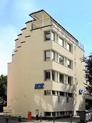 Library of the Israelitische Cultusgemeinde Zürich (ICZ) |
 682.630 | 246.380 | 47.363081°N 8.532492°E | |
| 8578 | Botanical Garden of the University of Zurich | Zollikerstrasse 107 | 684.722 | 245.944 | 47.358894°N 8.5601°E | |
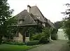
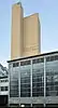
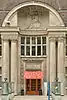
| 7872 |  Crédit Suisse Headquarters |
 Paradeplatz 8 | 683.065 | 247.142 | 47.369879°N 8.538391°E |
| 8036 | 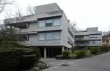 Doldertal Houses |
 Doldertal 17, 19 | 685.050 | 247.525 | 47.37307°N 8.564741°E |
| 9291 | 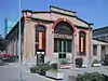 Former Factory Escher-Wyss |
 681.591 | 249.214 | 47.388698°N 8.519256°E | |
| 9806 | Former Girls' School am Grossmünster | Grossmünsterplatz 6 | 683.510 | 247.185 | 47.37021°N 8.54429°E | |
| 7860 8555 |
 Former Psychology Building of the University of Zürich and the Medical History Museum of the University of Zurich |
Rämistrasse 69 | 683.899 | 247.610 | 47.373982°N 8.549519°E |
| 7850 8798 8615 8950 8563 9353 |
 ETH Zurich Main Building and Library |
 Rämistrasse 101 | 683.786 | 247.882 | 47.376443°N 8.548074°E |
| 9170 | Fédération Internationale de Football Association (FIFA) |
Fédération Internationale de Football Association (FIFA) | Documentation Centre, Adolf-Jöhr-Weg 20 | 685.825 | 248.485 | 47.381604°N 8.575185°E |
| 9519 8538 |
 District Heating Plant, Machinery Laboratory and Geological / Mineralogical Exhibition of ETH Zurich |
Sonneggstrasse 5 | 683.750 | 248.043 | 47.377896°N 8.547627°E |
| 9262 | Frauenbad Stadthausquai | Stadthausquai 12 | 683.350 | 246.989 | 47.368467°N 8.542135°E | |
| 9003 |  Allenmoos Open Air Swimming Pool |
 Ringstrasse 79 | 683.060 | 251.100 | 47.405476°N 8.539059°E |
| 9004 |  Letzigraben Open Air Swimming Pool |
 Edelweissstrasse 5 | 680.250 | 248.245 | 47.380148°N 8.501323°E |
| 9520 |  Freigut |
 Brandschenkestrasse 48 | 682.435 | 246.965 | 47.368366°N 8.530018°E |
| 7923 |  Zürich Sihlfeld Cemetery |
 Aemtlerstrasse 149, 151 | 680.964 | 247.756 | 47.375663°N 8.510689°E |
| 10381 |  Geschäftshaus Metropol |
 Stadthausquai 11 | 683.297 | 246.961 | 47.368222°N 8.541429°E |
| 7926 | .jpg.webp) Geschäftshaus zur Trülle |
Geschäftshaus zur Trülle | Bahnhofstrasse 69 | 683.038 | 247.608 | 47.374074°N 8.53812°E |
| 7928 | Gesellschaftshaus zum Rüden | Limmatquai 42 | 683.419 | 247.259 | 47.370887°N 8.543099°E | |
| 10444 |  Gustav Ammann-Park |
 Langwiesstrasse | 682.689 | 251.726 | 47.411152°N 8.53426°E |
| 7852 | Hauptbahnhof (Main Railway Station) | Bahnhofplatz 15 / Museumsstrasse 1 | 683.190 | 247.980 | 47.3774°N 8.540201°E | |
| 9026 |  Main Building of the University of Zurich |
 Rämistrasse 71 | 683.856 | 247.679 | 47.374608°N 8.548963°E |
| 9381 | _-_Sihlbr%C3%BCcke_2011-08-13_19-58-22_ShiftN.jpg.webp) Haus Konstruktiv (im EWZ-Unterwerk Selnau) |
Haus Konstruktiv (im EWZ-Unterwerk Selnau) | Selnaustrasse 25 | 682.588 | 247.417 | 47.372412°N 8.532127°E |
| 7942 | 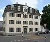 House zum Kiel / zum Lindentor |
 Hirschengraben 20 | 683.730 | 247.245 | 47.370721°N 8.547213°E |
| 7853 | 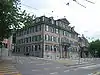 House zum Rechberg |
 Hirschengraben 40 / | 683.765 | 247.490 | 47.37292°N 8.547723°E |
| 7950 8778 9351 |
 House zum Sonnenhof and Swiss Social Archive |
 Stadelhofstrasse 12 | 683.760 | 246.810 | 47.366805°N 8.547529°E |
| 7854 8892 8949 |
 House zum Unteren Rech, Construction Archives of Zürich (BAZ) and City Archives |
Neumarkt 4 | 683.618 | 247.425 | 47.372354°N 8.545764°E |
| 7868 | Helmhaus and Wasserkirche | Limmatquai 31 | 683.424 | 247.142 | 47.369834°N 8.543143°E | |
| 7857 8483 |
Hochschule für Gestaltung und Kunst and Museum | Ausstellungsstrasse 60 | 682.850 | 248.592 | 47.382947°N 8.535813°E | |
| Unknown | Institut für Geschichte and Theorie of the Architektur | ETH Hönggerberg | 680.660 | 251.425 | 47.408697°N 8.507325°E | |
| 7963 |  Cantonal School of Freudenberg und Enge |
 Gutenbergstrasse 15 | 682.334 | 246.607 | 47.365159°N 8.528616°E |
| 10025 | 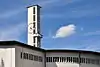 Catholic Church of Felix and Regula |
 Hardstrasse 76 | 681.155 | 248.345 | 47.380936°N 8.513324°E |
| 7958 |  Catholic Church of St. Antonius |
 Neptunstrasse 68 | 684.492 | 246.672 | 47.365471°N 8.557193°E |
| 10386 |  Kindergarten Wiedikon |
 Zentralstrasse 105 | 681.403 | 247.573 | 47.373963°N 8.516468°E |
| 7965 | _2011-08-01_16-40-46_ShiftN2.jpg.webp) Kongresshaus and Tonhalle |
Kongresshaus and Tonhalle | Gotthardstrasse 5 | 683.025 | 246.685 | 47.365774°N 8.537777°E |
| 10054 |  Crematorium at Zürich Sihlfeld |
 Albisriederstrasse 51 | 680.482 | 247.773 | 47.375875°N 8.50431°E |
| 7858 8477 |
Art Museum | Heimplatz 1 | 683.821 | 247.181 | 47.370134°N 8.548406°E | |
| 10446 | Lindenhof | Pfalzgasse | 683.250 | 247.480 | 47.372896°N 8.540903°E | |
| 8951 | 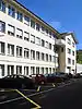 Medical History Archive of the Medical History Institute |
 Hirschengraben 82 | 683.607 | 247.853 | 47.376205°N 8.545699°E |
| 8806 | Migros-Cooperative Association, Documentation, Information and Audiovisual Archive |
Limmatstrasse 152 | 682.505 | 248.864 | 47.385436°N 8.531295°E | |
| 9382 | Migros Museum Modern Art | Limmatstrasse 270 | 682.045 | 249.280 | 47.389235°N 8.52528°E | |
| 7971 | 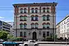 Militäranlage (Waffenplatz) |
 Kasernenstrasse 49 | 682.625 | 247.765 | 47.375537°N 8.532681°E |
| 8591 |  Moulagen Museum |
 Haldenbachstrasse 14 | 683.820 | 248.325 | 47.380423°N 8.548607°E |
| 7972 | 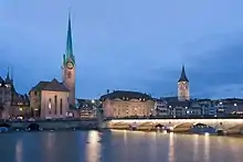 Münsterbrücke (Bridge) |
 683.374 | 247.154 | 47.369948°N 8.542484°E | |
| 7861 | 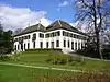 Muraltengut |
 Seestrasse 201, 203 | 682.645 | 245.316 | 47.35351°N 8.532494°E |
| 8590 |  Museum Bellerive |
 Höschgasse 3 | 683.950 | 245.660 | 47.356439°N 8.549829°E |
| 8899 | 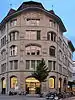 Neue Zürcher Zeitung, Archives |
Falkenstrasse 11 | 683.755 | 246.615 | 47.365052°N 8.547427°E |
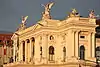
| 7862 | Opera House | Falkenstrasse 1 | 683.705 | 246.605 | 47.364969°N 8.546763°E | |
| 8485 8487 |
 Paleontological Museum, Zoological Museum and Anthropologicsal Museum of the University of Zurich |
 Karl-Schmid-Strasse 4 | 683.782 | 247.747 | 47.375229°N 8.547996°E |
| 10053 | Pavillon Le Corbusier | Höschgasse 8 | 684.031 | 245.624 | 47.356105°N 8.550894°E | |
| 7980 | 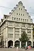 Peterhof / Leuenhof |
 Bahnhofstrasse 30, 32 | 683.137 | 247.213 | 47.370509°N 8.539357°E |
| 9524 |  Platzspitz |
 Platzpromenade 5 | 683.170 | 248.315 | 47.380415°N 8.539999°E |
| 7867 | 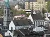 Prediger Church |
 Predigerplatz 1 | 683.603 | 247.589 | 47.373831°N 8.545596°E |
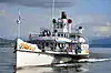
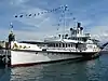
| 7869 | Paddle steamer Stadt Rapperswil | 683.100 | 246.500 | 47.364101°N 8.538735°E | ||
| 7870 | Paddle steamer Stadt Zürich | 683.150 | 246.550 | 47.364544°N 8.539406°E | ||
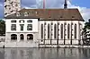
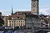
| 7871 | Zürich Town Hall | Limmatquai 55 | 683.381 | 247.335 | 47.371575°N 8.54261°E | |
| 7987 |  Swiss Reformed Church at Enge |
 Bürglistrasse 15 | 682.416 | 246.315 | 47.362523°N 8.529647°E |
| 7865 | 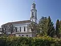 Swiss Reformed Church at Neumünster |
 Neumünsterstrasse 10 | 684.585 | 246.131 | 47.360594°N 8.558322°E |
| 7866 | Swiss Reformed Church of St. Peter | St. Peterhofstatt 1 | 683.227 | 247.291 | 47.371199°N 8.540563°E | |
| 7990 |  Swiss Reformed Holy Cross Church |
 Dolderstrasse 63 | 684.850 | 247.230 | 47.370443°N 8.562037°E |
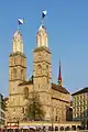
| 7863 | Swiss Reformed Fraumünster | Münsterhof 2 | 683.266 | 247.137 | 47.369809°N 8.541051°E | |
| 7864 | Swiss Reformed Grossmünster | Grossmünsterplatz 6 | 683.510 | 247.185 | 47.37021°N 8.54429°E | |
| 8814 |  Ringier AG, Corporate Archives |
Dufourstrasse 23 | 683.794 | 246.489 | 47.363914°N 8.547919°E |
| 9137 |  Rotach Houses |
 Wasserwerkstrasse 27–31 | 683.060 | 248.715 | 47.384026°N 8.538617°E |
| 7992 | 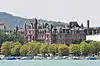 Rotes Schloss |
 Beethovenstrasse 1–7 | 682.990 | 246.595 | 47.364969°N 8.537297°E |
| 7849 | 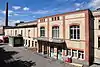 Schlachthofanlage |
 Herdernstrasse 59–63 | 680.645 | 248.770 | 47.384821°N 8.506648°E |
| 7995 | 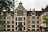 Hirschengraben School House |
 Hirschengraben 46 | 683.740 | 247.575 | 47.373688°N 8.547408°E |
| 9181 | Schweizer Radio DRS | D+A, Brunnenhofstrasse 22 | 682.795 | 250.650 | 47.401462°N 8.535466°E | |
| 8865 | _-_Schaffhauserstrasse_2011-08-17_14-49-08_ShiftN.jpg.webp) Schweizerische Gemeinnützige Gesellschaft (SGG) |
Schweizerische Gemeinnützige Gesellschaft (SGG) | Schaffhauserstrasse 7 | 683.080 | 249.205 | 47.388431°N 8.538972°E |
| 7873 8486 |
Swiss National Museum | Museumstrasse 2 | 683.247 | 248.172 | 47.379119°N 8.540992°E | |
| 7996 | 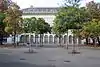 Swiss National Bank |
 Börsenstrasse 15, 17 | 683.253 | 246.919 | 47.36785°N 8.540838°E |
| 8793 | Staatsarchiv des Kantons Zürich | Winterthurerstrasse 170 | 683.680 | 250.200 | 47.397303°N 8.547104°E | |
| 8534 | Sukkulenten-Sammlung Zürich | Mythenquai 88 | 682.824 | 245.603 | 47.356069°N 8.534916°E | |
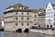
| 8001 | 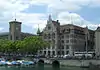 City House |
 Stadthausquai 17 | 683.270 | 247.080 | 47.369296°N 8.541093°E |
| 7918 | 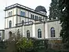 Sternwarte of the ETH Zurich |
 Schmelzbergstrasse 25 | 683.966 | 248.058 | 47.378003°N 8.55049°E |
| 7874 | 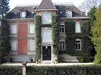 Foundation E.G. Bührle Collection |
 Zollikerstrasse 172 | 684.855 | 245.295 | 47.35304°N 8.561737°E |
| 8843 | .jpg.webp) |
Swiss Re, Swiss Reinsurance Company, Corporate Archives |
Mythenquai 50 | 682.816 | 246.018 | 47.359802°N 8.534887°E |
| 8952 |  Thomas Mann Archive of ETH Zürich |
 Schönberggasse 15 | 683.855 | 247.600 | 47.373898°N 8.548935°E |
| 8008 | 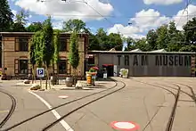 Tram Depot at Burgwies (Zürich Tram Museum) |
Forchstrasse 260 | 685.589 | 245.815 | 47.357622°N 8.57155°E |
| 11735 | Üetliberg, Prehistoric and Roman era Settlement |
679.500 | 244.900 | 47.350155°N 8.490799°E | ||
| 7848 | 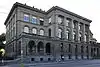 University of Zürich (former Eye Clinik) |
 Rämistrasse 73 | 683.852 | 247.761 | 47.375346°N 8.548925°E |
| 9724 |  |
Unteres Zürichseebecken Prehistoric pile dwelling settlements Alpenquai, Grosser and Kleiner Hafner |
prähistorische Seeufersiedlungen | 683.375 | 246.682 | 47.365703°N 8.542409°E |
| 8011 | 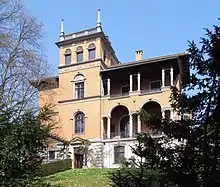 Villa Bleuler with Park |
 Zollikerstrasse 32 | 684.345 | 246.310 | 47.362234°N 8.555179°E |
| 8013 |  Villa Egli |
 Höschgasse 4 | 683.980 | 245.610 | 47.355985°N 8.550217°E |
| 8015 |  Villa Patumbah with Outbuildings and Park |
 684.690 | 245.722 | 47.356902°N 8.559634°E | |
| 7875 | 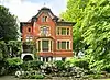 Villa Rieter (Schönberg) |
 Gablerstrasse 14 | 682.465 | 245.985 | 47.359549°N 8.530235°E |
| Unknown | Villa Tobler | Winkelwiese 4 | 683.688 | 247.179 | 47.370133°N 8.546645°E | |
| 8020 | 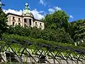 Villa Wegmann |
 Hohenbühlstrasse 15 | 683.995 | 246.770 | 47.366416°N 8.550633°E |
| 7876 8484 |
 Villa Wesendonck with Rietberg Museum |
 Gablerstrasse 15 | 682.470 | 245.920 | 47.358964°N 8.530289°E |
| 8023 | Villa zum Schönbühl | Kreuzbühlstrasse 36 | 684.135 | 246.640 | 47.365229°N 8.552461°E | |
| 8539 | 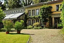 Ethnology Museum of the University of Zürich |
 Pelikanstrasse 40 | 682.759 | 247.244 | 47.370835°N 8.534359°E |
| 8025 | 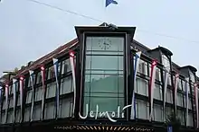 Warenhaus Jelmoli |
 Seidengasse 1 | 682.996 | 247.622 | 47.374205°N 8.537566°E |
| 8027 |  Wehrlimühle |
 Seefeldstrasse 219 | 684.780 | 245.166 | 47.35189°N 8.56072°E |
| 8028 |  Weisses Schloss |
 General-Guisan-Quai 34 | 682.860 | 246.495 | 47.364086°N 8.535557°E |
| 9101 |  House zum Brunnenhof with Jewish murals |
 Brunngasse 8 | 683.525 | 247.505 | 47.373086°N 8.544548°E |
| 8041 |  Wollishofen |
 Wohnkolonie Neubühl, Ostbühlstrasse 33–79 | 682.960 | 243.004 | 47.332677°N 8.536235°E |
| 9352 8608 |
 Central Library of Zürich including Handwritten Manuscript Section |
Zähringerplatz 6 | 683.556 | 247.616 | 47.37408°N 8.544979°E |
| 9551 | Central Library of Zürich including Music Section (Musikabteilung) |
Predigerplatz 1 | 683.603 | 247.589 | 47.373831°N 8.545596°E | |
| 7878 | Guild House zur Meise | Münsterhof 20 | 683.315 | 247.170 | 47.370099°N 8.541706°E | |
| 7879 | Zunfthaus zur Zimmerleuten | Limmatquai 40 | 683.438 | 247.232 | 47.370641°N 8.543345°E | |
| 8808 |  Zürcher Kantonalbank, Historical Archive |
 Bahnhofstrasse 9 | 683.148 | 246.940 | 47.368052°N 8.539452°E |
| 10441 | Zürichhorn | Seefeldquai | 684.803 | 244.899 | 47.349486°N 8.560974°E | |
| 8842 |  «Zürich» Versicherungsgesellschaft |
 Mythenquai 2 | 682.820 | 246.279 | 47.362149°N 8.534988°E |


_-_Z%C3%BCrich-Landid%C3%B6rfli_(Z%C3%BCrichhorn)_1939.jpg.webp)
References
- All entries, addresses and coordinates are from: "Kantonsliste A-Objekte". KGS Inventar (in German). Federal Office of Civil Protection. 2009. Archived from the original on 28 June 2010. Retrieved 25 April 2011.
External links
| Wikimedia Commons has media related to Cultural properties of national significance in the canton of Zürich. |
- Swiss Inventory of Cultural Property of National and Regional Significance (2009 KGS edition links):
- KGS Class A objects—(in German)
- KGS Class B objects—(in German)
- KGS Geographic information System−GIS
- "Revision of the PCP Inventory (Revision des KGS-Inventars)". KGS Forum. Federal Office of Civil Protection (13/2008). 2008. Archived from the original on 5 May 2011. Retrieved 25 April 2011.—(in German)
| Settlements |   | |
|---|---|---|
| Islands | ||
| Rivers | ||
| Valleys | ||
| Mountains | ||
| Landmarks | ||
| Transportation |
| |
| People | ||
This article is issued from Wikipedia. The text is licensed under Creative Commons - Attribution - Sharealike. Additional terms may apply for the media files.