Mahogany Avenue
The Mahogany Avenue or Mahogany Road (commonly referred to as Jose P. Rizal Street[1]), is a four-to-six lane, 2.53-kilometer (1.57 mi), secondary highway in Tagaytay, Cavite, Philippines.[2] It acts as the west bound route for Tagaytay–Nasugbu Highway.[1]
.svg.png.webp)  | ||||
|---|---|---|---|---|
| Mahogany Road Jose P. Rizal Street | ||||
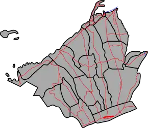 Mahogany Avenue highlighted in red | ||||
 Mahogany Avenue in 2013 | ||||
| Route information | ||||
| Maintained by Department of Public Works and Highways (DPWH) – Cavite 2nd District Engineering Office | ||||
| Length | 2.53 km (1.57 mi) | |||
| Component highways | ||||
| Major junctions | ||||
| East end | ||||
| West end | ||||
| Location | ||||
| Provinces | Cavite | |||
| Major cities | Tagaytay | |||
| Highway system | ||||
| ||||
The entire road is designated as National Route 413 (N413) of the Philippine highway network.[3]
Intersections
The entire route is located in Tagaytay. Intersections are numbered by kilometer posts, with Rizal Park in Manila designated as Kilometer zero.
| km | mi | Destinations | Notes | ||
|---|---|---|---|---|---|
| 58.010 | 36.046 | Eastern terminus | |||
| Crisanto Mendoza Delos Reyes Avenue – Amadeo, Manila | |||||
| 59.000 | 36.661 | Tagaytay kilometer zero | |||
| 60.630 | 37.674 | Western terminus | |||
| 1.000 mi = 1.609 km; 1.000 km = 0.621 mi | |||||
References
- Bulletin, The Manila. "SEA Games: Tagaytay assures services, security ready". Manila Bulletin Sports.
- "Cavite 2nd". www.dpwh.gov.ph. Archived from the original on October 1, 2018. Retrieved January 9, 2018.
- "Cavite 2nd". www.dpwh.gov.ph. Retrieved March 23, 2018.
External links
| Expressways |
| ||||||||
|---|---|---|---|---|---|---|---|---|---|
| National roads |
| ||||||||
| Arterial Routes |
| ||||||||
This article is issued from Wikipedia. The text is licensed under Creative Commons - Attribution - Sharealike. Additional terms may apply for the media files.