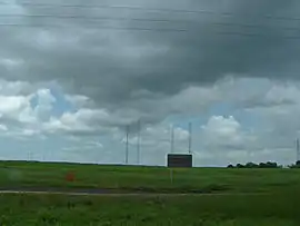
Middle Point, Northern Territory
Middle Point is an administrative locality in the Northern Territory of Australia.
| Middle Point Darwin, Northern Territory | |||||||||||||||
|---|---|---|---|---|---|---|---|---|---|---|---|---|---|---|---|
 Middle Point Antenna Farm or Department of Defence Transmitting Station | |||||||||||||||
 Middle Point | |||||||||||||||
| Coordinates | 12°35′56″S 131°19′34″E[1] | ||||||||||||||
| Population | 58 (2016 census)[2] | ||||||||||||||
| Established | 29 July 1998[1] | ||||||||||||||
| Postcode(s) | 0822[3] | ||||||||||||||
| Time zone | ACST (UTC+9:30) | ||||||||||||||
| Location | 53 km (33 mi) E of Darwin City | ||||||||||||||
| LGA(s) | Litchfield Municipality[1] | ||||||||||||||
| Territory electorate(s) | Goyder[4] | ||||||||||||||
| Federal Division(s) | Lingiari[5] | ||||||||||||||
| |||||||||||||||
| Footnotes | Locations[3] Adjoining suburbs[6][7] | ||||||||||||||
This locality derives its name from the ridge of fertile land sticking into the edge of the coastal plains of the Adelaide River.
Some features of this locality are
- a CSIRO Research Station,
- a school (the Middle Point School),
- a Department of Defence Transmitting Station ,
- assorted farms,
- Harrison Dam ,
- Fogg Dam Conservation Reserve
- and was the home of the failed Humpty Doo Rice Project .
The 2016 Australian census which was conducted in August 2016 reports that Middle Point had 58 people living within its boundaries.[2]
Middle Point is located within the federal division of Lingiari, the territory electoral division of Goyder and the local government area of the Litchfield Municipality.[5][4][7]
References
- "Place Names Register Extract for "Middle Point"". NT Place Names Register. Northern Territory Government. Retrieved 13 June 2019.
- Australian Bureau of Statistics (27 June 2017). "Middle Point (State Suburb)". 2016 Census QuickStats. Retrieved 28 June 2017.

- "Middle Point Postcode". postcode-finders.com.au. Retrieved 13 June 2019.
- "Division of Goyder". Northern Territory Electoral Commission. Retrieved 13 June 2019.
- "Federal electoral division of Lingiari". Australian Electoral Commission. Retrieved 13 June 2019.
- "Middle Point". NT Atlas and Spatial Data Directory. Northern Territory Government. Retrieved 4 May 2019.
- "Litchfield Municipality Localities" (PDF). Place Names Committee. Northern Territory Government. Archived from the original (PDF) on 18 March 2019. Retrieved 4 May 2019.
External links
This article is issued from Wikipedia. The text is licensed under Creative Commons - Attribution - Sharealike. Additional terms may apply for the media files.