Moffatdale, Queensland
Moffatdale is a rural locality in the South Burnett Region, Queensland, Australia.[2] In the 2016 census Moffatdale had a population of 179 people.[1]
| Moffatdale Queensland | |||||||||||||||
|---|---|---|---|---|---|---|---|---|---|---|---|---|---|---|---|
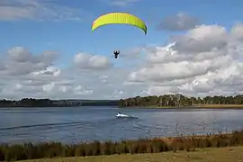 Parasailing on Lake Barambah impounded by the Bjelke-Petersen Dam, 2014 | |||||||||||||||
 Moffatdale | |||||||||||||||
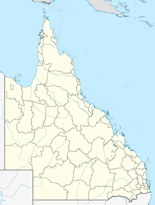
| Coordinates | 26.3080°S 152.0183°E | ||||||||||||||
| Population | 179 (2016 census)[1] | ||||||||||||||
| • Density | 3.403/km2 (8.81/sq mi) | ||||||||||||||
| Postcode(s) | 4605 | ||||||||||||||
| Area | 52.6 km2 (20.3 sq mi) | ||||||||||||||
| Time zone | AEST (UTC+10:00) | ||||||||||||||
| Location | |||||||||||||||
| LGA(s) | South Burnett Region | ||||||||||||||
| State electorate(s) | Nanango | ||||||||||||||
| Federal Division(s) | |||||||||||||||
| |||||||||||||||
Geography
The Bjelke-Peterson Dam is in the west of the locality (26.3032°S 151.9789°E) with the reservoir Lake Barambah (26.3269°S 151.9974°E) extending through the south-west of the locality.[3]
Although Moffatdale is not officially a town, there is a residential subdivision near the school. Apart from this, the land use is a mixture of grazing on native vegetation and crop growing.[3]
There are a number of homesteads in the locality, including:[4]
- Barambah-Dale (26.2954°S 152.0291°E)
- Bridgeman Downs (26.3128°S 152.0059°E)
- Brigalow Park (26.2839°S 152.0043°E)
- Dal Dowie Retreat (26.3283°S 152.0231°E)
- Lakeview (26.3350°S 152.0291°E)
- Moffatdale (26.2939°S 152.0258°E)
- Parrishs Paddock (26.3064°S 152.0151°E)
- Peppercorn (26.3254°S 152.0110°E)
- Sunny Brae (26.3175°S 152.0336°E)
History
Caulfield Provisional School opened on 1 November 1915. In 1916 it was renamed Barambah West Provisional School and again in 1918 as Moffatdale Provisional School. On 1 June 1926 it became Moffatdale State School.[5]
In the 2016 census Moffatdale had a population of 179 people.[1]
Education
Moffatdale State School is a government primary (Prep-6) school for boys and girls at 892 Barambah Road (26.3059°S 152.0117°E).[6][7] In 2018, the school had an enrolment of 42 students with 5 teachers (4 full-time equivalent) and 6 non-teaching staff (4 full-time equivalent).[8]
There is no secondary school in Moffatdale. The nearest secondary school is Murgon State High School in neighbouring Murgon to the north-west.[3]
Amenities
There are two boat ramps into Lake Barambah known as:[9]
- Bjelke-Petersen Dam (West) (26.3059°S 151.9820°E)
- Bjelke-Petersen Dam (East) (26.3063°S 151.9928°E)
Both are on Haager Drive and are managed by the South Burnett Regional Council.[9]
References
| Wikimedia Commons has media related to Moffatdale, Queensland. |
- Australian Bureau of Statistics (27 June 2017). "Moffatdale (SSC)". 2016 Census QuickStats. Retrieved 20 October 2018.

- "Moffatdale – locality in South Burnett Region (entry 46245)". Queensland Place Names. Queensland Government. Retrieved 29 December 2020.
- "Queensland Globe". State of Queensland. Retrieved 14 January 2021.
- "Homesteads - Queensland". Queensland Open Data. Queensland Government. 18 November 2020. Archived from the original on 24 November 2020. Retrieved 24 November 2020.
- Queensland Family History Society (2010), Queensland schools past and present (Version 1.01 ed.), Queensland Family History Society, ISBN 978-1-921171-26-0
- "State and non-state school details". Queensland Government. 9 July 2018. Archived from the original on 21 November 2018. Retrieved 21 November 2018.
- "Moffatdale State School". Archived from the original on 1 April 2020. Retrieved 21 November 2018.
- "ACARA School Profile 2018". Australian Curriculum, Assessment and Reporting Authority. Archived from the original on 27 August 2020. Retrieved 28 January 2020.
- "Recreational Boating Facilities Queensland". Queensland Open Data. Queensland Government. 12 November 2020. Archived from the original on 22 November 2020. Retrieved 22 November 2020.