Moonta Bay, South Australia
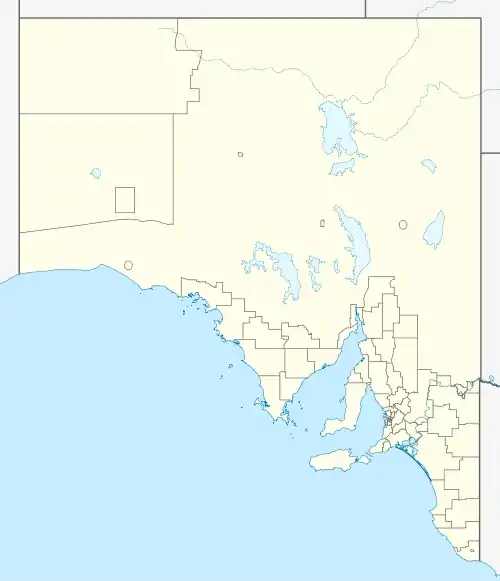
Moonta Bay is located in the Copper Coast region of Northern Yorke Peninsula South Australia, adjacent to the historic town of Moonta and Port Hughes.
| Moonta Bay South Australia | |||||||||||||||
|---|---|---|---|---|---|---|---|---|---|---|---|---|---|---|---|
 Jetty | |||||||||||||||
 Moonta Bay | |||||||||||||||
| Coordinates | 34.058020°S 137.569120°E | ||||||||||||||
| Population | 1,978 (2011 census)[1] | ||||||||||||||
| Established | 1999[2] | ||||||||||||||
| Postcode(s) | 5558[3] | ||||||||||||||
| Time zone | ACST (UTC+9:30) | ||||||||||||||
| • Summer (DST) | ACST (UTC+10:30) | ||||||||||||||
| Location | 136 km (85 mi) NW of Adelaide city centre | ||||||||||||||
| LGA(s) | Copper Coast Council | ||||||||||||||
| State electorate(s) | Narungga[4] | ||||||||||||||
| Federal Division(s) | Grey[5] | ||||||||||||||
| |||||||||||||||
| |||||||||||||||
| Footnotes | Distances[3] Coordinates[2] Climate[6] Adjoining localities[2] | ||||||||||||||
Description
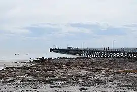
At the 2006 census, Moonta Bay had a population of 2,042.[7] The area is a popular tourist destination, with attractions including the beach and jetty where children are able to swim in a netted area. The jetty is also a popular fishing area particularly for those wanting to catch squid. The historic Rossiters Point Saltwater Intake and Pumping Station is listed on the South Australian Heritage Register.[8]
Governance
Moonta Bay is located within the federal Division of Grey, the state electoral district of Goyder and the local government area known as the Copper Coast Council.[9][5]
Local economy
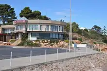
Accommodation is available for tourists at the beachside caravan park and motel. There are a range of restaurants, cafes and a functions venue.
Notes and references
- Australian Bureau of Statistics (31 October 2012). "Moonta Bay". 2011 Census QuickStats. Retrieved 6 April 2016.

- "Search result for "Moonta Bay (Locality Bounded)" (Record no SA0046039) with the following layer being selected - "Suburbs and Localities"". Department of Planning, Transport and Infrastructure. Archived from the original on 12 October 2016. Retrieved 5 April 2016.
- "Moonta Bay, South Australia (Postcode)". postcodes-australia.com. Retrieved 6 April 2016.
- Narungga (Map). Electoral District Boundaries Commission. 2016. Retrieved 1 March 2018.
- "Federal electoral division of Grey" (PDF). Australian Electoral Commission. Retrieved 24 July 2015.
- "Monthly climate statistics: Summary statistics KADINA AWS (nearest station)". Commonwealth of Australia , Bureau of Meteorology. Retrieved 6 April 2016.
- Australian Bureau of Statistics (25 October 2007). "Moonta Bay (State Suburb)". 2006 Census QuickStats. Retrieved 11 October 2011.
- "Saltwater Intake and Pumping Station, Rossiters Point". South Australian Heritage Register. Department of Environment, Water and Natural Resources. Retrieved 7 April 2016.
- "Goyder electorate boundaries as of 2014". ELECTORAL COMMISSION SA. Retrieved 23 July 2015.
External links
| Wikimedia Commons has media related to Moonta Bay, South Australia. |
| Major Townships | |||||||
|---|---|---|---|---|---|---|---|
| Minor Townships | |||||||
| Governance |
| ||||||
| Coastal features | |||||||
| Protected areas |
| ||||||
| Adjacent islands | |||||||
| Related and uncategorised | |||||||
| |||||||
Coastal bays and inlets of South Australia | |||
|---|---|---|---|
| West coast | |||
| Spencer Gulf | |||
| Investigator Strait | |||
| Kangaroo Island south and west coasts | |||
| Gulf St Vincent | |||
| Backstairs Passage | |||
| South east coast | |||
| Mainland |
| ||
| |||