Mount Byron, Queensland
Mount Byron is a rural locality in the Somerset Region, Queensland, Australia.[2] In the 2016 census Mount Byron had a population of 18 people.[1]
| Mount Byron Queensland | |||||||||||||||
|---|---|---|---|---|---|---|---|---|---|---|---|---|---|---|---|
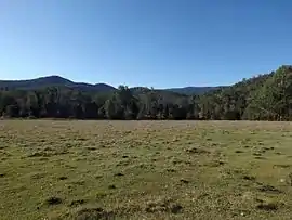
 Paddocks along Mount Byron Road, 2015 | |||||||||||||||
 Mount Byron | |||||||||||||||
| Coordinates | 27.1486°S 152.6844°E | ||||||||||||||
| Population | 18 (2016 census)[1] | ||||||||||||||
| • Density | 0.121/km2 (0.313/sq mi) | ||||||||||||||
| Postcode(s) | 4312 | ||||||||||||||
| Area | 148.9 km2 (57.5 sq mi) | ||||||||||||||
| Time zone | AEST (UTC+10:00) | ||||||||||||||
| LGA(s) | Somerset Region | ||||||||||||||
| State electorate(s) | Nanango | ||||||||||||||
| Federal Division(s) | Blair | ||||||||||||||
| |||||||||||||||
Geograpy
The rugged terrain of the D'Aguilar Range in the east is protected within the D'Aguilar National Park. Mount Byron reaches elevations greater than 600 metres (2,000 ft) above sea level. Lower elevations along Byron Creek, a tributary of the Stanley River, have been cleared of vegetation.
Mount Byron (27.1151°S 152.6726°E) is 617 metres (2,024 ft) above sea level.[3][4]
History
The locality takes its name from the mountain Mount Bryon.[5]
Brown & Broad operated a timber sawmill at Mount Byron around 1912.[6] By 1923 Raymond & Hossack were also operating a timber mill in the area.[7][8]
Mining operations commenced in 1918.[9]
Mount Byron State School opened on 29 May 1919 and closed ion 17 January 1930.[10][11][12]
A large bushfire occurred in October 1926.[13]
In the 2016 census Mount Byron had a population of 18 people.[1]
References
- Australian Bureau of Statistics (27 June 2017). "Mount Byron (SSC)". 2016 Census QuickStats. Retrieved 20 October 2018.

- "Mount Byron – locality in Somerset Region (entry 44900)". Queensland Place Names. Queensland Government. Retrieved 29 December 2020.
- "Mountain peaks and capes - Queensland". Queensland Open Data. Queensland Government. 12 November 2020. Archived from the original on 25 November 2020. Retrieved 25 November 2020.
- "Mount Byron – mountain in Somerset Region (entry 5593)". Queensland Place Names. Queensland Government. Retrieved 25 November 2020.
- "Mount Byron (entry 44900)". Queensland Place Names. Queensland Government. Retrieved 8 May 2014.
- "Advertising". The Queensland Times. National Library of Australia. 6 May 1913. p. 7 Edition: Daily. Retrieved 9 May 2014.
- "ESK". The Brisbane Courier. National Library of Australia. 23 October 1923. p. 10. Retrieved 9 May 2014.
- "SOUTHERN DISTRICT". The Worker. Brisbane: National Library of Australia. 19 February 1925. p. 12. Retrieved 9 May 2014.
- "Esk Letter". The Queensland Times. National Library of Australia. 14 August 1918. p. 6 Edition: DAILY. Retrieved 9 May 2014.
- "Item ID15496, Mount Byron No.1668 State School". Queensland State Archives. Retrieved 18 January 2021.
- "ESK". The Queensland Times. National Library of Australia. 10 October 1923. p. 7 Edition: DAILY. Retrieved 9 May 2014.
- "ESK". The Brisbane Courier. National Library of Australia. 18 June 1923. p. 8. Retrieved 9 May 2014.
- "BUSH FIRES". The Northern Miner. Charters Towers, Qld.: National Library of Australia. 15 October 1926. p. 2. Retrieved 9 May 2014.
- Queensland Family History Society (2010), Queensland schools past and present (Version 1.01 ed.), Queensland Family History Society, ISBN 978-1-921171-26-0