National Register of Historic Places listings in Juab County, Utah
This is a list of the National Register of Historic Places listings in Juab County, Utah.
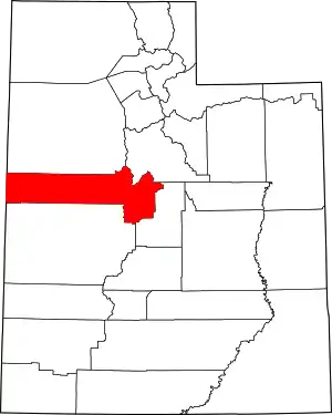
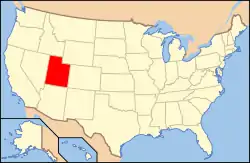
Location of Juab County in Utah
This is intended to be a complete list of the properties and districts on the National Register of Historic Places in Juab County, Utah, United States. Latitude and longitude coordinates are provided for many National Register properties and districts; these locations may be seen together in a map.[1]
There are 23 properties and districts listed on the National Register in the county. One other site in the county was once listed, but has since been removed.
- This National Park Service list is complete through NPS recent listings posted January 29, 2021.[2]
Current listings
| [3] | Name on the Register[4] | Image | Date listed[5] | Location | City or town | Description |
|---|---|---|---|---|---|---|
| 1 | Edwin Robert Booth House |  Edwin Robert Booth House |
December 6, 1979 (#79002497) |
94 W. 300 South 39°42′15″N 111°50′13″W |
Nephi | |
| 2 | Oscar M. Booth House |  Oscar M. Booth House |
April 18, 1983 (#83004399) |
395 E. 100 South 39°42′32″N 111°50′19″W |
Nephi | |
| 3 | Centennial-Eureka Mine | March 14, 1979 (#79003481) |
South of Eureka 39°56′40″N 112°07′22″W |
Eureka | ||
| 4 | Diamond Cemetery | March 14, 1979 (#79003474) |
Diamond 39°52′52″N 112°06′28″W |
Diamond | ||
| 5 | Eagle and Blue Bell Mine |  Eagle and Blue Bell Mine |
March 14, 1979 (#79003482) |
South of Eureka 39°56′50″N 112°07′00″W |
Eureka | |
| 6 | Eureka City Cemetery |  Eureka City Cemetery |
March 14, 1979 (#79003469) |
Southwest of Eureka off U.S. Route 6 39°56′42″N 112°08′46″W |
Eureka | |
| 7 | Eureka Historic District |  Eureka Historic District |
March 14, 1979 (#79002514) |
Roughly bounded by the city limits 39°57′19″N 112°06′55″W |
Eureka | |
| 8 | Fish Springs Caves Archeological District | May 11, 1981 (#81000582) |
Address Restricted[6] |
Callao | ||
| 9 | Fitch Cemetery | March 14, 1979 (#79003471) |
State Route 36 39°56′14″N 112°09′07″W |
Eureka | ||
| 10 | Grand Central Mine | March 14, 1979 (#79003480) |
North of Mammoth 39°56′12″N 112°06′58″W |
Mammoth | ||
| 11 | Juab County Jail | 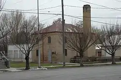 Juab County Jail |
November 20, 1987 (#87002060) |
45 W. Center 39°42′30″N 111°50′10″W |
Nephi | |
| 12 | Knight Grain Elevator |  Knight Grain Elevator |
March 14, 1979 (#79003470) |
State Route 36 39°56′33″N 112°11′39″W |
Eureka | |
| 13 | Knightsville School Foundation | 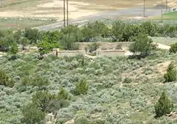 Knightsville School Foundation |
March 14, 1979 (#79003485) |
East of Eureka 39°57′16″N 112°05′58″W |
Knightsville | |
| 14 | Mammoth Historic District | 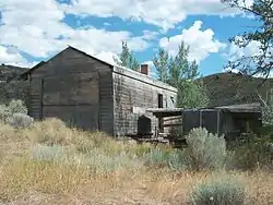 Mammoth Historic District |
March 14, 1979 (#79003468) |
Roughly bounded by city limits 39°55′38″N 112°07′30″W |
Mammoth | |
| 15 | Nephi Mounds | September 9, 1975 (#75001808) |
Address Restricted[6] |
Nephi | ||
| 16 | Showers Mine and Headframe | March 14, 1979 (#79003475) |
Southeast of Mammoth 39°53′24″N 112°05′40″W |
Mammoth | ||
| 17 | Silver City Cemetery | Silver City Cemetery |
March 14, 1979 (#79003473) |
Southwest of Mammoth 39°54′08″N 112°07′59″W |
Silver City | |
| 18 | Sunbeam Mine | March 14, 1979 (#79003476) |
East of Silver City 39°54′33″N 112°06′46″W |
Silver City | ||
| 19 | Tintic Smelter Site | 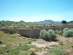 Tintic Smelter Site |
March 14, 1979 (#79003472) |
Off U.S. Route 6 39°55′01″N 112°08′22″W |
Silver City | |
| 20 | Union Pacific Railroad Depot | 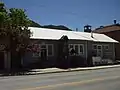 Union Pacific Railroad Depot |
March 14, 1979 (#79003478) |
241 W. Main St. 39°57′15″N 112°07′12″W |
Eureka | Originally built in Eureka, then moved near the Dragon Mine in Silver City. Moved back to Eureka, it now houses the Tintic Mining Museum |
| 21 | US Post Office-Eureka Main |  US Post Office-Eureka Main |
November 27, 1989 (#89001994) |
205 W. Main St.[7] 39°57′17″N 112°07′09″W |
Eureka | |
| 22 | US Post Office-Nephi Main |  US Post Office-Nephi Main |
November 27, 1989 (#89001996) |
10 N. Main 39°42′32″N 111°50′06″W |
Nephi | |
| 23 | George Carter Whitmore Mansion |  George Carter Whitmore Mansion |
December 12, 1978 (#78002663) |
106 S. Main 39°42′30″N 111°50′09″W |
Nephi |
Former listing
| [3] | Name on the Register | Image | Date listed | Date removed | Location | City or town | Summary |
|---|---|---|---|---|---|---|---|
| 1 | South Iron Blossom Headframe | 1979 (#79003477) | December 4, 1991 | Southeast of Mammoth 39°54′48″N 112°05′31″W |
Mammoth vicinity |
See also
References
- The latitude and longitude information provided in this table was derived originally from the National Register Information System, which has been found to be fairly accurate for about 99% of listings. Some locations in this table may have been corrected to current GPS standards.
- "National Register of Historic Places: Weekly List Actions". National Park Service, United States Department of the Interior. Retrieved on January 29, 2021.
- Numbers represent an alphabetical ordering by significant words. Various colorings, defined here, differentiate National Historic Landmarks and historic districts from other NRHP buildings, structures, sites or objects.
- "National Register Information System". National Register of Historic Places. National Park Service. April 24, 2008.
- The eight-digit number below each date is the number assigned to each location in the National Register Information System database, which can be viewed by clicking the number.
- Some listings on the NRHP are highly sensitive sites and may be subject to looting or vandalism. The NRHP lists this site as "Address Restricted."
- Address based on street number visible from photograph
External links
![]() Media related to National Register of Historic Places in Juab County, Utah at Wikimedia Commons
Media related to National Register of Historic Places in Juab County, Utah at Wikimedia Commons
 | |||
| Topics | |
|---|---|
| Lists by state |
|
| Lists by insular areas | |
| Lists by associated state | |
| Other areas | |
| Related | |
| |
Municipalities and communities of Juab County, Utah, United States | ||
|---|---|---|
| Cities | Map of Utah highlighting Juab County | |
| Towns | ||
| Unincorporated communities | ||
| Ghost towns | ||
| Indian reservation | ||
| Footnotes | ‡This populated place also has portions in an adjacent county or counties | |
| ||
This article is issued from Wikipedia. The text is licensed under Creative Commons - Attribution - Sharealike. Additional terms may apply for the media files.