National Register of Historic Places listings in Windham County, Connecticut
This is a list of the National Register of Historic Places listings in Windham County, Connecticut.
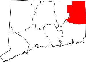
Location of Windham County in Connecticut
This is intended to be a complete list of the properties and districts on the National Register of Historic Places in Windham County, Connecticut, United States. The locations of National Register properties and districts for which the latitude and longitude coordinates are included below, may be seen in an online map.[1]
There are 85 properties and districts listed on the National Register in the county, including 3 National Historic Landmarks.
- This National Park Service list is complete through NPS recent listings posted February 5, 2021.[2]
Current listings
| [3] | Name on the Register[4] | Image | Date listed[5] | Location | City or town | Description |
|---|---|---|---|---|---|---|
| 1 | Abington Congregational Church |  Abington Congregational Church |
September 19, 1977 (#77001413) |
CT 97 41°51′27″N 72°00′29″W |
Pomfret | |
| 2 | Aldrich Free Public Library |  Aldrich Free Public Library |
July 27, 1994 (#94000768) |
299 Main St. 41°43′08″N 71°52′32″W |
Plainfield | |
| 3 | American Thread Company |  American Thread Company |
July 30, 2014 (#14000434) |
322, 440, 480, 560 Main & 157 Union Sts. 41°42′39″N 72°12′19″W |
Windham | In the Willimantic section of Windham |
| 4 | Ashford Academy |  Ashford Academy |
December 29, 1988 (#88002649) |
Fitts Rd. 41°52′22″N 72°07′25″W |
Ashford | |
| 5 | Benjamin Bosworth House | 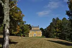 Benjamin Bosworth House |
February 17, 1978 (#78002857) |
John Perry Rd. 41°53′59″N 72°05′03″W |
Eastford | |
| 6 | Henry C. Bowen House | 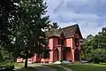 Henry C. Bowen House |
August 24, 1977 (#77001414) |
CT 169 41°56′57″N 71°58′37″W |
Woodstock | Gothic revival summer cottage visited by three U.S. presidents. Also known as Roseland Cottage. |
| 7 | Mathew Bowen Homestead | 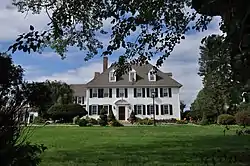 Mathew Bowen Homestead |
September 10, 1987 (#87000859) |
94 Plaine Hill Rd. 41°56′33″N 71°58′25″W |
Woodstock | Now the Inn at Woodstock. |
| 8 | Brayton Grist Mill | 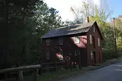 Brayton Grist Mill |
June 13, 1986 (#86001257) |
U.S. Route 44 41°51′39″N 71°58′57″W |
Pomfret | At the entrance to Mashamoquet Brook State Park |
| 9 | Broad Street – Davis Park Historic District | 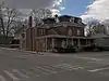 Broad Street – Davis Park Historic District |
December 31, 1998 (#98001556) |
Roughly along Broad St. from Dorrane St. to Winter St. 41°48′27″N 71°52′50″W |
Killingly | |
| 10 | Brooklyn Green Historic District |  Brooklyn Green Historic District |
September 23, 1982 (#82004401) |
CT 169, 205, and US 6, Wolf Den, Brown, Prince Hill, and Hyde Rds. 41°47′18″N 71°56′57″W |
Brooklyn | |
| 11 | Bush Hill Historic District | 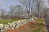 Bush Hill Historic District |
February 10, 1987 (#87000012) |
Parts of Bush Hill Rd., CT 169, and Wolf Den Rd. 41°48′43″N 71°57′52″W |
Brooklyn | |
| 12 | Butts Bridge | 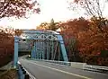 Butts Bridge |
May 24, 2010 (#10000272) |
Butts Bridge Rd. over Quinebaug River 41°39′05″N 71°58′15″W |
Canterbury | |
| 13 | Cady-Copp House | 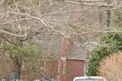 Cady-Copp House |
September 3, 2001 (#01000939) |
115 Liberty Highway 41°53′27″N 71°51′56″W |
Putnam | |
| 14 | Canterbury Center Historic District | 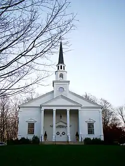 Canterbury Center Historic District |
April 10, 1998 (#97001446) |
Roughly along Elmdale, Library, N. Canterbury, S. Canterbury, and Westminster Rds. 41°42′06″N 71°58′22″W |
Canterbury | |
| 15 | Cargill Falls Mill (Wilkinson Mill) | 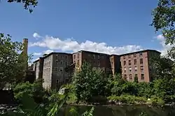 Cargill Falls Mill (Wilkinson Mill) |
July 29, 2014 (#14000435) |
52-58 Pomfret St. 41°54′54″N 71°54′42″W |
Putnam | |
| 16 | Central Village Historic District |  Central Village Historic District |
August 9, 1991 (#91000949) |
Roughly, School, Main and Water Sts., and Putnam Rd., north to Plainfield High School 41°43′06″N 71°54′21″W |
Plainfield | |
| 17 | Capt. Seth Chandler House | 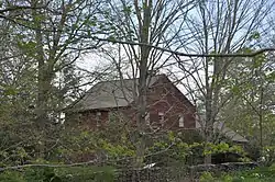 Capt. Seth Chandler House |
December 15, 1993 (#93001380) |
55 Converse St. 42°00′49″N 71°58′07″W |
Woodstock | |
| 18 | Chaplin Historic District | 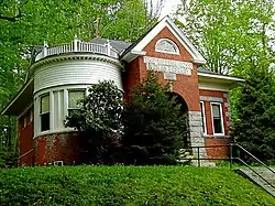 Chaplin Historic District |
October 11, 1978 (#78002856) |
Chaplin St. 41°47′38″N 72°07′40″W |
Chaplin | |
| 19 | Church Farm | 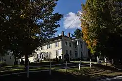 Church Farm |
November 17, 1988 (#88002650) |
396 Mansfield Rd. 41°50′21″N 72°10′11″W |
Ashford | Now the Church Center of Eastern Connecticut State University. |
| 20 | Capt. John Clark House | 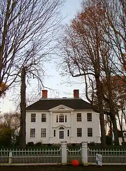 Capt. John Clark House |
October 6, 1970 (#70000699) |
Route 169, south of Canterbury 41°39′46″N 71°58′25″W |
Canterbury | |
| 21 | Prudence Crandall House | 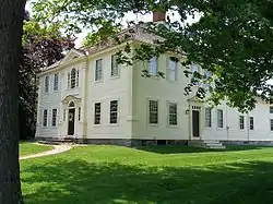 Prudence Crandall House |
October 22, 1970 (#70000696) |
Canterbury village green, junction of CT 14 and CT 169 41°41′52″N 71°58′19″W |
Canterbury | Site of Prudence Crandall's Canterbury Female Boarding School, which in 1833–1834 offered schooling to black girls. Forced to close by fierce town resistance, culminating in violence. Crandall, now Connecticut's state heroine, left Connecticut immediately, never to return. |
| 22 | Daniel's Village Archeological Site | 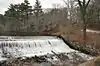 Daniel's Village Archeological Site |
March 30, 1978 (#78002861) |
north side of Five Mile River near Stone Road[6] 41°52′58″N 71°51′03″W |
Killingly | |
| 23 | Danielson Main Street Historic District | 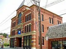 Danielson Main Street Historic District |
April 8, 1992 (#92000265) |
Main St. from Water St. to Spring St. 41°48′18″N 71°53′04″W |
Killingly | |
| 24 | Dayville Historic District |  Dayville Historic District |
August 25, 1988 (#88001422) |
Main and Pleasant Sts. 41°50′45″N 71°53′08″W |
Killingly | |
| 25 | Dorrance Inn | 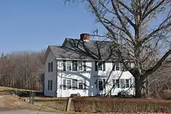 Dorrance Inn |
August 23, 2002 (#02000867) |
748 Plainfield Pike 41°41′28″N 71°50′48″W |
Sterling | |
| 26 | Elliottville Lower Mill |  Elliottville Lower Mill |
April 15, 1982 (#82004406) |
Peep Toad Rd. 41°50′21″N 71°50′33″W |
Killingly | |
| 27 | First Congregational Church of Plainfield | 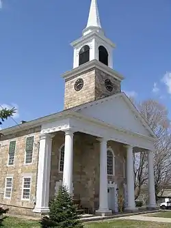 First Congregational Church of Plainfield |
July 31, 1986 (#86002116) |
CT 12 41°41′06″N 71°54′55″W |
Plainfield | |
| 28 | Forty-Seventh Camp of Rochambeau's Army | 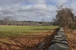 Forty-Seventh Camp of Rochambeau's Army |
January 23, 2003 (#02001732) |
Bolton Farm, Rt 14 near Mullen Hill Road[7] 41°42′09″N 72°09′00″W |
Windham | |
| 29 | Fourth Camp of Rochambeau's Army | 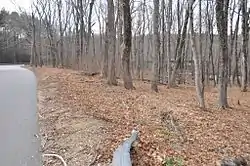 Fourth Camp of Rochambeau's Army |
January 8, 2003 (#02001680) |
Plains Road near Lovers Lane[7] 41°42′00″N 72°10′52″W |
Windham | |
| 30 | Glen Falls Bridge | 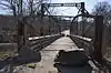 Glen Falls Bridge |
April 1, 1999 (#99000408) |
Brunswick Ave. over the Moosup River 41°43′01″N 71°51′43″W |
Plainfield | |
| 31 | Gwyn Careg | 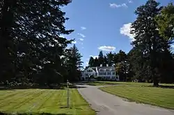 Gwyn Careg |
April 8, 1994 (#94000336) |
Wolf Den Rd. 41°51′20″N 71°59′52″W |
Pomfret | |
| 32 | Hampton Hill Historic District | 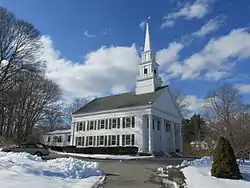 Hampton Hill Historic District |
September 23, 1982 (#82004408) |
Main St., Old Route 6, Cedar Swamp Rd. 41°46′57″N 72°03′19″W |
Hampton | |
| 33 | Hemlock Glen Industrial Archeological District | 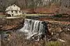 Hemlock Glen Industrial Archeological District |
June 5, 2007 (#07000508) |
Address Restricted |
Hampton | |
| 34 | Dr. Chester Hunt Office | 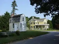 Dr. Chester Hunt Office |
October 6, 1970 (#70000708) |
Windham Center Rd. 41°42′00″N 72°09′30″W |
Windham | |
| 35 | Samuel Huntington Birthplace | 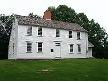 Samuel Huntington Birthplace |
November 11, 1971 (#71001009) |
CT 14, 2 mi (3.2 km) west of CT 97 41°41′57″N 72°05′10″W |
Scotland | Boyhood saltbox home of the American statesman, a signer of the Declaration of Independence, Governor of Connecticut and first presiding officer of the Congress of the Confederation |
| 36 | Israel Putnam School | 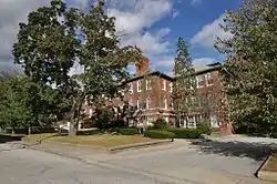 Israel Putnam School |
December 13, 1984 (#84000788) |
School and Oak Sts. 41°54′57″N 71°54′23″W |
Putnam | |
| 37 | William Jillson Stone House | 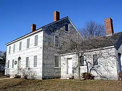 William Jillson Stone House |
August 5, 1971 (#71000912) |
561 Main St. 41°42′40″N 72°12′38″W |
Windham | In the Willimantic section of the town |
| 38 | Old Killingly High School | 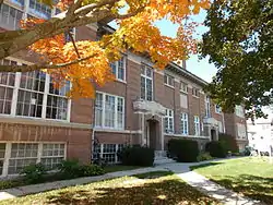 Old Killingly High School |
March 26, 1992 (#92000266) |
185 Broad St. 41°48′13″N 71°53′08″W |
Killingly | |
| 39 | Knowlton Memorial Hall | 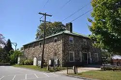 Knowlton Memorial Hall |
March 17, 1994 (#94000252) |
5 Town Hall Rd. 41°51′49″N 72°09′42″W |
Ashford | |
| 40 | Lawton Mills Historic District | 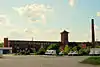 Lawton Mills Historic District |
February 16, 1996 (#96000028) |
Roughly bounded by 2nd St., Railroad Ave., Norwich Rd., and 5th and 9th Sts. 41°40′32″N 71°55′13″W |
Plainfield | |
| 41 | Main Street Historic District | 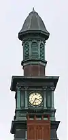 Main Street Historic District |
June 28, 1982 (#82004410) |
21-65 Church St., 667-1009 Main St., 24-28 N. St., and 20-22 Walnut St.; also 32, 50, and 54 North St. 41°42′44″N 72°12′54″W |
Windham | In the Willimantic section of the town. Second set of boundaries represents a boundary increase of July 29, 1992 |
| 42 | Mansfield Hollow Dam | 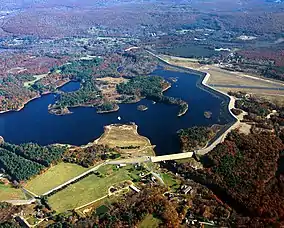 Mansfield Hollow Dam |
April 12, 2009 (#03000194) |
141 Mansfield Hollow Rd. 41°45′20″N 72°10′54″W |
Windham | Extends into Tolland County |
| 43 | March Route of Rochambeau's Army: Manship Road-Barstow Road |  March Route of Rochambeau's Army: Manship Road-Barstow Road |
January 8, 2003 (#02001678) |
Manship Rd., Barstow Rd. from its junction with Manship Rd. to Westminster Rd. 41°42′07″N 72°00′13″W |
Canterbury | |
| 44 | March Route of Rochambeau's Army: Old Canterbury Road |  March Route of Rochambeau's Army: Old Canterbury Road |
June 6, 2003 (#03000310) |
Old Canterbury Rd: Canterbury Rd. from its junction with Old Canterbury Rd. 41°41′22″N 71°57′04″W |
Plainfield | |
| 45 | March Route of Rochambeau's Army: Palmer Road |  March Route of Rochambeau's Army: Palmer Road |
June 6, 2003 (#03000311) |
Palmer Rd, from intersection with Miller Rd. to east of its junction with Pudding Hill Rd. 41°41′57″N 72°03′47″W |
Scotland | |
| 46 | March Route of Rochambeau's Army: Plainfield Pike |  March Route of Rochambeau's Army: Plainfield Pike |
June 6, 2003 (#03000312) |
Plainfield Pike from intersection with Industrial Dr., east to its junction with Ledge Hill Rd. 41°40′55″N 71°53′53″W |
Plainfield | |
| 47 | March Route of Rochambeau's Army: Scotland Road |  March Route of Rochambeau's Army: Scotland Road |
June 6, 2003 (#03000314) |
Scotland Rd., from intersection with Back Rd. to 80 Scotland Rd. 41°42′03″N 72°08′43″W |
Windham | |
| 48 | Mixer Tavern |  Mixer Tavern |
March 17, 1994 (#94000253) |
14 Westford Rd. 41°51′56″N 72°09′33″W |
Ashford | |
| 49 | Natchaug Forest Lumber Shed |  Natchaug Forest Lumber Shed |
September 4, 1986 (#86001732) |
Kingsbury Rd., Natchaug State Forest 41°50′21″N 72°05′04″W |
Eastford | |
| 50 | New Roxbury Ironworks Site | February 23, 1996 (#96000130) |
Address Restricted |
Woodstock | ||
| 51 | George Pickering Nichols House |  George Pickering Nichols House |
July 31, 1991 (#91000990) |
42 Thompson Rd. 41°56′51″N 71°53′04″W |
Thompson | |
| 52 | North Grosvenordale Mill Historic District | 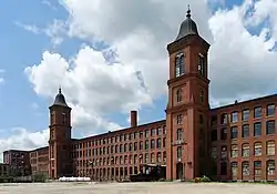 North Grosvenordale Mill Historic District |
April 16, 1993 (#93000288) |
Riverside Dr. (CT 12), Buckley Hill Rd., Floral Ave., Market La., and Marshall, Central, River, and Holmes Sts. 41°59′09″N 71°53′53″W |
Thompson | |
| 53 | Old Westfield Cemetery | 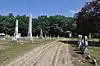 Old Westfield Cemetery |
August 26, 2010 (#10000578) |
320 North St. 41°49′08″N 71°53′21″W |
Killingly | |
| 54 | Packerville Bridge | 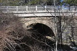 Packerville Bridge |
November 27, 1992 (#92001565) |
Packerville Rd. over Mill Brook 41°40′01″N 71°56′56″W |
Plainfield | |
| 55 | Plainfield Street Historic District | 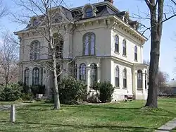 Plainfield Street Historic District |
April 11, 1991 (#91000350) |
Roughly Norwich Rd. from Railroad Ave. to Academy Hill Rd. 41°41′09″N 71°54′54″W |
Plainfield | |
| 56 | Plainfield Woolen Company Mill | 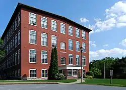 Plainfield Woolen Company Mill |
August 29, 1985 (#85001919) |
Main St. 41°43′11″N 71°54′25″W |
Plainfield | |
| 57 | Pomfret Street Historic District | 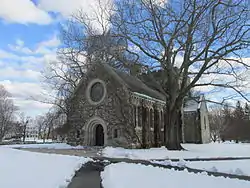 Pomfret Street Historic District |
April 23, 1998 (#98000372) |
Roughly along Pomfret St. and CT 169, from Bradley Rd. to Woodstock Rd. 41°53′19″N 71°57′51″W |
Pomfret | |
| 58 | Pomfret Town House | 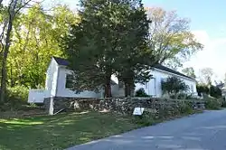 Pomfret Town House |
January 19, 1989 (#88003221) |
Town House Rd. 41°51′53″N 71°57′50″W |
Pomfret | Home to the local historical society. |
| 59 | Prospect Hill Historic District | 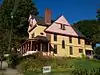 Prospect Hill Historic District |
August 29, 2003 (#03000814) |
Roughly bounded by Bolivia St., Jackson St., Valley St. and Birch St. 41°43′09″N 72°12′12″W |
Windham | In the Willimantic section of the town |
| 60 | Putnam Farm | 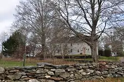 Putnam Farm |
March 11, 1982 (#82004399) |
Spaulding Rd. 41°49′24″N 71°57′03″W |
Brooklyn | |
| 61 | Putnam High School | 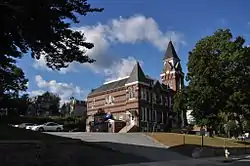 Putnam High School |
December 10, 1993 (#93001343) |
126 Church St. 41°55′06″N 71°54′47″W |
Putnam | Putnam's first high school, now Putnam Town Hall. |
| 62 | Putnam Railroad Station | 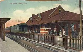 Putnam Railroad Station |
July 24, 2007 (#07000742) |
35 and 45-47 Main St. 41°54′51″N 71°54′30″W |
Putnam | |
| 63 | Israel Putnam Wolf Den | 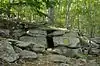 Israel Putnam Wolf Den |
May 2, 1985 (#85000949) |
Off Wolf Den Rd. in Mashamoquet Brook State Park 41°50′36″N 71°59′04″W |
Pomfret | |
| 64 | Quinebaug Mill-Quebec Square Historic District | 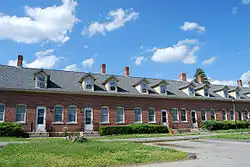 Quinebaug Mill-Quebec Square Historic District |
August 29, 1985 (#85001921) |
Roughly bounded by the Quinebaug River, Quebec Square, and Elm and S. Main Sts. 41°47′54″N 71°53′21″W |
Brooklyn and Killingly | |
| 65 | Quinebaug River Prehistoric Archeological District |  Quinebaug River Prehistoric Archeological District |
September 7, 2009 (#09000696) |
Between Connecticut Route 169 and the Quinebaug River 41°40′24″N 71°57′26″W |
Canterbury | |
| 66 | Hezekiah S. Ramsdell Farm |  Hezekiah S. Ramsdell Farm |
August 23, 1990 (#90000442) |
Ramsdell Rd. 41°57′07″N 71°54′39″W |
Thompson | |
| 67 | Sterling Hill Historic District | 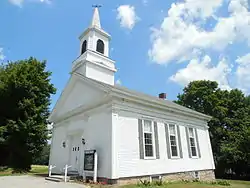 Sterling Hill Historic District |
February 6, 1986 (#86000152) |
Green Ln. and CT 14A 41°41′23″N 71°50′56″W |
Plainfield and Sterling | |
| 68 | Sumner-Carpenter House | 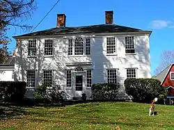 Sumner-Carpenter House |
December 26, 1991 (#91001854) |
333 Old Colony Rd. 41°54′11″N 72°04′01″W |
Eastford | |
| 69 | Taylor's Corner | 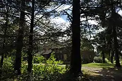 Taylor's Corner |
January 19, 1989 (#88003220) |
Route 171 41°56′57″N 72°00′43″W |
Woodstock | |
| 70 | Temple Beth Israel | 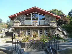 Temple Beth Israel |
April 16, 2013 (#13000162) |
39 Killingly Dr. 41°48′14″N 71°52′40″W |
Killingly | |
| 71 | Thompson Hill Historic District | 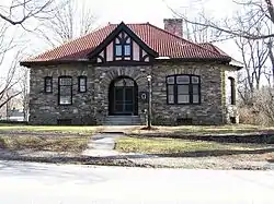 Thompson Hill Historic District |
December 31, 1987 (#87002186) |
Chase and Quaddick Rds. and CT 193 and CT 200 41°57′27″N 71°52′06″W |
Thompson | |
| 72 | Trinity Church |  Trinity Church |
October 15, 1970 (#70000703) |
Church St. 41°48′00″N 71°55′28″W |
Brooklyn | |
| 73 | Union Society of Phoenixville House | 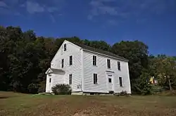 Union Society of Phoenixville House |
December 11, 2007 (#07001247) |
4 Hartford Turnpike 41°52′37″N 72°05′12″W |
Eastford | |
| 74 | Unitarian Meetinghouse | 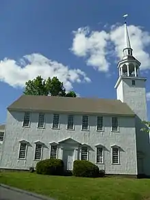 Unitarian Meetinghouse |
November 9, 1972 (#72001335) |
Junction of CT 169 and US 6 41°47′16″N 71°57′01″W |
Brooklyn | |
| 75 | Edward Waldo House |  Edward Waldo House |
November 21, 1978 (#78002879) |
South of Scotland on Waldo Rd. 41°39′33″N 72°06′05″W |
Scotland | |
| 76 | Wauregan Historic District | 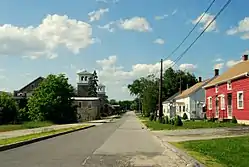 Wauregan Historic District |
August 24, 1979 (#79003789) |
Roughly bounded by CT 12, CT 205, 3rd St., the Quinebaug River, and Chestnut St. 41°44′38″N 71°54′38″W |
Plainfield | |
| 77 | Jonathan Wheeler House | 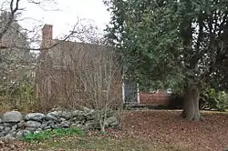 Jonathan Wheeler House |
February 11, 1982 (#82004405) |
N. Society Rd. 41°45′03″N 71°59′26″W |
Canterbury | |
| 78 | Willimantic Armory |  Willimantic Armory |
September 12, 1985 (#85002310) |
255 Pleasant St. 41°42′35″N 72°12′54″W |
Windham | In the Willimantic section of the town |
| 79 | Willimantic Elks Club | 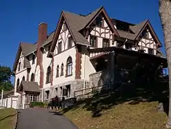 Willimantic Elks Club |
September 21, 2005 (#05001045) |
198 Pleasant St. 41°42′34″N 72°12′47″W |
Windham | In the Willimantic section of the town |
| 80 | Willimantic Footbridge |  Willimantic Footbridge |
April 19, 1979 (#79002654) |
Railroad St. 41°42′42″N 72°12′49″W |
Windham | In the Willimantic section of the town |
| 81 | Willimantic Freight House and Office | 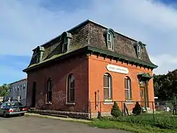 Willimantic Freight House and Office |
June 14, 1982 (#82004414) |
Bridge St. 41°42′44″N 72°13′15″W |
Windham | In the Willimantic section of the town |
| 82 | Windham Center Historic District | 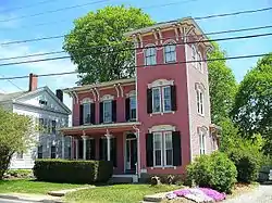 Windham Center Historic District |
June 4, 1979 (#79002655) |
CT 14 and CT 203 41°42′08″N 72°09′40″W |
Windham | |
| 83 | Witter House | 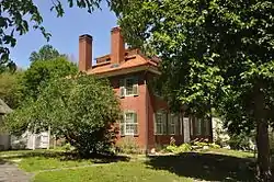 Witter House |
October 6, 1970 (#70000704) |
Chaplin St. 41°47′47″N 72°07′46″W |
Chaplin | |
| 84 | Woodstock Academy Classroom Building |  Woodstock Academy Classroom Building |
February 16, 1984 (#84001176) |
Academy Rd. 41°57′02″N 71°58′33″W |
Woodstock | |
| 85 | Woodstock Hill Historic District |  Woodstock Hill Historic District |
January 6, 1999 (#98001578) |
Roughly along Plain Hill Rd., and Academy Rd., including parts of Old Hall Rd. and Child Hill Rd. 41°57′04″N 71°58′32″W |
Woodstock |
See also
| Wikimedia Commons has media related to National Register of Historic Places in Windham County, Connecticut. |
References
- The latitude and longitude information provided in this table was derived originally from the National Register Information System, which has been found to be fairly accurate for about 99% of listings. Some locations in this table may have been corrected to current GPS standards.
- "National Register of Historic Places: Weekly List Actions". National Park Service, United States Department of the Interior. Retrieved on February 5, 2021.
- Numbers represent an alphabetical ordering by significant words. Various colorings, defined here, differentiate National Historic Landmarks and historic districts from other NRHP buildings, structures, sites or objects.
- "National Register Information System". National Register of Historic Places. National Park Service. March 13, 2009.
- The eight-digit number below each date is the number assigned to each location in the National Register Information System database, which can be viewed by clicking the number.
- "History of Killingly's Villages". Killingly Historical Society. Retrieved 2013-10-10.
- "Supplemental Destination Guide Signs" (PDF). State of Connecticut. Retrieved 2015-01-05.
| Lists by county |  | |
|---|---|---|
| Lists by city or town | ||
| Other lists | ||
Municipalities and communities of Windham County, Connecticut, United States | ||
|---|---|---|
| Towns | | |
| Borough | ||
| Former cities | ||
| Other communities | ||
| ||
This article is issued from Wikipedia. The text is licensed under Creative Commons - Attribution - Sharealike. Additional terms may apply for the media files.