National Register of Historic Places listings in Windsor, Connecticut
This is a list of the National Register of Historic Places listings in Windsor, Connecticut.
This is intended to be a complete list of the properties and districts on the National Register of Historic Places in Windsor, Connecticut, United States. The locations of National Register properties and districts for which the latitude and longitude coordinates are included below, may be seen in various online maps.[1]
There are more than 400 properties and districts listed on the National Register in Hartford County, including 21 National Historic Landmarks. The 41 properties and districts located in the town of Windsor include one National Historic Landmark and are listed below. The properties and districts in the remaining parts of the county are listed separately.
- This National Park Service list is complete through NPS recent listings posted January 29, 2021.[2]
Current listings
| [3] | Name on the Register[4] | Image | Date listed[5] | Location | City or town | Description |
|---|---|---|---|---|---|---|
| 1 | Capt. Benjamin Allyn II House | 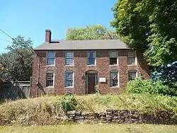 Capt. Benjamin Allyn II House |
June 26, 1979 (#79002633) |
119 Deerfield Rd. 41°49′13″N 72°39′11″W |
||
| 2 | Giles Barber House | 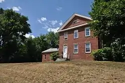 Giles Barber House |
September 15, 1988 (#88001498) |
411-413 Windsor Ave. 41°48′53″N 72°39′29″W |
||
| 3 | Bissell Tavern-Bissell's Stage House | 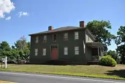 Bissell Tavern-Bissell's Stage House |
August 23, 1985 (#85001825) |
1022 Palisado Ave. 41°53′12″N 72°37′38″W |
||
| 4 | Broad Street Green Historic District | 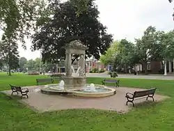 Broad Street Green Historic District |
December 30, 1999 (#99001613) |
Roughly along Broad St. from Batchelder Rd. to Union St. 41°51′01″N 72°38′33″W |
||
| 5 | Benomi Case House | 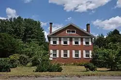 Benomi Case House |
September 15, 1988 (#88001497) |
436 Rainbow Rd. 41°55′05″N 72°41′35″W |
||
| 6 | Hezekiah Chaffee House | 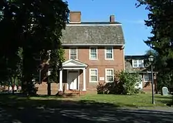 Hezekiah Chaffee House |
July 31, 1972 (#72001336) |
Meadow Lane off Palisado Green 41°51′28″N 72°38′11″W |
||
| 7 | Taylor Chapman House | 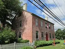 Taylor Chapman House |
September 15, 1988 (#88001492) |
407 Palisado Ave. 41°51′59″N 72°37′49″W |
||
| 8 | Horace H. Ellsworth House | 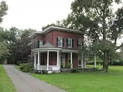 Horace H. Ellsworth House |
September 15, 1988 (#88001489) |
316 Palisado Ave. 41°51′49″N 72°37′53″W |
||
| 9 | Oliver Ellsworth Homestead |  Oliver Ellsworth Homestead |
October 6, 1970 (#70000707) |
778 Palisado Ave. 41°52′40″N 72°37′31″W |
Home of the third Chief Justice of the United States | |
| 10 | Farmington River Railroad Bridge |  Farmington River Railroad Bridge |
August 25, 1972 (#72001334) |
Spans the Farmington River and Pleasant St. west of Palisado Ave. 41°51′28″N 72°38′30″W |
||
| 11 | First Church Parsonage | 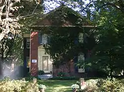 First Church Parsonage |
September 15, 1988 (#88001488) |
160 Palisado Ave. 41°51′34″N 72°38′06″W |
||
| 12 | John Fitch School | 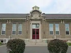 John Fitch School |
December 2, 1986 (#86003326) |
156 Bloomfield Ave. 41°51′10″N 72°39′06″W |
||
| 13 | Former Fire Station | 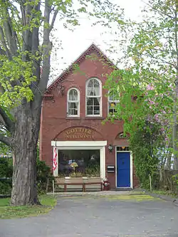 Former Fire Station |
September 15, 1988 (#88001485) |
14 Maple Ave. 41°51′05″N 72°38′44″W |
||
| 14 | Grace Church Rectory |  Grace Church Rectory |
September 15, 1988 (#88001477) |
301 Broad St. 41°50′59″N 72°38′37″W |
||
| 15 | Hartford & New Haven Railroad Depot | 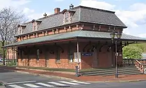 Hartford & New Haven Railroad Depot |
September 15, 1988 (#88001479) |
Central St. 41°51′08″N 72°38′34″W |
||
| 16 | Hartford & New Haven Railroad-Freight Depot | 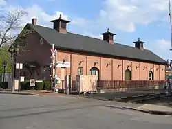 Hartford & New Haven Railroad-Freight Depot |
September 15, 1988 (#88001505) |
40 Central St. 41°51′06″N 72°38′32″W |
||
| 17 | William H. Harvey House | 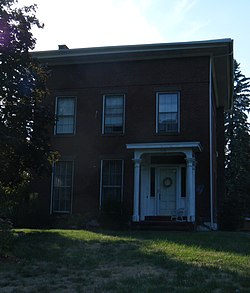 William H. Harvey House |
September 15, 1988 (#88001503) |
1173 Windsor Ave. 41°50′23″N 72°39′07″W |
||
| 18 | Hathaways Store |  Hathaways Store |
September 15, 1988 (#88001482) |
32 East St. 41°51′25″N 72°38′57″W |
||
| 19 | Capt. Nathaniel Hayden House | 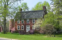 Capt. Nathaniel Hayden House |
September 15, 1988 (#88001483) |
128 Hayden Station Rd. 41°53′31″N 72°37′49″W |
||
| 20 | House at 111 Maple Avenue | 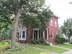 House at 111 Maple Avenue |
September 15, 1988 (#88001486) |
111 Maple Ave. 41°51′04″N 72°38′59″W |
||
| 21 | House at 130 Hayden Station Road | 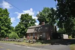 House at 130 Hayden Station Road |
September 15, 1988 (#88001484) |
130 Hayden Station Rd. 41°53′32″N 72°37′55″W |
||
| 22 | House at 44 Court Street | 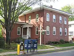 House at 44 Court Street |
September 15, 1988 (#88001480) |
44 Court St. 41°51′07″N 72°38′48″W |
||
| 23 | House at 736 Palisado Avenue |  House at 736 Palisado Avenue |
September 15, 1988 (#88001494) |
736 Palisado Ave. 41°52′37″N 72°37′32″W |
||
| 24 | Capt. James Loomis House | 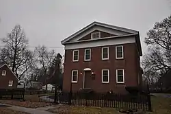 Capt. James Loomis House |
September 15, 1988 (#88001499) |
881 Windsor Ave. 41°49′47″N 72°39′24″W |
||
| 25 | Col. James Loomis House | 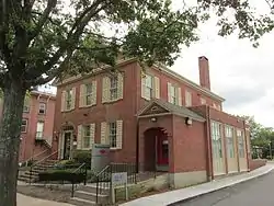 Col. James Loomis House |
September 15, 1988 (#88001476) |
208-210 Broad St. 41°51′07″N 72°38′41″W |
||
| 26 | George G. Loomis House | 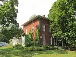 George G. Loomis House |
September 15, 1988 (#88001500) |
1003 Windsor Ave. 41°50′03″N 72°39′18″W |
||
| 27 | Gordon Loomis House | 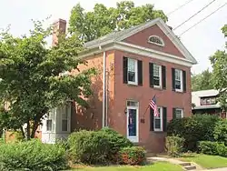 Gordon Loomis House |
September 15, 1988 (#88001501) |
1021 Windsor Ave. 41°50′05″N 72°39′18″W |
||
| 28 | Ira Loomis, Jr. House | 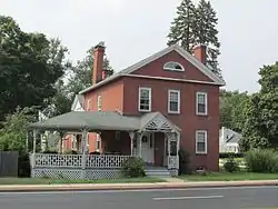 Ira Loomis, Jr. House |
September 15, 1988 (#88001502) |
1053 Windsor Ave. 41°50′08″N 72°39′17″W |
||
| 29 | Henry Magill House | 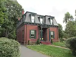 Henry Magill House |
September 15, 1988 (#88001491) |
390 Palisado Ave. 41°51′57″N 72°37′48″W |
||
| 30 | Elijah Mills House | 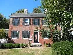 Elijah Mills House |
August 23, 1985 (#85001829) |
45 Deerfield Rd. 41°49′06″N 72°39′20″W |
||
| 31 | Oliver W. Mills House | 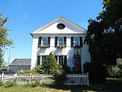 Oliver W. Mills House |
February 19, 1982 (#82004443) |
148 Deerfield Rd. 41°49′16″N 72°39′09″W |
||
| 32 | Timothy Dwight Mills House | 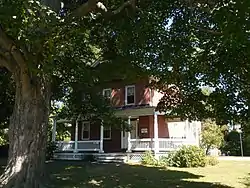 Timothy Dwight Mills House |
September 15, 1988 (#88001481) |
184 Deerfield Rd. 41°49′20″N 72°39′11″W |
||
| 33 | Deacon John Moore House | 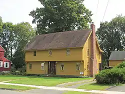 Deacon John Moore House |
July 29, 1977 (#77001416) |
37 Elm St. 41°51′01″N 72°38′46″W |
||
| 34 | Edward and Ann Moore House | 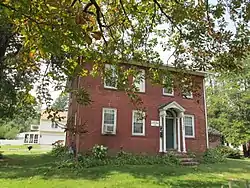 Edward and Ann Moore House |
September 15, 1988 (#88001478) |
464 Broad St. 41°50′42″N 72°38′54″W |
||
| 35 | Patrick Murphy House | 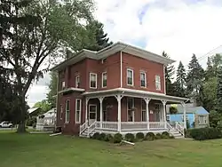 Patrick Murphy House |
September 15, 1988 (#88001490) |
345 Palisado Ave. 41°51′53″N 72°37′53″W |
||
| 36 | Palisado Avenue Historic District | 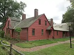 Palisado Avenue Historic District |
August 25, 1987 (#87000799) |
Palisado Ave. (signed as Connecticut Route 159) between the Farmington River and Bissell Ferry Rd. 41°51′35″N 72°38′10″W |
||
| 37 | Daniel Payne House |  Daniel Payne House |
September 15, 1988 (#88001495) |
27 Park Ave. 41°50′20″N 72°39′14″W |
||
| 38 | Eli Phelps House |  Eli Phelps House |
September 15, 1988 (#88001487) |
18 Marshall Phelps Rd. 41°53′23″N 72°40′33″W |
||
| 39 | William Shelton House |  William Shelton House |
September 15, 1988 (#88001496) |
40 Pleasant St. 41°51′29″N 72°38′58″W |
||
| 40 | Stony Hill School |  Stony Hill School |
September 15, 1988 (#88001504) |
1195 Windsor Ave. 41°50′25″N 72°39′04″W |
||
| 41 | Sophia Sweetland House |  Sophia Sweetland House |
September 15, 1988 (#88001493) |
458 Palisado Ave. 41°52′04″N 72°37′45″W |
See also
| Wikimedia Commons has media related to National Register of Historic Places in Windsor, Connecticut. |
References
- The latitude and longitude information provided in this table was derived originally from the National Register Information System, which has been found to be fairly accurate for about 99% of listings. Some locations in this table may have been corrected to current GPS standards.
- "National Register of Historic Places: Weekly List Actions". National Park Service, United States Department of the Interior. Retrieved on January 29, 2021.
- Numbers represent an alphabetical ordering by significant words. Various colorings, defined here, differentiate National Historic Landmarks and historic districts from other NRHP buildings, structures, sites or objects.
- "National Register Information System". National Register of Historic Places. National Park Service. March 13, 2009.
- The eight-digit number below each date is the number assigned to each location in the National Register Information System database, which can be viewed by clicking the number.
| Lists by county |  | |
|---|---|---|
| Lists by city or town | ||
| Other lists | ||