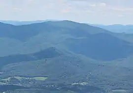
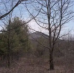
National Scenic Area (United States)
A National Scenic Area in the United States is a federally designated area of outstanding natural and scenic value that receives a level of protection that is less stringent than wilderness designation. Scenic areas are typically occupied or used in some manner by people and either cannot be considered for wilderness designation, or are seen as suitable for a wider range of uses than those permitted under wilderness designation.[1]
The first National Scenic Area in the United States was Mono Basin National Scenic Area in 1984,[2] followed by the much larger and more ambitious Columbia River Gorge National Scenic Area in 1986. The Columbia River Gorge was in a region of outstanding natural beauty that was already heavily used by people. The designation of the Columbia Gorge was controversial, as it imposed a significant amount of federal control on public and private lands that had previously not been significantly regulated.[3] Subsequent scenic area designations have been significantly less far-reaching, typically involving existing federal lands.
List of national scenic areas
| Name | Image | Agency | Location | Date established | Description |
|---|---|---|---|---|---|
| Alabama Hills |  |
BLM | California 36.36°N 118.05°W |
2019 | The Alabama Hills are a range of hills and rock formations near the eastern slope of the Sierra Nevada in the Owens Valley, just west of Lone Pine, California. The site is home to dozens of natural arches. |
| Bear Creek | USFS | Virginia 36.54°N 81.24°W |
2009 | Protects the headwaters of Bear Creek in the valley between the convergent ridges of Walker Mountain (to the north) and Brushy Mountain (to the south). | |
| Beech Creek | USFS | Oklahoma 34.35°N 94.31°W |
1988 | ||
| Columbia River Gorge | .jpg.webp) |
USFS | Oregon and Washington 45.42°N 121.47°W |
1986 | The Columbia River Gorge is a canyon that stretches for over 80 mi (130 km) as the Columbia River winds westward through the Cascade Range, forming the boundary between the state of Washington to the north and Oregon to the south. |
| Coosa Bald |  |
USFS | Georgia 34.46°N 83.58°W |
1995 | |
| Indian Nations | .jpg.webp) |
USFS | Oklahoma 34.46°N 94.42°W |
1988 | The wildlife and scenic area consists of 41,051 acres (16,613 ha), comprising the Winding Stair Mountains, Cedar Lake, several campgrounds, and many hiking trails. Talimena Scenic Drive winds through the southern portion of the wildlife and scenic area. |
| Mono Basin | .jpg.webp) |
USFS | California 37.57°N 119.03°W |
1984 | Mono Basin is an endorheic drainage basin located east of Yosemite National Park in California and Nevada. Notable features in the basin include Mono Lake and the Mono-Inyo Craters. |
| Mount Pleasant |  |
USFS | Virginia 37.45°N 79.10°W |
1994 | |
| Saint Helena Island | USFS | Michigan 45.51°N 84.52°W |
2000 | St. Helena Island is an uninhabited 240 acres (97 ha) island in the Lake Michigan approach to the Straits of Mackinac. A small shallow embayment on the island's northern shore provided shelter for both Native Americans and voyageurs who sought shelter from fierce southerly storms. By contrast, the south of the island features a watery shoal at its southernmost point, a navigational hazard which inspired the construction of the St. Helena Island Light in 1873. | |
| Seng Mountain |  |
USFS | Virginia 36.43°N 81.35°W |
2009 | The scenic area includes Rowland Creek Falls and all portions of the Iron Mountain system within the upper drainage of the South Fork of the Holston River. |
Proposed National Scenic Areas
Several proposals have been advanced for additional National Scenic Areas:
- Big Sur Coast National Scenic Area, California, 1980[4]
- Big Schloss National Scenic Area, Virginia and West Virginia, 2009[5]
- Kelley Mountain National Scenic Area, Virginia, 2009[6]
- Shenandoah Mountain National Scenic Area, Virginia, 2009[7]
- Sedona-Red Rocks National Scenic Area, Arizona, legislation introduced in 2010 failed.[8]
- Grandfather National Scenic Area, North Carolina, 2011[9]
- Black Mountain Scenic Area, California, 2019[10]
- Condor Ridge Scenic Area, California, 2019[10]
Former National Scenic Areas
- East Mojave National Scenic Area, designated Mojave National Preserve in 1994
See also
References
- Johnson, Randy (July 21, 2011). "National Scenic Areas Near and Far - A Path for the High Country?". High Country Press. Archived from the original on October 4, 2011.
- USFS contributors (2009). "Inyo National Forest: Special Places". United States Forest Service. Retrieved 2010-02-07.
- "About the Scenic Area". Columbia River Gorge Commission. Archived from the original on 11 August 2012. Retrieved 26 April 2012.
- "Big Sur National Scenic Area Proposed" (PDF). Big Sur Gazette. February 1980. Retrieved July 16, 2012.
- "Big Schloss Proposed National Scenic Area". Virginia Wilderness Committee. Archived from the original on July 15, 2010. Retrieved July 16, 2012.
- "Kelley Mountain". Virginia Wilderness Committee. Archived from the original on July 15, 2010. Retrieved July 16, 2012.
- Averill, Graham (February 19, 2009). "Shenandoah Mountain National Scenic Area?". Blue Ridge Outdoors. Retrieved July 16, 2012.
- "H.R. 4823 (111th): Sedona-Red Rock National Scenic Area Act of 2010". Govtrack. Retrieved July 16, 2012.
- Johnson, Randy (July 14, 2011). "Grandfather National Scenic Area: An Introduction". High Country News. Archived from the original on November 19, 2011. Retrieved July 16, 2012.
- "Central Coast Heritage Protection Act" (PDF). U.S. Congress. April 2019. Retrieved November 21, 2019.