Oxelösund Municipality
Oxelösund Municipality (Oxelösunds kommun) is a municipality in Södermanland County in southeast Sweden. Its seat is located in the city of Oxelösund.
Oxelösund Municipality
Oxelösunds kommun | |
|---|---|
 Oxelösund City Hall in June 2013 | |
 Coat of arms | |
 | |
| Country | Sweden |
| County | Södermanland County |
| Seat | Oxelösund |
| Area | |
| • Total | 746.54 km2 (288.24 sq mi) |
| • Land | 35.39 km2 (13.66 sq mi) |
| • Water | 711.15 km2 (274.58 sq mi) |
| Area as of 1 January 2014. | |
| Population (31 December 2019)[2] | |
| • Total | 11,983 |
| • Density | 16/km2 (42/sq mi) |
| Time zone | UTC+1 (CET) |
| • Summer (DST) | UTC+2 (CEST) |
| ISO 3166 code | SE |
| Province | Södermanland |
| Municipal code | 0481 |
| Website | www.oxelosund.se |
In 1950 the Nikolai Rural municipality was dissolved. One part formed the then City of Oxelösund, one of the last newly created cities of Sweden. The rest of Nikolai was incorporated into the neighbouring City of Nyköping. In 1971 the city became a unitary municipality without addition of territory, and it is with its 35.75 square kilometres (13.80 sq mi) one of Sweden's smallest municipalities.
Geography
It covers a peninsula in the Baltic Sea, and borders by land only to Nyköping Municipality.
Still marked by its industrial past, the politics is dominated by the Social Democratic Party, and the industry by the harbour and iron works.
International relations
Twin towns - Sister cities
Oxelösund is a member of the Douzelage, a unique town twinning association of 24 towns across the European Union. This active town twinning began in 1991 and there are regular events, such as a produce market from each of the other countries and festivals.[3][4] Discussions regarding membership are also in hand with three further towns (Agros in Cyprus, Škofja Loka in Slovenia, and Tryavna in Bulgaria).
 Altea, Spain - 1991
 Bad Kötzting, Germany - 1991
 Bellagio, Italy - 1991
 Bundoran, Ireland - 1991
 Granville, France - 1991
 Holstebro, Denmark - 1991
.svg.png.webp) Houffalize, Belgium - 1991
Houffalize, Belgium - 1991 Meerssen, the Netherlands - 1991
 Niederanven, Luxembourg - 1991
 Preveza, Greece - 1991
 Sesimbra, Portugal - 1991
 Sherborne, United Kingdom - 1991
 Karkkila, Finland - 1997
 Oxelösund, Sweden - 1998
 Judenburg, Austria - 1999
 Chojna, Poland - 2004
 Kőszeg, Hungary - 2004
 Sigulda, Latvia - 2004
 Sušice, Czech Republic - 2004
 Türi, Estonia - 2004
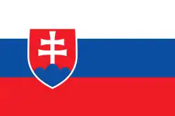 Zvolen, Slovakia - 2007
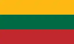 Prienai, Lithuania - 2008
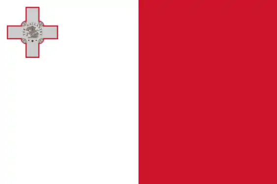 Marsaskala, Malta - 2009
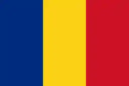 Siret, Romania - 2010
Elections since the 1972 municipal reform
Riksdag
No boundary changes. The Sweden Democrats' numbers were not listed by the SCB agency from 1988 to 1998 due to the party being out of contention for Riksdag entry.
| Year | Turnout | Votes | V | S | MP | C | L | KD | M | SD | ND |
|---|---|---|---|---|---|---|---|---|---|---|---|
| 1973[5] | 92.2 | 7,945 | 7.3 | 61.6 | 0.0 | 15.7 | 7.3 | 0.9 | 7.6 | 0.0 | 0.0 |
| 1976[6] | 93.1 | 8,480 | 6.4 | 61.4 | 0.0 | 14.4 | 8.6 | 0.7 | 8.1 | 0.0 | 0.0 |
| 1979[7] | 91.9 | 8,755 | 8.0 | 62.1 | 0.0 | 9.0 | 8.3 | 0.6 | 11.5 | 0.0 | 0.0 |
| 1982[8] | 93.2 | 8,774 | 7.7 | 63.2 | 1.0 | 7.8 | 4.4 | 0.8 | 14.4 | 0.0 | 0.0 |
| 1985[9] | 91.6 | 8,610 | 7.8 | 61.4 | 1.2 | 4.9 | 10.5 | 0.0 | 13.8 | 0.0 | 0.0 |
| 1988[10] | 87.1 | 8,161 | 9.0 | 58.7 | 5.1 | 5.1 | 9.0 | 1.1 | 11.5 | 0.0 | 0.0 |
| 1991[11] | 87.8 | 8,183 | 6.4 | 54.6 | 2.5 | 3.8 | 6.4 | 3.9 | 13.0 | 0.0 | 8.7 |
| 1994[12] | 88.8 | 7,772 | 8.1 | 63.3 | 4.0 | 2.9 | 5.0 | 2.1 | 12.8 | 0.0 | 0.8 |
| 1998[13] | 83.2 | 6,891 | 14.8 | 55.2 | 3.7 | 2.1 | 2.9 | 7.7 | 12.1 | 0.0 | 0.0 |
| 2002[14] | 80.8 | 6,791 | 11.6 | 56.1 | 4.7 | 1.8 | 8.8 | 5.8 | 9.8 | 0.5 | 0.0 |
| 2006[15] | 81.9 | 6,944 | 8.1 | 50.7 | 4.7 | 3.4 | 5.7 | 4.6 | 18.5 | 2.3 | 0.0 |
| 2010[16] | 85.0 | 7,526 | 7.8 | 44.2 | 7.2 | 2.8 | 5.3 | 3.3 | 23.1 | 4.8 | 0.0 |
| 2014[17] | 86.0 | 7,597 | 8.0 | 44.1 | 5.2 | 2.7 | 3.4 | 2.8 | 17.1 | 14.0 | 0.0 |
Blocs
This lists the relative strength of the socialist and centre-right blocks since 1973, but parties not elected to the Riksdag are inserted as "other", including the Sweden Democrats results from 1988 to 2006, but also the Christian Democrats pre-1991 and the Greens in 1982, 1985 and 1991. The sources are identical to the table above. The coalition or government mandate marked in bold formed the government after the election. New Democracy got elected in 1991 but are still listed as "other" due to the short lifespan of the party.
| Year | Turnout | Votes | Left | Right | SD | Others | Elected |
|---|---|---|---|---|---|---|---|
| 1973 | 92.2 | 7,945 | 68.9 | 30.6 | 0.0 | 1.5 | 98.5 |
| 1976 | 93.1 | 8,480 | 67.8 | 31.1 | 0.0 | 1.1 | 98.9 |
| 1979 | 91.9 | 8,755 | 70.1 | 28.8 | 0.0 | 1.1 | 98.9 |
| 1982 | 93.2 | 8,774 | 70.5 | 26.6 | 0.0 | 2.9 | 97.1 |
| 1985 | 91.6 | 8,610 | 69.2 | 29.2 | 0.0 | 1.6 | 98.4 |
| 1988 | 87.1 | 8,161 | 72.8 | 25.6 | 0.0 | 1.6 | 98.4 |
| 1991 | 87.8 | 8,183 | 61.0 | 27.1 | 0.0 | 11.9 | 96.8 |
| 1994 | 88.8 | 7,772 | 75.4 | 22.8 | 0.0 | 1.8 | 98.2 |
| 1998 | 83.2 | 6,891 | 73.7 | 24.8 | 0.0 | 1.5 | 98.5 |
| 2002 | 80.8 | 6,791 | 72.4 | 26.2 | 0.0 | 1.4 | 98.6 |
| 2006 | 81.9 | 6,944 | 63.5 | 32.2 | 0.0 | 4.3 | 95.7 |
| 2010 | 85.0 | 7,526 | 59.2 | 34.5 | 4.8 | 0.0 | 98.5 |
| 2014 | 86.0 | 7,597 | 57.3 | 26.0 | 14.0 | 2.7 | 97.3 |
References
- "Statistiska centralbyrån, Kommunarealer den 1 januari 2014" (in Swedish). Statistics Sweden. 2014-01-01. Archived from the original (Microsoft Excel) on 2016-09-27. Retrieved 2014-04-18.
- "Folkmängd i riket, län och kommuner 31 december 2019" (in Swedish). Statistics Sweden. February 20, 2020. Retrieved February 20, 2020.
- "Douzelage.org: Home". www.douzelage.org. Archived from the original on 2010-02-17. Retrieved 2009-10-21.
- "Douzelage.org: Member Towns". www.douzelage.org. Archived from the original on 2009-04-06. Retrieved 2009-10-21.
- "Riksdagsvalet 1973 (page 162)" (PDF) (in Swedish). SCB. Retrieved 21 July 2017.
- "Riksdagsvalet 1976 (page 157)" (PDF) (in Swedish). SCB. Retrieved 21 July 2017.
- "Riksdagsvalet 1979 (page 181)" (PDF) (in Swedish). SCB. Retrieved 21 July 2017.
- "Riksdagsvalet 1982 (page 182)" (PDF) (in Swedish). SCB. Retrieved 21 July 2017.
- "Riksdagsvalet 1985 (page 183)" (PDF) (in Swedish). SCB. Retrieved 21 July 2017.
- "Riksdagsvalet 1988 (page 164)" (PDF) (in Swedish). SCB. Retrieved 21 July 2017.
- "Riksdagsvalet 1991 (page 23)" (PDF) (in Swedish). SCB. Retrieved 21 July 2017.
- "Riksdagsvalet 1994 (page 37)" (PDF) (in Swedish). SCB. Retrieved 21 July 2017.
- "Riksdagsvalet 1998 (page 37)" (PDF) (in Swedish). SCB. Retrieved 21 July 2017.
- "Valresultat Riksdag Oxelösunds kommun 2002" (in Swedish). Valmyndigheten. Retrieved 21 July 2017.
- "Valresultat Riksdag Oxelösunds kommun 2006" (in Swedish). Valmyndigheten. Retrieved 21 July 2017.
- "Valresultat Riksdag Oxelösunds kommun 2010" (in Swedish). Valmyndigheten. Retrieved 21 July 2017.
- "Valresultat Riksdag Oxelösunds kommun 2014" (in Swedish). Valmyndigheten. Retrieved 21 July 2017.
External links
- Oxelösund Municipality - Official site