Raceland, Louisiana
Raceland is an unincorporated community and census-designated place (CDP) on Bayou Lafourche in Lafourche Parish, Louisiana, United States. The population was 10,193 at the 2010 census.[1] It is part of the Houma–Bayou Cane–Thibodaux Metropolitan Statistical Area.
Raceland, Louisiana | |
|---|---|
 Raceland Location in Louisiana  Raceland Location in the United States | |
| Coordinates: 29°43′21″N 90°36′19″W | |
| Country | United States |
| State | Louisiana |
| Parish | Lafourche |
| Area | |
| • Total | 21.6 sq mi (56.0 km2) |
| • Land | 21.6 sq mi (55.9 km2) |
| • Water | 0.04 sq mi (0.1 km2) |
| Elevation | 14 ft (4 m) |
| Population (2010) | |
| • Total | 10,193 |
| • Density | 473/sq mi (182.5/km2) |
| Time zone | UTC-6 (CST) |
| • Summer (DST) | UTC-5 (CDT) |
| ZIP Code | 70394 |
| Area code(s) | 985 |
| FIPS code | 22-63155 |


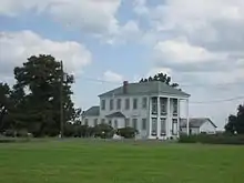
According to the Louisiana Office of Tourism, Raceland was named for the Race family that once owned a large plantation named "Raceland" on Bayou Lafourche.[2]
Geography
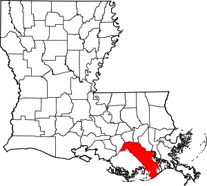
Raceland is located at 29°43′21″N 90°36′19″W (29.722576, -90.605172),[3] on both sides of Bayou Lafourche. It is bordered to the southeast by Mathews.
U.S. Route 90 passes through the southeast part of Raceland, leading northeast 44 miles (71 km) to New Orleans and west 40 miles (64 km) to Morgan City. Louisiana Highways 1 and 308 pass through the center of Raceland, on the south and the north sides of Bayou Lafourche, respectively. Both highways lead southeast (downriver) 7 miles (11 km) to Lockport and northwest (upriver) 15 miles (24 km) to Thibodaux, the parish seat. Louisiana Highway 182 passes through the center of Raceland on the old route of US-90; it leads northeast 3.5 miles (5.6 km) to US-90 and southwest 12 miles (19 km) to Houma.
According to the United States Census Bureau, the Raceland CDP has a total area of 21.6 square miles (56.0 km2), of which 0.04 square miles (0.1 km2), or 0.23%, are water.[4]
Demographics
As of the census[5] of 2000, there were 10,224 people, 3,656 households, and 2,837 families residing in the CDP. The population density was 472.3 people per square mile (182.3/km2). There were 3,908 housing units at an average density of 180.5 per square mile (69.7/km2). The racial makeup of the CDP was 71.19% White, 26.23% African American, 0.96% Native American, 0.25% Asian, 0.04% Pacific Islander, 0.65% from other races, and 0.68% from two or more races. Hispanic or Latino of any race were 1.54% of the population.
There were 3,656 households, out of which 37.2% had children under the age of 18 living with them, 57.2% were married couples living together, 15.8% had a female householder with no husband present, and 22.4% were non-families. 18.9% of all households were made up of individuals, and 8.6% had someone living alone who was 65 years of age or older. The average household size was 2.77 and the average family size was 3.14.
In the CDP, the population was spread out, with 27.7% under the age of 18, 9.3% from 18 to 24, 27.5% from 25 to 44, 22.6% from 45 to 64, and 12.9% who were 65 years of age or older. The median age was 35 years. For every 100 females, there were 93.7 males. For every 100 females age 18 and over, there were 89.3 males.
The median income for a household in the CDP was $31,969, and the median income for a family was $35,460. Males had a median income of $33,340 versus $17,399 for females. The per capita income for the CDP was $15,539. About 15.6% of families and 18.0% of the population were below the poverty line, including 27.8% of those under age 18 and 19.2% of those age 65 or over.
Government and infrastructure
The U.S. Postal Service operates the Raceland Post Office.[6]
Education
Lafourche Parish Public Schools operates public schools.
Central Lafourche High School is in Mathews,[10] and has a Raceland postal address.[11] The school serves all of Raceland.[12][13]
Raceland High School opened in 1912 and was expanded in 1924; it was consolidated into Lafourche Central High along with Lockport High School in 1966. An elementary school occupies the former Raceland High.[14] In the era before desegregation (circa 1969) Raceland Colored School educated black residents.[15]
Lafourche Parish Library operates the Raceland Branch.[16]
Notable people
- Donald G. Bollinger, founder of Bollinger Shipyards (1946) and state chairman of the Republican Party of Louisiana (1986–1988); born and died in Raceland, resided as an adult in Lockport
- Jimmy Clanton, singer and actor; born in Raceland
- Ron Estay, football player, All-American defensive lineman for LSU; played professionally for the Canadian Football League's Edmonton Eskimos
- Freddie John Falgout, widely believed to be the first American killed in what would become known as World War II
- Aaron Loup, pitcher for the Tampa Bay Rays
- Punch Miller, jazz musician; born in Raceland
- Larry Wilson, basketball player and NBA draft pick
References
- "Total Population: 2010 Census DEC Summary File 1 (P1), Raceland CDP, Louisiana". data.census.gov. U.S. Census Bureau. Retrieved February 27, 2020.
- https://www.louisianatravel.com/cities/raceland
- "US Gazetteer files: 2010, 2000, and 1990". United States Census Bureau. 2011-02-12. Retrieved 2011-04-23.
- "U.S. Gazetteer Files: 2019: Places: Louisiana". U.S. Census Bureau Geography Division. Retrieved February 27, 2020.
- "U.S. Census website". United States Census Bureau. Retrieved 2008-01-31.
- "Raceland." U.S. Census Bureau. Retrieved on March 12, 2017. "109 RACELAND ST RACELAND, LA 70394-9998"
- Home. Raceland Lower Elementary School. Retrieved on November 29, 2016.
- Home. Raceland Upper Elementary School. Retrieved on November 29, 2016.
- Home. Raceland Middle School. Retrieved on November 29, 2016.
- "2010 CENSUS - CENSUS BLOCK MAP: Mathews CDP, LA." U.S. Census Bureau. Retrieved on November 29, 2016.
- Home. Central Lafourche High School. Retrieved on November 29, 2016. "4820 Highway 1, Raceland, LA 70394"
- "2010 CENSUS - CENSUS BLOCK MAP (INDEX): Raceland CDP, LA." U.S. Census Bureau. Retrieved on November 29, 2016. Pages: 1, 2.
- "SCHOOL ATTENDANCE BOUNDARIES Archived 2016-12-02 at the Wayback Machine." Lafourche Parish Public Schools. Retrieved on December 2, 2016. Based on the text description of the school boundaries
- Theriot, Clifton. Lafourche Parish. Arcadia Publishing, December 1, 2014. ISBN 1439648662, 9781439648667. p. 71.
- Engineering News-Record, Volume 143, Part 1. McGraw-Hill, 1949. p. 50. "C.+M.+Washington+Colored" See search page.
- "Branch Locations and Contact." Lafourche Parish Library. Retrieved on November 28, 2018.
External links
| Wikimedia Commons has media related to Raceland, Louisiana. |

