Rosslea, Queensland
Rosslea is a suburb of Townsville within the City of Townsville, Queensland, Australia.[2]
| Rosslea Townsville, Queensland | |||||||||||||||
|---|---|---|---|---|---|---|---|---|---|---|---|---|---|---|---|
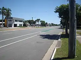
 Bowen Road, Rosslea | |||||||||||||||
 Rosslea | |||||||||||||||
| Coordinates | 19°17′53″S 146°48′00″E | ||||||||||||||
| Population | 1,600 (2011 census)[1] | ||||||||||||||
| Postcode(s) | 4812 | ||||||||||||||
| LGA(s) | City of Townsville | ||||||||||||||
| State electorate(s) | |||||||||||||||
| Federal Division(s) | Herbert | ||||||||||||||
| |||||||||||||||
Geography
Rosslea is bounded to the east and south by the Ross River. The suburb is very flat (approx 5m above sea level). The eastern half of the suburb is occupied by the Townsville Golf Club. The rest of the suburb is residential.[3] Being low-lying on a river, Rosslea can be affected by flooding, mostly in the golf club area.[4]
History
Rosslea is situated in the traditional Wulgurukaba Aboriginal country.[5] The name "Rosslea" is a combination of "Ross" (representing the Ross River) and "lea", the Old English word for a grassy meadow.[2]
In the 2011 census, Rosslea had a population of 1,600 people.[1]
Community groups
The Rosslea branch of the Queensland Country Women's Association meets at the CWA Hall at 36 Latchford Street, Pimlico.[6]
References
- Australian Bureau of Statistics (31 October 2012). "Rosslea". 2011 Census QuickStats. Retrieved 5 March 2016.

- "Rosslea (entry 44636)". Queensland Place Names. Queensland Government. Retrieved 5 March 2016.
- "Queensland Globe". State of Queensland. Retrieved 5 March 2016.
- "Ross River Flood Study: Base-line flooding assessment" (PDF). Townsville City Council. 4 April 2013. Retrieved 6 March 2016.
- "Traditional Landowners - History and Heritage". Retrieved 25 June 2020.
- "Branch Locations". Queensland Country Women's Association. Retrieved 26 December 2018.