SODO Busway
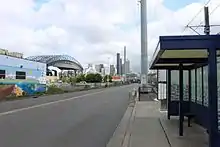
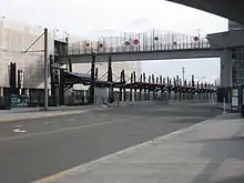
The SODO Busway, also referred to as the E-3 Busway, is a 1.5-mile-long (2.4 km)[1] busway in the SoDo neighborhood of Seattle, Washington. It has four stops, including two that connect to Link light rail stations, and functions as an extension of the Downtown Seattle Transit Tunnel, which was formerly used by buses. The busway is served by ten bus routes—seven King County Metro routes from southern King County and three Sound Transit Express routes from Pierce County.
| E-3 Busway | |
.jpg.webp) King County Metro route 150 bus operating on the SODO Busway. | |
| Part of | 5th Avenue South |
|---|---|
| Type | Busway |
| Maintained by | Seattle Department of Transportation, King County Metro |
| Length | 1.5 mi[1] (2.4 km) |
| Location | SoDo, Seattle |
| South end | South Spokane Street |
| North end | Royal Brougham Way |
| Construction | |
| Completion | December 8, 1991[2] |
Route
SODO Busway | |||||||||||||||||||||||||||||||||||||||||||||||||||||||||||||||||||||
|---|---|---|---|---|---|---|---|---|---|---|---|---|---|---|---|---|---|---|---|---|---|---|---|---|---|---|---|---|---|---|---|---|---|---|---|---|---|---|---|---|---|---|---|---|---|---|---|---|---|---|---|---|---|---|---|---|---|---|---|---|---|---|---|---|---|---|---|---|---|
| |||||||||||||||||||||||||||||||||||||||||||||||||||||||||||||||||||||
The busway begins at an intersection with S Spokane Street, which is split into a couplet underneath the elevated Spokane Street Viaduct. The entrance is located about two blocks away from ramps to Interstate 5, which most routes utilize to travel between Downtown Seattle and their southern terminal.
The busway follows the 5th Avenue S corridor, which was a railroad right of way that once ran to Union Station.[1] Buses share the corridor with freight trains (between S Spokane Street and S Forest Street), Central Link light rail trains (between S Forest Street and the Downtown Seattle Transit Tunnel portal), and the SODO Trail (between S Forest Street and S Royal Brougham Way). The busway ends at S Royal Brougham Way at the southern portal of the Downtown Seattle Transit Tunnel. Buses continue into downtown using 4th Avenue or other nearby streets.
Stops
| Mile | km | Location | Routes | Notes |
|---|---|---|---|---|
| 0.0 | 0 | South Spokane Street | 50, 101, 102, 150, 177, 178, 190, 590, 594, 595 | |
| 0.6 | 0.97 | South Lander Street | 50 (southbound only), 101, 102, 150, 177, 178, 190, 590, 594, 595 | Adjacent to SODO light rail station. Northbound trips on route 50 serve a nearby stop on S Lander Street. |
| 1.0 | 1.6 | South Holgate Street | 101, 102, 150, 177, 178, 190, 590, 594, 595 | |
| 1.4 | 2.3 | South Royal Brougham Way | 101, 102, 150, 177, 178, 190, 590, 594, 595 | Adjacent to Stadium light rail station. Adjacent to Greyhound station. Also served by southbound night owl routes 5, 11, D Line, and E Line that connect with 4:42am light rail departure. |
Services
Approximately 43,000 passengers use services on the SODO Busway on an average weekday.[3]
| Operator | Route | Service type | Destinations served | Notes |
|---|---|---|---|---|
| King County Metro | 50 (partial) | all-day | West Seattle (westbound)
Othello Station (eastbound) |
Only serves stops at S Spokane St & S Lander St (eastbound) |
| 101 | all-day | Renton | ||
| 102 | peak-only | Fairwood via Renton | ||
| 150 | frequent | Kent via Tukwila, Southcenter | ||
| 177 | peak-only | Federal Way | ||
| 178 | peak-only | South Federal Way | ||
| 190 | peak-only | Redondo Heights via Star Lake | ||
| Sound Transit Express | 590 | peak-only | Tacoma | |
| 594 | all-day | Lakewood via Tacoma | ||
| 595 | peak-only | Gig Harbor |
History

The SODO Busway runs through the SODO area of Seattle that has historically been used for industrial purposes, and today remains largely zoned for industry. The right-of-way was originally used by Milwaukee Road and Union Pacific trains to access Union Station.[1] Milwaukee Road discontinued passenger service to the station in 1961, followed by Union Pacific in 1971. Freight railway spurs still serve industrial customers in the area.
The busway was built by the Washington State Department of Transportation in the late 1980s at total cost of $4.5 million, as part of a package of improvements to Interstate 90, that also included the addition of significant bus transit infrastructure on the freeway. During planning and construction the busway was named "E3 Busway" after the final selected option (Alternative E, Option 3).[4]
The busway would have four stops, one at each street that intersected the busway: South Spokane Street, South Lander Street, South Holgate Street and South Royal Brougham Way. The busway also has electronic sensors buried in the roadway, triggering transit signal priority as buses approach intersections.[1]
The SODO busway opened for bus traffic on December 8, 1991[2] and was initially used by 350 daily trips by King County Metro routes, serving 10,000 passengers and 43 daily trips by Pierce Transit express routes, serving 1,500 passengers.[1] The busway shortened travel times by at least three minutes and even more during traffic on Interstate 5.[1]
.jpg.webp)
In September 1999, the Pierce Transit express routes were replaced by Sound Transit Express routes, including on the busway.[5][6]

In November 2003, Sound Transit began construction of the Central Link light rail line, which included relocating utilities along the busway. In August 2005, the first rails were laid adjacent to busway from Holgate to Lander. Construction of SODO and Stadium stations was completed in May 2006, and opened along with the rest of the line on July 18, 2009.[7][8]
Future
Sound Transit plans to use some or all of the busway to build a light rail corridor between West Seattle and Downtown Seattle as part of the voter approved Sound Transit 3 package. It is scheduled to open in 2030.[9]
One of the challenges faced by buses using the SODO Busway is that drivers are forced to exit the high-occupancy vehicle lanes of Interstate 5 miles before they reach Downtown Seattle, cross all lanes of traffic to reach the busway at the Spokane Street exit. In heavy traffic, this maneuver slows buses, often negating the time savings achieved by using the SODO Busway. As part of the 2007 Roads & Transit package, the Regional Transportation Investment District proposed building a direct connection from the Interstate 5 high-occupancy vehicle lanes to the SODO Busway at a cost of $83 million (2006 dollars).[10][11] The plan was rejected by voters.
The SODO Busway was studied in 2012 as a possible route for buses to West Seattle after the demolition of the Alaskan Way Viaduct. Ramps would be built between the busway and 5th Avenue at the current site of the entrance to the Downtown Seattle Transit Tunnel and between the busway and the West Seattle Bridge.[12] King County Metro instead chose to route buses to West Seattle via transit only lanes on Columbia Street and a new Alaskan Way surface street.
Public art
Many of the buildings surrounding the busway are industrial in nature and have entrances facing towards other streets. The backsides, which faced the busway, became blighted with graffiti and inspired a campaign to cleanup the area.[13] In fall 1995, the Sodo Business Association created the ArtWorks program to clean up the area. With a $15,000 grant from Seattle Public Utilities, a volunteer crew was able to cover over graffiti and hauled away some 300 tons of trash.
In an effort to keep the area clean in the long term, ArtWorks received an $80,000 matching grant from the city to help create the Sodo Urban Art Corridor project, a mural-painting and cleanup effort. The project also received contributions from SoDo businesses, including $5,000 from Starbucks, which has its corporate headquarters nearby,[14] and in-kind donations of paint from Sears, Home Depot and the city of Seattle.
On July 25, 2016, work began on the SODO Track mural corridor which added to and replaced some of the volunteer murals with works commissioned from professional artists from around the world.[15][16] The project was completed in July 2018, featuring 62 artists with 50 works on 32 walls.[17][18]
References
- Lane, Bob (December 7, 1991). "New Busway To Help South End Commuters -- Route To Downtown Avoids Traffic". The Seattle Times.
- Bae, Christine; Chalana, Manish; Oschner, Jeffrey; Viriyincy, Oran. Back To The Future: A History of Transit Planning in the Puget Sound Region. University of Washington. p. 52. ISBN 9781304103390.
- Porter, Lynn (August 4, 2016). "32 murals will make Sodo buildings shine". Seattle Daily Journal of Commerce. Retrieved September 4, 2017.
- "Can you talk transit?". King County Metro. March 13, 2006. Archived from the original on August 14, 2009.
- "Nine new ways to get around Puget Sound: Sound Transit to launch its first nine new ST Express regional bus routes" (Press release). Seattle, Washington: Sound Transit. September 8, 1999.
- Whitely, Peyton (September 17, 1999). "Buses Ready To Roll". The Seattle Times.
- "Link light rail launches new era of mobility for central Puget Sound" (Press release). Seattle, Washington: Sound Transit. July 18, 2009.
- Lindblom, Mike (July 20, 2009). "Light-rail trains run smoothly, if not to capacity, on first day". The Seattle Times.
- "Sound Transit 3 - West Seattle to Downtown Seattle Light Rail" (PDF). Sound Transit. July 1, 2016. Retrieved November 27, 2016.
- "King County Investments: I-5 Direct Access Project". Moving Forward Together: A Blueprint for Progress (PDF) (Report). Regional Transportation Investment District Planning Committee. June 8, 2007. p. 61. Archived from the original (PDF) on July 28, 2007.
- Lindblom, Mike (January 27, 2007). "$800M for tunnel option shifted to other projects". The Seattle Times.
- "South Downtown Transit Priority Pathways" (PDF). City of Seattle. August 2012. pp. 6–7.
- Vuong, Mary (March 5, 2003). "Jefferson Award winner: Finding creative solution to blight". Seattle Post-Intelligencer. Retrieved November 13, 2016.
- Moriwaki, Lee (June 21, 1997). "Starbucks, Developer Help Boost Sodo Area -- `South Of Dome' Gets Makeover To Become `South Of Downtown'". The Seattle Times.
- Martin, Casey (August 5, 2016). "New Murals Bring Art to the SoDo Track". KBCS. Retrieved November 13, 2016.
- "Help Set the SODO Track in Motion". 4Culture. July 29, 2016. Retrieved November 14, 2016.
- Hubbard, Mac (July 19, 2018). "SoDo Track Project's Huge Murals Are Finally Done". Seattle Met. Retrieved July 28, 2018.
- Davis, Brangien (August 1, 2018). "Seattle's SODO Track mural corridor is now the longest in the world". Crosscut.com. Retrieved August 1, 2018.