Sainte-Reine-de-Bretagne
Sainte-Reine-de-Bretagne (Breton: Santez-Rouanez-Breizh) is a commune in the Loire-Atlantique department in western France.
Sainte-Reine-de-Bretagne | |
|---|---|
Commune | |
 | |
.svg.png.webp) Coat of arms | |
Location of Sainte-Reine-de-Bretagne 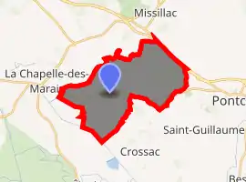
| |
 Sainte-Reine-de-Bretagne  Sainte-Reine-de-Bretagne | |
| Coordinates: 47°26′29″N 2°11′33″W | |
| Country | France |
| Region | Pays de la Loire |
| Department | Loire-Atlantique |
| Arrondissement | Saint-Nazaire |
| Canton | Pontchâteau |
| Intercommunality | Pays de Pont-Château–Saint-Gildas-des-Bois |
| Government | |
| • Mayor (2020–2026) | Michel Perrais |
| Area 1 | 19.73 km2 (7.62 sq mi) |
| Population (2017-01-01)[1] | 2,374 |
| • Density | 120/km2 (310/sq mi) |
| Time zone | UTC+01:00 (CET) |
| • Summer (DST) | UTC+02:00 (CEST) |
| INSEE/Postal code | 44189 /44160 |
| Elevation | 0–37 m (0–121 ft) (avg. 12 m or 39 ft) |
| 1 French Land Register data, which excludes lakes, ponds, glaciers > 1 km2 (0.386 sq mi or 247 acres) and river estuaries. | |
Population
| Year | Pop. | ±% |
|---|---|---|
| 1793 | 600 | — |
| 1806 | 629 | +4.8% |
| 1821 | 679 | +7.9% |
| 1831 | 667 | −1.8% |
| 1841 | 812 | +21.7% |
| 1851 | 859 | +5.8% |
| 1861 | 922 | +7.3% |
| 1872 | 967 | +4.9% |
| 1881 | 1,004 | +3.8% |
| 1891 | 1,085 | +8.1% |
| 1901 | 1,128 | +4.0% |
| 1911 | 1,175 | +4.2% |
| 1921 | 1,112 | −5.4% |
| 1931 | 1,047 | −5.8% |
| 1946 | 1,170 | +11.7% |
| 1954 | 1,157 | −1.1% |
| 1962 | 1,260 | +8.9% |
| 1968 | 1,303 | +3.4% |
| 1975 | 1,497 | +14.9% |
| 1982 | 1,768 | +18.1% |
| 1990 | 1,779 | +0.6% |
| 1999 | 1,682 | −5.5% |
| 2010 | 2,135 | +26.9% |
| 2017 | 2,374 | +11.2% |
References
- "Populations légales 2017". INSEE. Retrieved 6 January 2020.
| Wikimedia Commons has media related to Sainte-Reine-de-Bretagne. |
| Authority control |
|---|
This article is issued from Wikipedia. The text is licensed under Creative Commons - Attribution - Sharealike. Additional terms may apply for the media files.