San Quentin, California
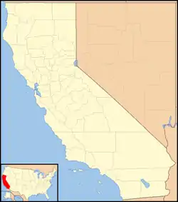
San Quentin (Spanish for '"Saint Quentin"') is a small unincorporated community in Marin County, California, United States.[1] It is located west of Point San Quentin,[2] at an elevation of 30 feet (9 m).[1]
San Quentin, California | |
|---|---|
 | |
 San Quentin, California Location in California  San Quentin, California San Quentin, California (the United States) | |
| Coordinates: 37°56′29″N 122°29′06″W | |
| Country | United States |
| State | California |
| County | Marin County |
| Elevation | 30 ft (9 m) |
| Area codes | 415/628 |
Description
San Quentin is adjacent to San Quentin State Prison; located just east of the prison, it is also known as San Quentin Village[3][4] or Point San Quentin Village.[4][5][6] It has 40 single-family houses and a condominium complex with 10 units, and its population is about 100.[4][6]
The town was originally housing for the prison's employees and their families. Residents rent their driveways to media vans during controversial executions. The reporters are attracted to the place because it is the only place in California where prisoners are executed and many death penalty abolitionists appear and demonstrate against the practice. This garners much media attention.[7]
Government and infrastructure

The United States Postal Service operates the San Quentin Post Office.[8] A post office operated at San Quentin for a time in 1859, and from 1862.[2] The Tamal post office is a substation of the San Quentin post office.[2]
In the state legislature, San Quentin is in the 3rd Senate District, and in the 6th Assembly District.
Federally, San Quentin is in California's 2nd congressional district, represented by Democrat Jared Huffman.[9]
The village is served by Golden Gate Transit route 40 between Richmond and El Cerrito del Norte BART stations across the Richmond-San Rafael Bridge in Contra Costa County and San Rafael Transit Center in downtown San Rafael. The community is in ZIP code 94964 and area codes 415 and 628. Prior to the opening of the Richmond–San Rafael Bridge, the Richmond–San Rafael Ferry Company operated car ferries between here and Castro Point in Richmond.
References
- U.S. Geological Survey Geographic Names Information System: San Quentin, California
- Durham, David L. (1998). California's Geographic Names: A Gazetteer of Historic and Modern Names of the State. Clovis, Calif.: Word Dancer Press. p. 697. ISBN 1-884995-14-4.
- Liberatore, Paul. "No escape from San Quentin Village". Marin Independent Journal, December 12, 2004.
- Klaner, Shelley Shepherd. "Village People Archived 2011-07-19 at the Wayback Machine". Pacific Sun, October 17, 2008. Retrieved January 9, 2009.
- Simerman, John. "Prison's neighbors dread more closure talk - residents of the scenic community say the area has charm that will vanish if the facility is torn down". Contra Costa Times, July 11, 2001.
- Wood, Jim. "Point San Quentin Village. Arguably, Marin's most unique community" Archived 2008-08-27 at the Wayback Machine. Marin Magazine, November 2007. Retrieved January 9, 2009.
- Bowman, Catherine. "San Quentin Village recovering - Harris execution created a 'carnival' atmosphere". San Francisco Chronicle, April 27, 1992.
- "Post Office Location - SAN QUENTIN". United States Postal Service. Retrieved on August 24, 2010.
- "California's 2nd Congressional District - Representatives & District Map". Civic Impulse, LLC. Retrieved March 8, 2013.
External links
![]() Media related to San Quentin, California at Wikimedia Commons
Media related to San Quentin, California at Wikimedia Commons

